Outdoor Links
Hike Arizona
Trip Planning Guide
Trip Report Index
Calendar of Events
Library
|
Walnut Canyon Point Day Hike Flagstaff July 7, 2012 by Bill Zimmermann |
|
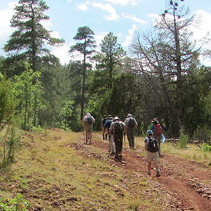
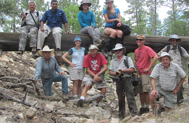 Eleven enlightened Trailblazers overlook Walnut Canyon. |
|
We made it. “Y4” (Walnut Point) offered gorgeous views Walnut Canyon National Monument and Pueblo Ruins. |
 The view from Walnut Point. |
 Our rocky descent to the valley. |
 Monument Headquarters. |
|
Eight hikers left the valley at 6:25. We met three more at the Marshall Lake turnoff. After introductions and group picture we headed out. Under partly cloudy skies we bushwhacked through the lakebed of dried reeds. The route took us past the remaining water pocket. There we joined the road. We walked the road to the cattle grate at “R6” |
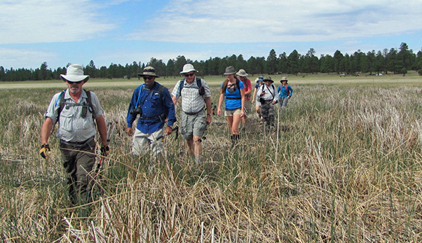 Now don’t get your feet wet crossing Marshall Lake. |
|
At “R6” we left the road. We zigzagged our way thru junipers on our way to pre-entered GPS waypoint “M”, a high point of Anderson Mesa. We walked past the first of many bone treasures as we proceeded down hill crossing roads at “R1” and “R2” Our route took us through the tips of canyon washes on our way to “Y1”. We came across 6 foot tall 2 foot diameter fencing. Gary Gray shared to the group it was to protect some grasses so the Forest Service has a baseline from which to measure the impact of grazing in the area. |
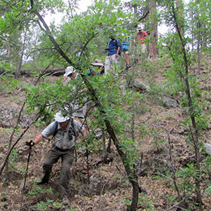 You did say there would be bushwhacking ... |
 ... fence crossing. Nicole shows how it’s done. |
|
On the way to “Y2” Anikó spotted two elk. Following an animal trail we got to experience a unique fence crossing. We took a short food and photo break at “Y2”. |
|
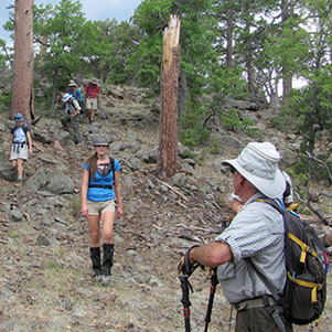
We experience a few more ups and downs as we passed “Y3”. Walnut Canyon came into view at “L” where we stopped for lunch. Individually hikers traveled to the final point at “Y4”. It offered views of Pueblo Ruins not offered to the public via Park Service trails. On the return trip bushwhacking continued until we reached “R5”. The road was a welcome break from the ankle-rolling dead-tree-hopping off trail maneuvers. |
 How duct tape saved Arturo’s shoe. |
|
At creek bottom “CB” we took a short break before heading uphill. We were making good time; however, we were on some road (not on my TOPO map) headed in the wrong direction. We continued walking, hoping the road would make a sharp left turn and head us toward “R6”. At “LR1” we bailed off the road and bushwhacked our way toward “R6”. |
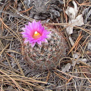 Spinystar brightens the valley. |
 Are you sure this is the right road? |
 We beat the heat — and the rain. |
|
Partly cloudy skies that became partly sunny when we were at “Y4” now changed to dark blue as we headed back across the dry grasses of Marshall Lake. No rain. We had dinner in Flagstaff before parting and heading home. |
|
→ More pictures and commentary, by Jim Buyens. |
 Top of Page
Arizona Trailblazers Hiking Club, Phoenix, Arizona
Comments? Send them to the AZHC .
updated September 12, 2016