Outdoor Links
Hike Arizona
Trip Planning Guide
Trip Report Index
Calendar of Events
Library
|
Woodchute Mountain Day Hike Jerome May 5, 2012 by Dave French |
|
 Trailblazers on the edge of Woodchute Mountain. [photo by Bill Zimmermann] |
|
25 Arizona Trailblazers met and traveled from Bell Road and I-17 to Mingus Mountain off SR 89A between Prescott and Jerome. The best route is to take SR 69 from Cordes Junction and then turn right on Fain Road at a signalized intersection near Prescott Country Club just past Dewey-Humboldt. Fain Road takes you to SR 89A where you turn right again and then head up the mountain. Right at the summit of Mingus Mountain Pass, there is a paved cross road. There are restrooms on the right side of the road and a paved parking area. To get to the Woodchute Trailhead, turn left onto the paved road and go a couple of blocks to signed road to the left for Woodchute Trailhead. At the end of the pavement there is a single restroom. Travel another half mile on unpaved road to the end and the trailhead. The road was a little rough due to spring rains, but very passible. |
 Beginning of hike, with SR 89A leading to Jerome. |
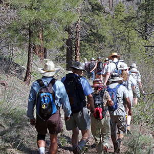 25 hikers all in a row. |
|
|
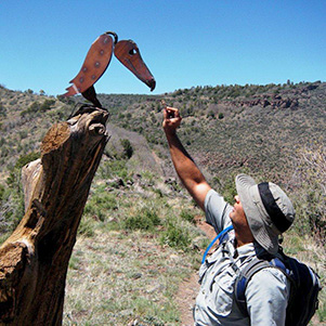
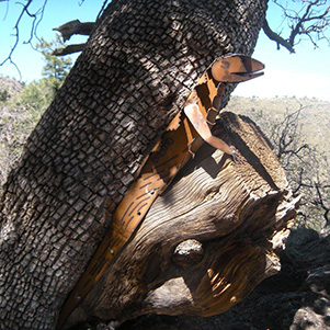
| Trailside sculptures make Woodchute an artistic hike. [photos by Ajay] | |
|
The 25 hikers made the 7 mile round trip in about 4 hours. Some hikers made some side trips after we met at the overlook and ended up hiking as much as 9 miles. We began the hike at 9 AM, and it was cool and very pleasant. With a starting elevation of 7120 and a high elevation of 7650, it is a pleasant early summer hike. |
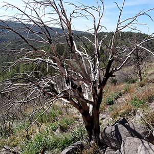 Evidence of forest fire. |
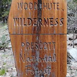 Wilderness sign. |
 The historic woodchute went around the mountain to Jerome. [Ted] |
We found some interesting art and lots of wildflowers along the trail. Ted pointed out a rock outcropping which is near the start of the chute that transported harvested trees to build Jerome during its mining heyday more than a 100 years ago. |
 Woodchute Tank and Chino Valley, from the trail. [by Ted] |
At the 1.9 mile point we entered the Woodchute Wilderness area with large Ponderosa Pines. At this point we began the 600 foot elevation gain to the trail high point. |
|
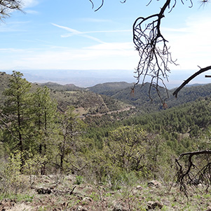
After traversing through a nice forest of pines for maybe a half mile on the high mesa, we came to a fork in the trail. We went to the right which took us to the overlook of Clarkdale with Sycamore Canyon Wilderness as a backdrop and the San Francisco Peaks in the distance. Jerome was to our right and hidden by a portion of the mountain we were on. |
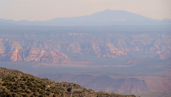 Sycamore Wilderness Canyon. |
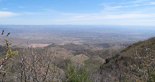 Clarkdale |
|
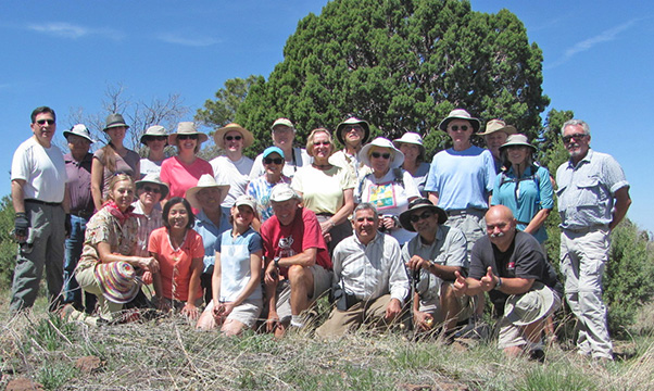
After resting and eating our lunches at the overlook, Bill took the traditional group photo. The large party then split up into smaller groups to explore along the rim of the mountain. Rudy and some others went east but later reported that they still could not see Jerome. Others went west for additional views before heading back down the trail. |
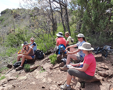 Well-deserved rest and lunch at Clarkdale Overlook. |
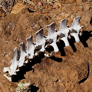 A great hike! Make no bones about it. [by Ajay] |
 Claret cup cactus brightens our trail. [Ajay] |
|
Eventually we all reconvened at the trailhead. Some of the carpools went to Cottonwood for a well-earned light supper and drink before returning to Phoenix. |
| Ted’s wildflower pictures: | |
 Symphyotrichum falcatum – White Aster |
 Phlox tenuifolia – Mountain Phlox |
 Iris miisouriensis – Rocky Mountain Iris |
 Taraxacum officinale – Dandelion |
 Layia glandulosa – Tidytips |
 Erigeron divergens – Fleabane |
 Lupinus sparsiflorus – Coulter’s Lupine |
 Senecio lemmonii – Lemmon’s Ragwort |
 Anikó and Bill enjoying the repast. [photo by Ajay] |
 Top of Page
Arizona Trailblazers Hiking Club, Phoenix, Arizona
Comments? Send them to the AZHC .
updated September 21, 2018