Outdoor Links
Hike Arizona
Trip Planning Guide
Trip Report Index
Calendar of Events
Library
Sierra Ancha
August 24, 2013
by Chuck Parsons
|
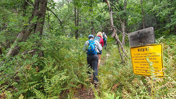
Unfortunately, these bright yellow warning signs are becoming more and more commonplace throughout Arizona’s forests as well as forests across the entire Southwest. They are posted at trailheads or along the trail itself and are grim testimony to the plight of forests struggling with prolonged drought, bark beetle attacks on an epic scale, and monster wildfires that morph into raging firestorms that consume millions of acres of prime forests across the Southwest every year. The Coon Creek Fire of May, 2000 was the result of a careless campfire that got out of control and torched nearly 10,000 acres of forests in the Sierra Ancha Wilderness surrounding Aztec Peak. |
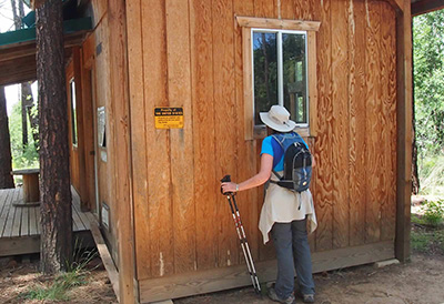
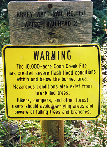 Warning sign posted at the trailhead. [photo by Chuck] |
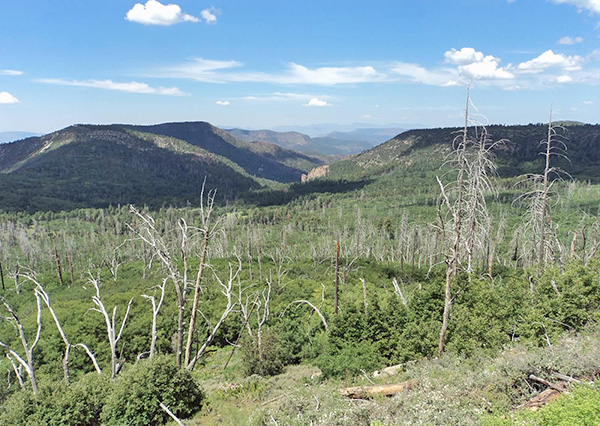 Death and rebirth on the slopes of Aztec Peak. [photo by Eileen] |
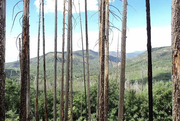 Thirteen years later many burned trees are still standing. [photo by Eileen] |
|
Thirteen years later hundreds of dead trees are still standing as testimony to that fire, and severe flash flood conditions continue to pose a threat. Falling trees, branches, and limbs also continue to endanger hikers and campers in the area. Although the forests do eventually recover after these fires, the aftermath can often last for decades. |
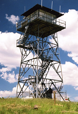
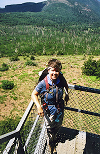 Eileen on the Aztec Peak lookout tower. [photo by Chuck] |
 Relaxing on recliners of solid rock. [photo by Eileen] |
|
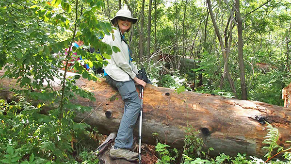
At my request, Eileen did an exploratory hike with me of the Abbey Way Trail #151 to the top of Aztec Peak on the Tuesday before the official club hike. I had earlier talked to several people and received conflicting information about trail conditions to the peak and decided to pre-hike it to find out for myself. After reaching the peak and checking out the lookout tower we took a break on these unique rock recliners. Thanks for joining me, Eileen. |
 Arizona Trailblazers strike out from the trailhead. [photo by Quy] |
|
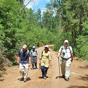
Fast forward to Saturday, August 24, 2013, and twelve eager Arizona Trailblazers hit the trail running in anticipation of reaching Aztec Peak while the weather still holds out. The NOAA forecast for the Aztec Peak area has remained unchanged over the past 24 hours, calling for a 40% chance of showers and thunderstorms and blowing winds, mainly after 11:00 AM. There are certainly plenty of overhead clouds that threaten rain, but no rainfall and thankfully no lightning or thunder as we start hiking at 10:15 AM on a cool Saturday morning in the Sierra Ancha Wilderness. The temperature at the 6,900 foot Abbey Way Trailhead is a pleasant 72 degrees as we begin hiking. |
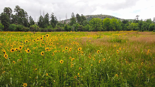 A sea of bright yellow sunflowers nods gently on the breeze. [photo by Quy] |
|
I warn everyone at the trailhead that at the first signs of lightning or thunder we may have to reconsider our options and think about turning back. An exposed mountain peak is the last place you want to be during a severe thunderstorm. But for now we press on and think positive thoughts about the weather. “Rain, rain go away. Come back some other day.” You probably need to be in your 50s or 60s to remember that little childhood ditty. Sometimes it works and sometimes it doesn’t. |
 Sandy maneuvers over a fallen tree across the trail. [photo by Quy] |
 Florence straddles the giant trunk of a mighty ponderosa pine. [photo by Quy] |
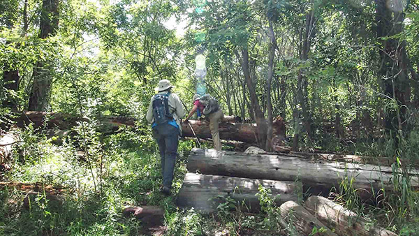
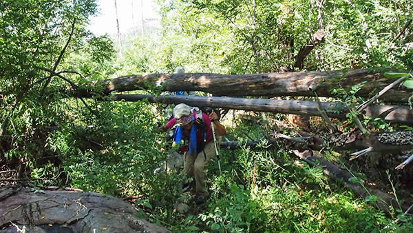 Some we go over and others we go under. [photo by Quy] |
 Michael ducks beneath yet another fallen tree. [photo by Quy] |
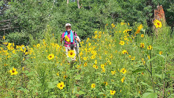 Sandy among the sunflowers that are out in abundance today. [photo by Quy] |
|
As seen from this series of pictures, another aspect of hiking that is becoming more commonplace lately is the increasing numbers of fallen trees across the trail, requiring hikers to become more creative in navigating the trails by going over, under, or around the trees. Whether it’s trees killed by fire, bark beetles, or just reaching the end of their life cycle and dying a natural death, on almost every forest hike we do there are ever-increasing numbers of fallen trees across the trails. Overworked and understaffed forest crews clear the trails as best they can, but the trees continue to fall down faster than they can keep up with them. We just have to be thankful they aren't falling down as we pass through, although that is becoming an increasing threat with the sheer numbers of trees falling in the forests. |
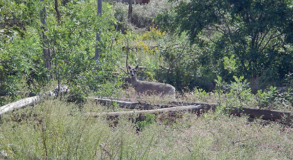 A curious mule deer keeps an eye on the photographer. [photo by Sandy] |
 Does bear grass mean that bear are around? [photo by Quy]  Apparently so in this case. Yikes – fresh bear scat right on the trail! |
With just the two of us and no other hikers sharing the trail with us all day long last Tuesday, Eileen and I were definitely concerned about the presence of bears in the area since we kept coming across their calling cards, conspicuously deposited right on the trail for all to see. But each pile we came across appeared to be at least two to three days old. Nevertheless, the tall grasses and heavy undergrowth along the length of much of the trail were a cause for concern, since bears could be lurking nearby without us ever knowing it. Eileen did have a canister of bear spray with her, but was concerned that she might not be able to access it fast enough in the event of an actual encounter with a bear. So we kept making a lot of noise and talking loudly and fortunately never came across a bear, although at some point they were no doubt watching us with some degree of curiosity from the protection of the undergrowth. |
|
With twelve hikers on today’s hike, we have the advantage of safety in numbers as long as we keep close together or hike in smaller groups. We definitely don't want anyone to get isolated from the rest of the group with bears in the area. Sandy and Florence would later tell me they were certain they heard a bear somewhere nearby along the lower stretch of trail before reaching the upper switchbacks, although they never saw anything. With ideal moisture and temperature conditions, wildflowers are out in abundance all along the trail today and Quy wastes little time in capturing their timeless and alluring beauty with her camera. This budding photographer is learning her craft quickly and is fast becoming one of our leading photographers for the Arizona Trailblazers. [photos below by Quy] |
 Sunflowers, up close and personal. |
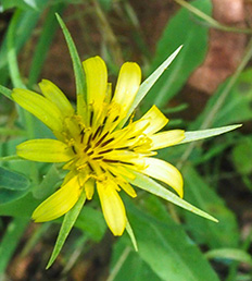 Yellow Salsify |
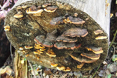 The fungus among us. |
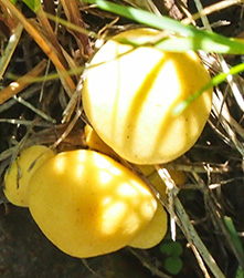 Bright yeller will kill a feller. |
 Goldenrod |
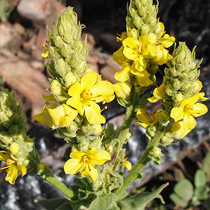 Wooly Mullein |
|
After about 1.3 miles of bushwhacking through heavy undergrowth, much of it the thorny and prickly variety, and going over, under, or around numerous trees across the trail, we finally break out into a clearing at the base of Aztec Peak and begin a long series of ascending switchbacks up to the peak. We will climb almost 800 feet getting to the summit. As we steadily gain elevation, the air temperature becomes cooler and a welcoming breeze out of the west cools us even further. |
 This is WB7ATA. Does anyone copy? [photo by Quy] |
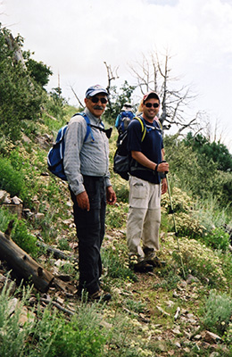 George and Dan take a break on the switchbacks. [photo by Chuck] |
 Roosevelt Lake and Four Peaks from the upper trail. [photo by Quy] |
|
Great views begin to open up below us of thick green forests, rolling hills, and cliffs all the way out to Roosevelt Lake with the majestic Four Peaks and the southern end of the Mazatzals as the backdrop. The sun is making a valiant effort to break through the heavy cloud cover, and does so periodically as the rains continue to hold off for now. The Aztec Peak lookout tower begins to come into view high above the trail, and we know we’re getting close now. Just a few more switchbacks and it’s a straight path right to the base of the tower. |
 “AZTEC” spelled out in stone near the tower. [photo by Chuck] |
 Hello up there! Is anyone in the tower? [photo by Chuck] |
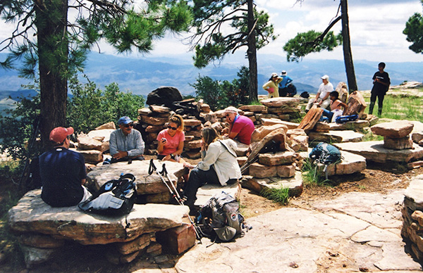
We arrive at the peak, highest point in the Sierra Ancha Range at 7,748 feet, shortly after 11:30. We have covered two miles in about an hour and twenty minutes – not bad considering all the bushwhacking we had to do along the lower stretch of the trail and the 848 feet of elevation gain to the peak. The lookout tower is still unmanned, just as it was this past Tuesday – a bit strange considering all the wildfires still going in Arizona. Most of us climb to the upper level of the tower for a better view of the surrounding area and are rewarded with unrestricted and spectacular 360 degree views all the way around the peak. We then make our way over to a large rocky area to the east of the tower where we’ll take a well-deserved rest and lunch break. |
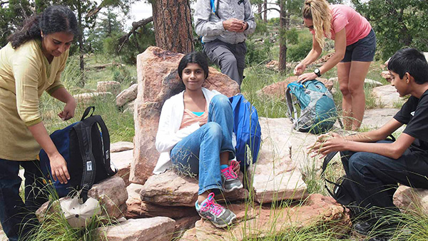
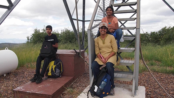 Lata, with her son Varun and daughter Ritu, at the base of the tower. [photo by Quy] |
||||||
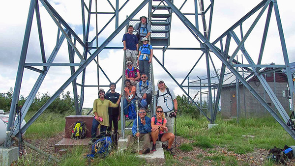 Eleven Trailblazers gather on the steps of the Aztec Peak lookout tower. [photo by Quy] |
||||||
|
||||||
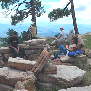
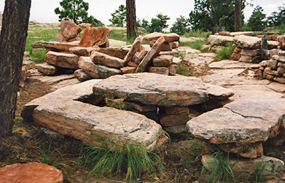 Is this the work of Paul Bunyan? [photo by Chuck] Are you kidding me? Is this Arizona’s version of Stonehenge or Easter Island? Actually no, there is a much simpler explanation to this mystery. It seems that a previous occupant of the lookout tower decided one day that he wanted a unique collection of vandal-proof, bomb-proof, and weatherproof furniture on his peak. |
|
Comment by Bryan Frost: I came across this account of a hike by Arizona Trailblazers up Aztec Peak. An enjoyable read. Just to clear up one detail regarding the stone furniture you enjoyed on top. It was built by my brother, Richard Frost, who accompanied his wife Kathy, while she served as lookout. He was a strong man, certainly, and he had no help that I know of. He worked on the seats and tables over several seasons. I believe Kathy had written an account for an AZhiker site (not sure if I have that name right) some time ago. I saw a photo elsewhere that claimed they were built by boy scouts. Amazing what people will come up with in the absence of facts. My brother has passed away, but I like to think of people enjoying this bit of his legacy after a good climb. |
 Trailblazers enjoy lunch under the pines. [photo by Chuck] |
|
So apparently he invited a few dozen of his Arnold Schwarzenegger type body-building friends up to push tons of sandstone slabs around and fabricate them into this amazing collection we see before us today. Either that, or he drove a backhoe up to the peak. However he did it, it is certainly an amazing feat that will no doubt still be impressing visitors well into the next century or perhaps even into the next millennia. This stuff is built to last for a long, long time. |
 There’s nothing like a fresh bag of Cheetos after a tough hike. [photo by Sandy] |
 Michael sinks back into his comfortable sandstone chair. [photo by Quy] |
 Now what can compare to relaxing in a good sandstone chair? [photo by Quy] |
|
What a beautiful day to be hiking in Arizona! I was thinking earlier if we’re going to see any rain at all today, it will more than likely be on the peak itself since this is our highest point on the hike. But as these pictures show, the sky is filled with fluffy white cumulus clouds (admittedly some a bit ominous looking) and plenty of large patches of blue in between. The weather couldn’t be more perfect. I check my camera bag thermometer once again and it’s reading a very pleasant 75 degrees. The highest temperature we will see today is about 82 degrees. |
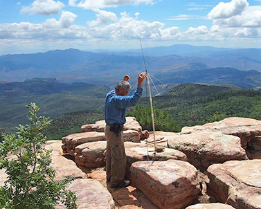 Arturo sets up his custom VHF antenna on Aztec Peak. 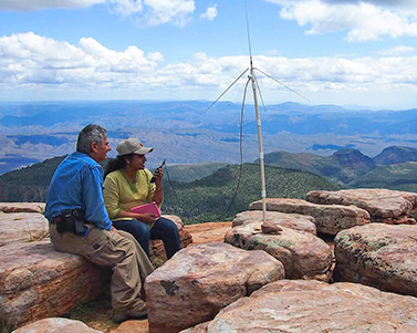 Lata sends out a message over Arturo’s radio. [photos by Quy] |
Arturo, WB7ATA, uses his VHF radio to make SO TA contacts from Aztec Peak. SO TA, short for Summits On The Air, is a program that encourages radio amateurs who enjoy hiking and the great outdoors to take their radios and operate from remote mountain tops. An award program is available to those who activate the summits and to those who contact the summits. Aztec Peak, designated as W7A/AW-011, is worth 10 points. As you earn points you qualify for awards. This is open to operators around the world and not limited to U.S. summits. From Arturo: “In that short time I was able to make several contacts without using the help of a repeater, which is not accepted as a valid way to make two-way radio contact to earn points towards awards.” |
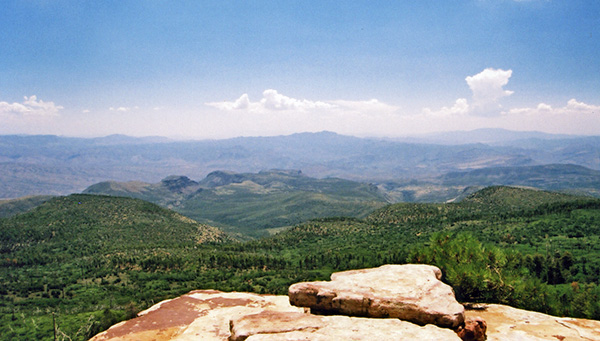 View looking to the east of Aztec Peak. [photo by Chuck] |
|
So before we leave this peak just what is the story behind the name of this trail (Abbey Way Trail #151) that we hiked today to reach Aztec Peak? The trail is named after Edward Abbey, author, lecturer, park ranger, fire lookout, and self-proclaimed rebel, environmental extremist, and desert anarchist, who worked as a Forest Service Fire Spotter in this very lookout tower during the summers of 1977, 1978, and 1979. (The tower itself was constructed in 1956.) That experience had a profound effect on Abbey and became the inspiration behind his book Confessions of a Barbarian. Abbey also wrote a number of other books, his most famous being Desert Solitaire and The Monkey Wrench Gang. Edward Abbey died at the age of 62 in 1989. The following is one of his more memorial quotes from Desert Solitaire: “Wilderness is not a luxury but a necessity of the human spirit, and as vital to our lives as water and good bread. A civilization which destroys what little remains of the wild, the spare, the original, is cutting itself off from its origins and betraying the principle of civilization itself. We need wilderness whether or not we ever set foot in it. We need a refuge even though we may never need to set foot in it. We need the possibility of escape as surely as we need hope; without it the life of the cities would drive all men into crime or drugs or psychoanalysis.” |
 Trailblazers make their way back down from Aztec Peak. [photo by Quy] |
 Hoofing it back to the trailhead on FR487. [photo by Sandy] |
 Arturo picks some green apples from a tree growing next to the trail. [photo by Quy] |
 Florence peers into the window of a Forest Service cabin just off the trail. [photo by Quy] Although hiking on a Forest Service road is generally not preferable to hiking on a trail, in this case we make an exception since the road is a much easier and quicker route back to the trailhead, although it is a bit longer. We’re also not as likely to encounter any bears on the road. We stop to check out a relatively new Forest Service cabin along the way, probably built to house employees working in the area. The cabin comes equipped with a kitchen, cabinets, a loft, an outdoor bathroom, and an outdoor sun shower. Anyone need to stop for a quick shower? Oops – never mind. There’s no water. photos by Quy: |
 Fleabane |
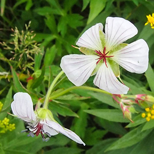 Richardson’s Geranium |
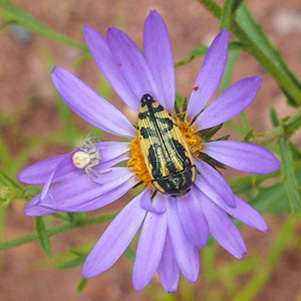 Aster |
 Birdbill Dayflower |
 Anyone for Elderberry wine? |
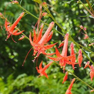 Firecracker Penstemon |
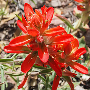 Indian Paintbrush |
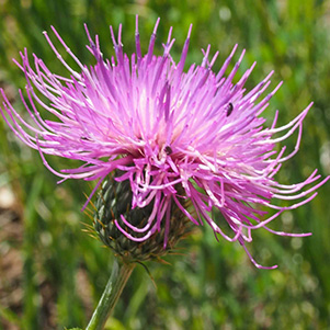 New Mexico Thistle |
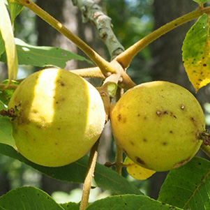 Not your typical grocery store walnut. |
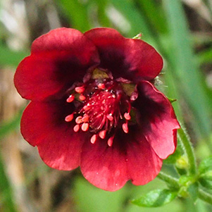 Scarlett Cinquefoil |
 Milkvetch |
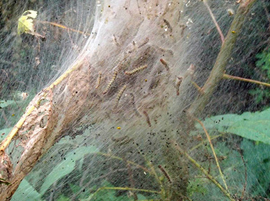 Tent caterpillars are out in force all along FR487. |
|
FR487 seems to go on and on, but eventually we all arrive safely back at the trailhead parking area by 2:15 in the afternoon, where we clean up, stow away our gear, and discuss a few options for the remainder of the day. One option is to do a longer loop drive by continuing north on 288 to the town of Young, stopping for lunch there, and then continue heading north until we link up with Highway 260 and take that west to Highway 87 and return home by way of Payson. A second option is a shorter loop drive which involves driving back down 288 to 188 and continue driving northwest to Roosevelt Lake and the Visitor Center. From there we will link up with Highway 88 (the Apache Trail) and drive to Tortilla Flat where we will stop for lunch. The last option is to simply go back the way we came and stop for lunch in Superior. The last option is the winner so we start the drive back down 288, although George opts for option #1 and will head for Young and then make the drive back to his cabin in Pine. But first we all make the short drive back down 487 to the Workman Creek Falls Overlook we had passed earlier in the day on the way to the trailhead. |
|
Although today the falls is just a serene trickle as seen in the picture below, this scene would probably have been described as both fascinating and terrifying by any witnesses who may have stood on this very spot across from the falls during the infamous Labor Day storm of 1970. → On September 4th and 5th of that year the remains of Tropical Storm Norma, still swollen with moisture from the gulf, pushed into central Arizona and spawned the deadliest storm in the state’s history, with severe and widespread flooding that resulted in 23 deaths. An unprecedented 11.92 inches of rainfall pummeled the Workman Creek area, almost all of it falling within a 24 hour period, while 5-10 inches of rain fell over a widespread area surrounding the creek. Dozens of creeks, streams, and rivers burst from their banks and resulted in the single deadliest flash flood in Arizona’s history, when 14 people were either drowned or swept away along Tonto Creek near Kohl’s Ranch. |
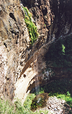 Workman Creek Falls, 180' high. [Chuck] |
 Hoodoos overlooking Workman Creek Falls. [photo by Chuck] |
|
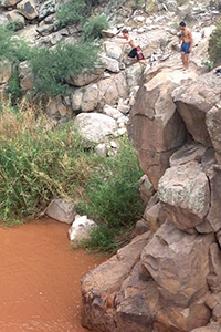
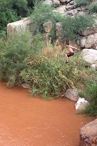
After leaving the falls, we decide to make one last stop next to the Salt River bridge on 288 and pull into the large dirt parking area just before the bridge as a group of rowdy high school students from Globe drives up. They call themselves the “Crazy Rednecks” and make a challenging as well as somewhat dangerous sport of diving from the nearby cliffs or directly off the bridge itself into the swirling and muddy waters of the Salt River, flowing about thirty feet beneath the bridge. We stay long enough to witness several dives, and almost every time hear the diver comment “I touched!” when he bobs back to the surface, indicating that his feet had touched bottom during the dive. As dangerous as it looks, kids have probably been diving from these cliffs for many years and no doubt from the bridge since it was constructed. In fact, one of the divers comments that his grandfather dived from this bridge when he was a kid many decades ago and points to a blackened and foot-shaped area on the bridge railing, left by countless sets of feet over many years of diving, that marks the spot were divers launch themselves into the river. Leaving the bridge and those “Crazy Redneck” divers behind, we continue down Highway 288 towards Globe and Superior and after about thirty minutes that 40% chance of showers and thunderstorms finally catches up with us in the form of intermittent light rain showers just hard enough to justify turning on the windshield wipers. Although it doesn’t last long, we see a line of hard rainfall in the distance over the Four Peaks area. We eventually arrive in Superior and stop for a late lunch at Los Hermanos before making the drive back home. Aztec Peak has been a great hike and hopefully we won’t wait another fourteen years to do it again. |
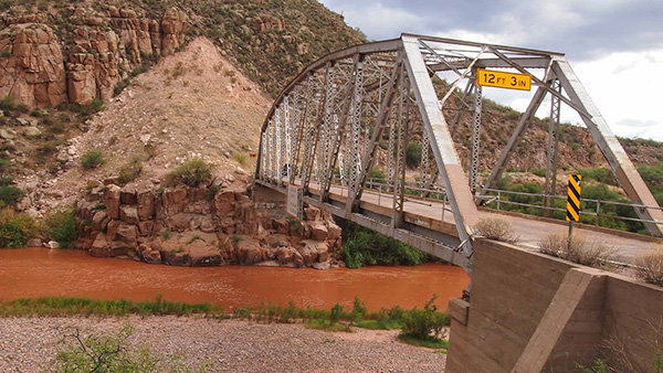 Bridge over the Salt River on Highway 288. [photo by Quy] |
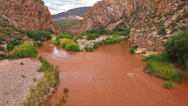 The muddy Salt River flows below the bridge. [photo by Quy] |
|
|

|
| Those ”Crazy Rednecks” diving from the cliffs. [photos by Lori] | ||
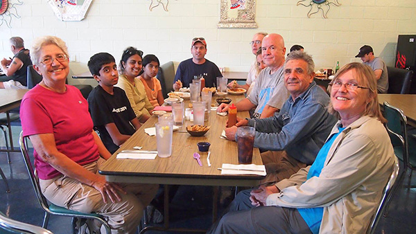 Trailblazers enjoying a late lunch at Los Hermanos in Superior. [photo by Quy] |
 Top of Page
Arizona Trailblazers Hiking Club, Phoenix, Arizona
Comments? Send them to the AZHC .
updated November 26, 2019