Outdoor Links
Hike Arizona
Trip Planning Guide
Trip Report Index
Calendar of Events
Library
|
Crucifix Canyon Day Hike Tonto National Forest March 16, 2013 by Bill Zimmermann |
|
 Nancy, George, Tom, Bill, Lil, Ceci, Jim, Eileen, Gary, Chip |
|
Eight hikers (Bill, Eileen, George, Cecilia, Jim, Gary, Chip, Nancy) left the meeting place at 7:03 and joined Tom and Lil at Tortilla Flat before diving to Mesquite Flat Trailhead. We drove to our starting location, then parked two vehicles at the gates that led to Horse Mesa Dam. |
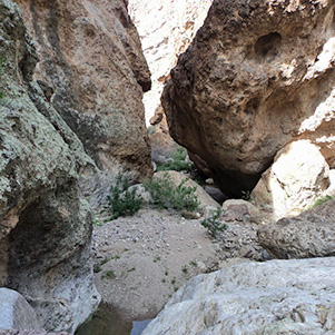
 Columns mark the narrow way in Crucifix Canyon. |

|

|
| The upper reaches of the canyon are steep. | |
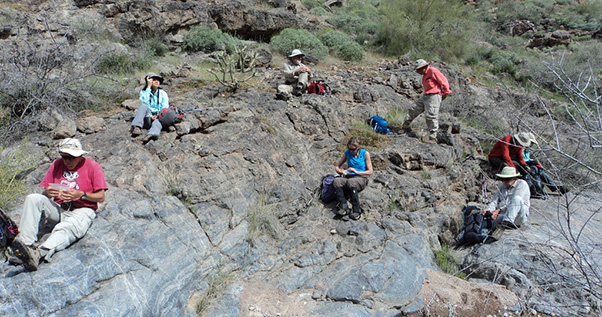
 What? No bowling today? |
We “STRUCK-OUT” at 8:40 AM but would we finish with time to SPARE (pun)? Shortly into the hike we found bowling ball fragments. One hundred yards later Gary slipped and we applied first aid to a cut on his knee. Overcast skies began to clear and the cool breeze subsided. |

|

|
| A badly skinned knee doesn’t stop us. | |

|

|
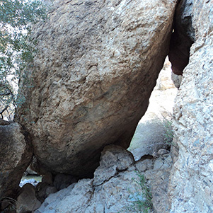
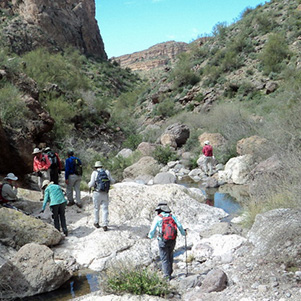
| It takes some fancy footwork to get over those rocks. | |
 Gary makes a big jump for the stepping stone. |
|
The hike continued without major problems. We were like flying geese. As the point person would descend into a dead-end the second person would become the new point searching for an easier route. Water was running. We avoided most pools. We had a few wet feet from rock hopping mishaps. We stopped for two short breaks. |
|
|
| Narrow passageways are a challenge. [photos by Eileen] | |
 Let’s take a break. [photo by Eileen]. |
|
When we reached site of the Bat Cave it was time to climb out. Bill Gary and Chip recognized the location but did not remember the specific route we took in February of 2010. We went left side. It was steeper but it had some shade. We crossed over to the right. As we got close to the saddle we faced a four-foot vertical shelf. Long leg Tom and Gary led the way and helped others. Bill and Cecilia followed George up a more gradual but don’t dare slip ledge. Lil took a longer less scary route to the far right. |
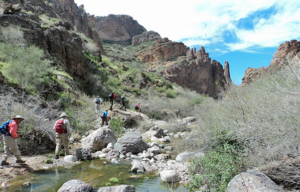 Beyond the narrows, the canyon is easier going. [photo by Eileen] |
 Now which way is the crucifix? [photo by Eileen] |
 Onward and upward. [photos by Eileen] |
 We’re not past the pools yet. |
|
We regrouped for a group picture. We still had more up to go. The heat of the day ruled. We cancel the “R0 R1 R2” route, an exciting canyon with an uncertain out at RX. We made a beeline for the Mickey Mouse Cactus (where the road ends, or starts if you are headed back). Drifting down an easy slope to a cliff. Oops. Who said bees fly in a straight line? |
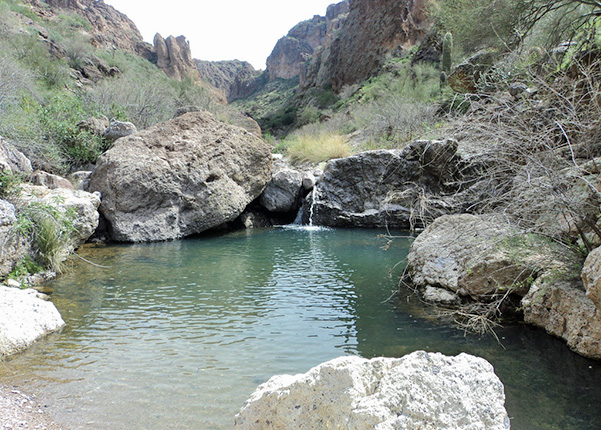 The water looks refreshing on a warm day. [photo by Eileen] |
 Now let’s get to the bottom of this ... |
 Trailblazers climbing up and out of Crucifix Canyon. |
 We reach Mesquite Dam on the way to Mesquite Flat. |
|
A quick return via the road had a bump in it. We unknowingly went left to the Mesquite Dam. It did not hold back any water. From there we split up, taking several different routes before we rejoined the road. A cold beer, then off to Tortilla Flat for some grub. |
 Top of Page
Arizona Trailblazers Hiking Club, Phoenix, Arizona
Comments? Send them to the AZHC .
updated May 31, 2020