Outdoor Links
Hike Arizona
Trip Planning Guide
Trip Report Index
Calendar of Events
Library
Grand Canyon National Park
June 6-10, 2013
by Chuck Parsons
 This one is for you Wendy R. [photo by Cyd] |
|
Front Row: Karen, Wendy, Kim, Quy, Rudy, Debbie, and Cyd. Back Row: Mark, Scott, Chuck, Lisa, Mike, Monika, Ken, Gary, Michael, and K.G. |
|
We want you to know that the “W” not only stands for “We Love You Wendy”, but also implies “We Want To See You Hiking With Us ASAP.” We all love you Wendy and are behind you all the way as you continue on your path to full recovery. Please take comfort in knowing that you are not in this alone because you are in our thoughts and prayers every day. We anxiously await the day when you are hiking and exploring the trails of Arizona with us once again. You are a very important part of this hiking club, and we miss your leadership, your friendship, and your unique sense of humor. To that end we are dedicating this June, 2013, North Rim of the Grand Canyon trip report in your honor, knowing that although you couldn’t be with us in person you were certainly with us in spirit. Happy Trails and God speed, dear friend. Twenty-one Arizona Trailblazers are on their way to the North Rim of the Grand Canyon for five days of camping and hiking in one of the most beautiful places in all of Arizona. And the timing is perfect, with scorching 110+ degree temperatures in store for Phoenix and the lower desert areas over the next several days of what some experts are already predicting may be just the beginning of another record-breaking summer for southern Arizona. With that rather depressing thought in mind, it’s time to get the heck out of Dodge and head for the high country and cooler weather. Sitting at an elevation of 8,000 feet and higher (8,803 feet at Point Imperial), the North Rim is usually at least 25-30 degrees cooler than the Phoenix area during the hot summer months and one of the best places in Arizona to beat the heat. Oddly enough, though, only 10% of the five million visitors to the Grand Canyon annually take the time to drive the extra miles to the North Rim and settle instead for the closer, but warmer and more crowded, South Rim. So let the crowds have the South Rim. We’ll have that much more space and privacy on the more secluded North Rim. |
| [Lunch at Cameron Trading Post, pictures by John] | |
 Rudy, Debbie, K.G., and Karen |
 Gary G., Gary M., Wendy, and Chuck |
 Dottie, Mark, Cyd, Mike, Lisa, and Scott |
 Bronze marker at the Cameron Bridge. |
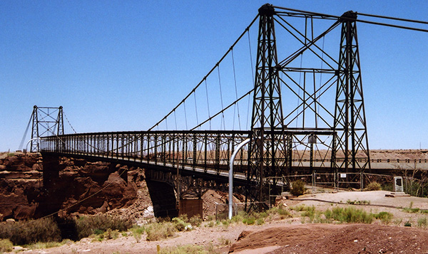 The original Cameron Bridge, built in 1911. [bridge and plaque pictures by Chuck] |
|
After a brief rendezvous stop at the McDonald’s on the far end of the Flagstaff Mall on Highway 89, we head for Cameron and lunch at the Cameron Trading Post and Restaurant, about an hour’s drive away. Founded in 1911, the Cameron Trading Post is one of the oldest surviving trading posts in Arizona. The tiny community of Cameron sits on the south side of the picturesque Little Colorado River Gorge on the Navajo Reservation and marks the location of the first bridge to span the Little Colorado in 1911. The trading post was built in the same year on the west side of the bridge and the community of Cameron, founded in 1916, gradually built up around the trading post. An Arizona-shaped bronze marker set in concrete near the bridge tells a brief history of this community. |
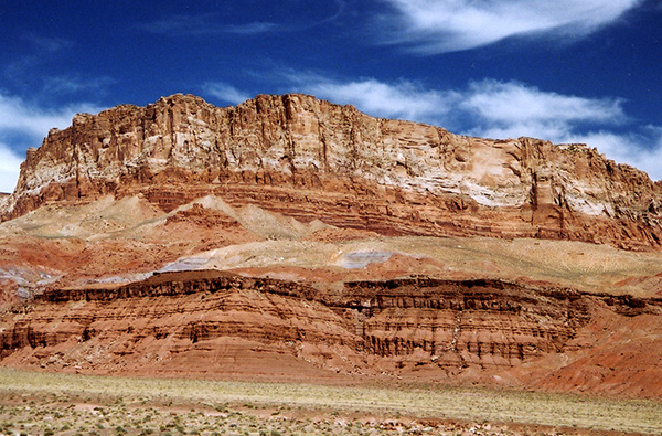 The colorful Vermilion Cliffs dominate the skyline for miles along Highway 89A. [photo by Chuck] |
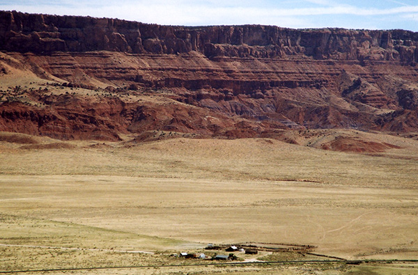 A small ranching community lies nestled at the base of the cliffs. [photo by Chuck] |
 The original and new Navajo Bridges span the Colorado River at Marble Canyon. [photo by Chuck] |
|
With the spectacular Vermilion Cliffs dominating the background, two massive steel arch bridges span the Colorado River at Marble Canyon, representing the only crossing over the river for over 500 miles. The bridge on the right is the original, completed in 1929 and now used as a pedestrian bridge, while the bridge on the left is its replacement, completed in 1995. |
 A somber new warning sign on the old Navajo Bridge. [photo by John] |
|
The new “NO JUMPING FROM BRIDGE” sign is a stark and somber reminder of a recent suicide who tragically jumped to his death off the Navajo Bridge just last year. His body was discovered floating in the river several days later by a passing rafting party. We take a break here to stretch our legs, visit the restrooms and the Navajo Bridge Interpretive Center, and then walk out onto the middle of the bridge where we look directly down into the dark green swirling waters of the Colorado River, flowing 467 feet beneath our feet on its epic journey to the far east end of the Grand Canyon and beyond. We search in vain for one of the California condors that we saw on our 2011 trip, as it perched precariously on one of the bridge’s support beams beneath us. The Vermilion Cliffs are the predominant landscape feature for nearly 40 miles between Lee’s Ferry and Jacob Lake. In geological terms these towering 2,000 to 3,000-foot cliffs represent the southern and eastern escarpment of the Paria Plateau. Major John Wesley Powell named these magnificent cliffs (vermilion meaning reddish in Spanish), in addition to Echo Cliffs, Glen Canyon, Marble Canyon, and many other geographic features along the Colorado River during his epic journey through the Grand Canyon in 1869. That year Powell and his nine-man crew embarked on one of the greatest and most perilous adventures in human history. Using four heavy wooden dories, they set out on a 99-day journey down one of the most dangerous and feared rivers in the world, marking the first navigation of the Colorado River through the full length of the Grand Canyon (Exploration of the Colorado River of the West and Its Tributaries). The following is an excerpt from Powell’s book: “The landscape everywhere is of rock – cliffs of rock, tables of rock, plateaus of rock, terraces of rock, crags of rock – ten thousand strangely carved forms. One must think of a whole land of naked rock, with giant forms carved on it: cathedral-shaped buttes, towering hundreds or thousands of feet, cliffs that cannot be scaled, and canyon walls that shrink the river into insignificance, with vast, hollow domes and tall pinnacles and shafts set on the verge overhead; and all highly colored – buff, gray, red, brown, and chocolate.” |
 Marble Canyon and the Colorado River from the old Navajo Bridge. [photo by Chuck] |
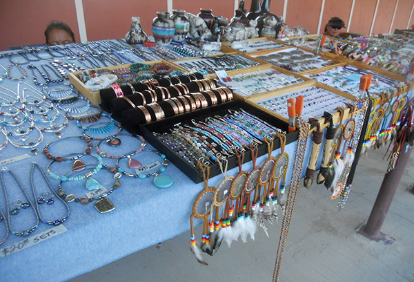 A typical Navajo jewelry stall at the Navajo Bridge. [photo by John] |
|
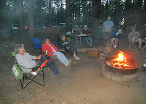
After a long, hard day of driving most of us finally arrive at the North Rim Campground between 4:00 and 5:00 PM on Thursday afternoon, with plenty of daylight left to set up our tents, fix dinner, and start our first campfire for the evening. And it appears that we have enough firewood on hand for at least a week’s worth of campfires. |
 A colorful rainbow of tent fabric stands out against forest green. [photo by Quy] |
|
Thankfully Group Site A is large enough to easily accommodate our record number of 19 tents with room to spare, ranging from a one-man pup tent, definitely not for the claustrophobic, to a roomy 8-person, two bedroom tent mansion with built-in vestibules at both ends. Now that’s what I call a tent. Hopefully we’ll all sleep good tonight since we have a busy day ahead of us for tomorrow. On Friday we’ll make the drive out to Timp Point and do an exploratory hike along the Rainbow Rim Trail out to North Timp Point. |
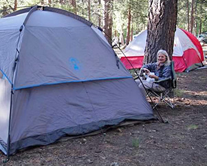 K.G. settles in by her tent. [photo by Quy] |
 Mike H. prepares his meal. [photo by Cyd] |
 Gary G. prepares dinner on his super stove. [Quy] |
 Gary M. thinks of what to fix for dinner. [Quy] |
|
The Rainbow Rim Trail is featured as the “Hike of the Month” in the current June, 2013 issue of Arizona Highways magazine. I had originally planned on hiking the Uncle Jim Trail today, a five-mile loop trail off the Ken Patrick Trail going out to Point Imperial and featuring many great views of Transept Canyon. However, Cyd and I both saw the Arizona Highways article at about the same time and thought this would make a great substitute for the Uncle Jim Trail that we had hiked previously on our June, 2011 North Rim trip. Quoting from the magazine: “The views from this remote trail are priceless and they’re unlike anything you’ll see in the national park or on postcards or in coffee-table books featuring photos of the most beautiful places on Earth.” Descriptions like this are certainly enough to get any hiker’s juices flowing. The Rainbow Rim Trail actually runs for a total of 18 miles (one-way), connecting five major lookout points on the far western edge of the Kaibab Plateau, including Timp Point, North Timp Point, Locust Point, Fence Point, and Parissawampitts Point at the far north end. As the crow flies, it’s only about three miles between the two end points. But since the trail follows the sinuous and winding contours of the rim and numerous steep side canyons along the way, that short three miles eventually stretches out to a full 18 miles in length. No crow in his right mind would follow that route. Today we are only hiking a total of six miles round trip between Timp Point and North Timp point, which the magazine describes as the most scenic and picturesque of the five points. Getting out to Timp Point is somewhat of an adventure in itself since it involves driving 23 miles of Forest Service roads out to the trailhead. The drive takes us well over an hour, although most of the road is in pretty good shape and appears to have been graded recently with the exception of occasional rough passages that put our vehicle’s suspension systems to the test. |
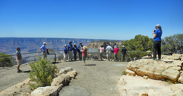
 Trailblazers gather around the Rainbow Rim Trail sign at Timp Point. [photo by John] |
|
After arriving at the trailhead, we all pile out of our vehicles and make a beeline for the trees to relieve kidneys that have also been put to the test along particularly rough stretches of road. We slip on our hiking gear, gather for a quick group picture in front of the Rainbow Rim Trail sign, and then put hiking boots to the trail in search of North Timp Point and Grand Canyon nirvana. The trail is fairly level for most of the first half as it passes through large stands of towering ponderosa pines, some up to twelve feet or more in circumference. |
 Trailblazers strike out on the Rainbow Rim Trail. [photo by John] |
 Towering ponderosa pines line the trail. [photo by Quy] |
|
Much of the trail is in open sun or light shade, and at these elevations we can really feel the sun’s intensity. |
|
|
A quick check of my camera bag thermometer reveals 85 degrees, but we would later discover that the high for this day was actually a record-breaking 92 degrees. In five previous trips to the North Rim I have never seen such warm temperatures. Global warming, or is it just exceptionally warm weather for June? Eventually the trail descends into a shaded gully where we get some relief from the heat before it begins switchbacking uphill and leveling out once again as it approaches the canyon’s rim and North Timp Point. |
 Trailblazers take a break along the Rainbow Rim Trail. [John] |
|
We make many stops in the shaded areas to cool off, and if we’re lucky enough to catch a light cooling breeze that makes it all the better. At some point I joke with one of our hikers that if we can’t get cool on the North Rim, then hiking to the top of Mt. Humphreys might just be the only cool place left in Arizona. |
|
 Here lie the mortal remains of the anonymous Mr. Bones. [photo by Quy] |
||||||
|
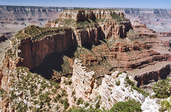
North Timp Point provides sweeping, panoramic views of the Grand Canyon that include Steamboat Mountain, Powell Plateau, Great Thumb Mesa, and Tapeats Amphitheater. After trying to soak it all in and taking numerous pictures to capture and preserve the views, we find a cool shady retreat among the trees and sit down for a well-deserved lunch and rest break. Debbie is determined to finish her post-lunch power nap, but we urge her on and return to the main point for a group picture, graciously taken by a former Colorado River runner hiking the trail with a small group of friends. And the anonymous Mr. Bones? Cyd and I had concluded earlier that it was likely all that remained from a mountain lion kill, the victim most likely being a young hybrid buffalo (bison), commonly referred to as beefalo — more on that topic to follow. |
||||||
 The panoramic view from North Timp Point is breathtaking. [photo by Chuck] |
||||||
 After three miles of hiking, 21 Trailblazers finally reach North Timp Point. [photo by Chuck] |
||||||
|
 Diana and Ken take in the view from North Timp Point. [photo by Quy] |
 Dottie and John enjoy a quiet moment together at the point. [photo by Quy] |
 Kim tries to capture the scene with her digital camera. [photo by Quy] |
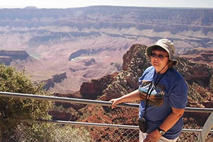
 Wendy poses by the rim’s edge for this classic shot. [photo by Quy] |
|
Our next stop is Monument Point, suggested by Michael H. So we all pile back into our vehicles and make the long, bumpy drive out to Monument Point. |
 A second panoramic view from Monument Point. [photo by Chuck] |
 Lisa takes in the view from Monument Point. [photo by Chuck] |
We hit a couple of minor detours along the way and the drive takes longer than expected, but I think we all agree that it was worth it when we finally arrive and make the short hike out to the point. The nearby Bill Hall Trail is named in honor of Park Ranger Ward “Bill” Hall, who died in the line of duty somewhere nearby on July 16, 1979. As much as we would like to stay longer, it’s already late in the day and we have a lot of road to travel getting back to the campground. So we’re off once again. By the time we finally hit the paved North Rim Parkway (Highway 67 out of Jacob Lake), Gary G. announces that we have driven almost 75 miles of Forest Service roads for the day. No wonder we all have sore behinds! |
|
After we finally arrive back at the campground, we all get cleaned up and waste no time in preparing for the Great Friday Night Potluck Extravaganza. |
 A hungry horde of Trailblazers descends on the food-laden potluck table. [photo by Quy] |
 Trailblazers sit down to the Great Friday Night Potluck Extravaganza. [photo by John] |
On this evening’s menu we have a wide variety of delicious foods ranging from firehouse chili and lite beef stew, Korean style pork chop BBQ, potato salad, tuna hash, BBQ chicken drumsticks and BBQ meatballs, to a huge tossed garden salad, veggie stir fry, thinly-sliced and sautéed prickly pear pads and onions, raw veggies, and three-bean salad, to desert items including chocolate chip cookies, brownies, two large apple cakes, and fresh fruit salad. All this washed down by water, iced tea, soda, beer, wine, and even Rudy’s special Jeremiah Weed (oops – that’s for sipping later while sitting around the campfire). Unfortunately, the French-fried grasshoppers were a no-show on the menu since they apparently took flight and escaped prior to preparation. Either that or they somehow got to the Jeremiah Weed and took off HUI (hopping under the influence). |
|
Despite our best efforts, we still have enough food left over for the next two nights. Stuffed to the gills, we loosen our belts and waddle over to the campfire for an evening of tall tales and wild stories that get even taller and wilder as the evening wears on and Jeremiah Weed (similar in fire-power to 190-proof Ever Clear) makes the rounds. Most are too tall and too wild to even discuss here so we’ll all have to rely on our memories, while those who were not with us on this trip will have to rely strictly on their imaginations. |
| photos by Cyd: | |
 A smorgasbord of culinary delights. |
 Gary G.’s colorful and tasty stir-fry dish. |
 Gary G.’s chicken breast BBQ. |
 Gary G.’s rice and mushroom dish. |
|
I will say, though, there was one rather interesting story by the campfire about someone who allegedly slugged some poor shmuck at the lodge bar and sent his upper dentures flying across the room to a perfect splash-landing in a steaming hot bowl of clam chowder. But as they say, what goes on at the North Rim stays at the North Rim. |
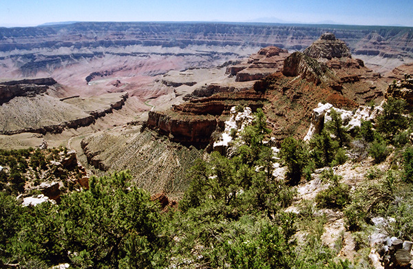
 Grand Canyon’s version of the Golden Dome, bathed in early morning light. [photo by Quy] |
 An intricate play of shadows deep within the abyss of the Grand Canyon. [photo by Chuck] |
|
Very early Saturday morning at the North Rim Campground, and it’s dark as the inside of a West Virginia coal mine during a power outage. Unbelievably, someone or something is rattling my tent! I look at my watch and the time is precisely 4:10 AM. Are you kidding me? Who the heck is up this early? Then a soft, almost apologetic, voice tells me that it’s time to get up and watch the sunrise. Is that you, Quy? Are you sleepwalking again? Please — go back to bed and try to get some sleep. Then it hits me. Quy talked me into getting up in the middle of the night and heading out to Bright Angel Point to take pictures of the morning sunrise from the point, just as she did on our June, 2011 trip. Note to self: must get head examined when I get back home from this trip. Reluctantly, I crawl out of my warm sleeping bag, splash some cold water on my face to wake up, throw on a light flannel shirt and shoes, and stagger out into the darkness to orient myself. Then quickly back into the tent again to put on pants. Quy, Wendy and I gather the rest of our gear and walk in silence to my Dodge Dakota pickup to make the short drive out to the point. Surprisingly, the point isn’t nearly as crowded as it was on our 2011 trip. Apparently most people aren’t as crazy as we are. So we find our favorite spots, take up position with cameras at the ready, and wait for Nature’s light and magic show to begin. Then, almost as if on queue, the first golden shafts of sunlight breach the canyon rim behind us and ever-so-slowly begin to paint the canyon’s walls, terraces, buttes, and temples in a kaleidoscopic fusion of soft pastel colors from pink to burning gold, starting from the uppermost points and almost imperceptibly working their way deeper and deeper into the unseen shadowy depths of the canyon as the sun slowly climbs higher above the rim. This is truly a magical moment like few others in life, beyond the ability of mere words and photographs to attempt to capture, and definitely worth the early wake up call since a Grand Canyon sunrise is like none other on Earth. “But the COLORS, the living rejoicing COLORS, chanting morning and evening in chorus to heaven! No other range of mountainous rock-work of anything like the same extent have I seen that is so strangely, boldly, lavishly colored. The prevailing colors are wonderfully deep and clear, changing and blending with varying intensity from hour to hour, day to day, season to season; throbbing, wavering, glowing, responding to every passing cloud or storm, a world of color in itself, now burning in separate rainbow bars streaked and blotched with shade, now glowing in one smooth, all-pervading ethereal radiance like the alpenglow, uniting the rocky world with the heavens.” |
 Debbie’s quick & easy omelet-in-a-bag breakfast. [photo by John] |
 The chef enjoys her tasty omelet creation. [photo by John] |
 John and Dottie admire Gary G.’s campground set-up. [photo by Quy] |
 Cyd enjoys a quite, reflective moment at breakfast. [photo by Quy] |
|
When we three early birds finally arrive back at the campground, most of the others are already busily preparing breakfast. So we all assemble to eat a hearty breakfast before starting another day of hiking on the North Rim of the Grand Canyon. Today will be a bit easier than yesterday, with a short four-mile round trip hike on the Widforss Trail out to the head of Transept Canyon and back, followed by lunch at the Widforss Trailhead. After that we’ll take the Point Sublime Road out to Point Sublime, the western-most point on the North Rim within Grand Canyon National Park. The total driving distance over Forest Service roads will only be about half of what we did yesterday – 36 miles round trip out to the point and back. Here is one viewer’s description of Point Sublime: “Everything you imagine about the Grand Canyon is made into reality when you visit Point Sublime.” That’s certainly good enough for us. With breakfast out of the way and all coolers and food boxes safely stored away, twelve of us get into three vehicles for the short drive out to the Widforss Trailhead. The rest of the group elects to remain at camp for a more leisurely day of relaxing and exploring on the rim. |
 Twelve Arizona Trailblazers gather around the Widforss Trail sign. [photo by Cyd] Michael, Quy, Chuck, Monika, Scott, Wendy, Kim, Lisa, Gary M., Mark, Dottie, and Gary G. |
|
The Widforss Trailhead is located about a mile north of the campground and just beyond the turnoff for the North Kaibab Trailhead on Highway 67. It’s just off the Point Sublime Road about a quarter mile from Highway 67. The trail is named after Swedish-born watercolorist Gunnar Widforss, famous for his paintings of numerous national parks including Yosemite, Yellowstone, Bryce, and Zion, in addition to the Grand Canyon which was his home base from the early 1920s until his death in 1934. The trail begins climbing shortly beyond the trailhead and continues in a series of ascents and descents as it winds its way through a mixed forest of ponderosa pine, Douglas fir, and blue spruce and begins skirting the rim of Transept Canyon, sometimes referred to simply as The Transept. |
 Approaching the head of Transept Canyon. [photo by Quy] |
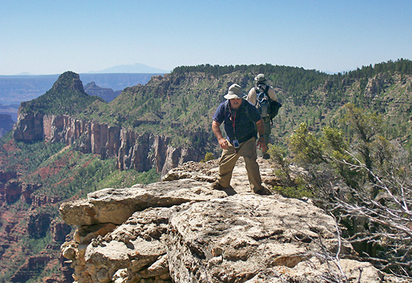 Gary M. and Chuck scramble out on a rocky peninsula for a better view of the canyon. [photo by John] |
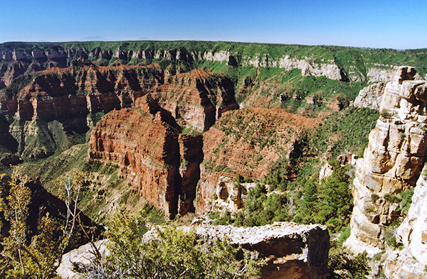
 Sweeping view from the head of Transept Canyon. [photo by Chuck] |
|
Transept Canyon is a major tributary gorge for Bright Angel Canyon, which runs from Roaring Springs Canyon and Roaring Springs all the way down to the Colorado River, almost 6,000 feet below the North Rim. The trail runs for five miles out to Widforss Point which overlooks Haunted Canyon. But today we are only hiking about half that distance to the head of Transept Canyon, one of the best views on the entire trail. Thankfully, we are getting an earlier start today to hopefully beat the heat, and there is also more shade along the Widforss Trail than we had yesterday along the Rainbow Rim Trail out to North Timp Point. Another added bonus is our higher elevation and more cooling breezes. So we make good time and arrive at the head of Transept Canyon in well under two hours. After taking a break and lots of pictures we reverse course and make the return hike back to the trailhead and lunch. |
 Don’t back up, Lisa! [photo by Quy] |
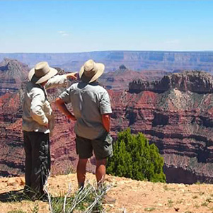 Scott and Mark look over Point Sublime. [by Quy] |
|
Cyd and Mike arrive shortly after lunch to accompany us on the drive to Point Sublime. The drive out to the point is 18 miles on the well-graded Point Sublime Road, traveling through old-growth ponderosa pine and Douglas fir forests with scattered large open meadows along the way, beginning with the vast Harvey Meadow located just across the road from the Widforss Trailhead. We make good time and cover the distance in about 45 minutes, despite several rough spots that slow us down over the last couple of miles. One of the most breathtaking vistas anywhere in the Grand Canyon from the North or South Rim, Point Sublime offers a broad and sweeping 270 degree view deep into the heart and soul of the Grand Canyon. It is the western-most point on the North Rim within Grand Canyon National Park and arguably the most outstanding view from anywhere on the North Rim. And today we have the entire point all to ourselves to explore and photograph. One viewer was moved to write “Everything you imagine about the Grand Canyon is made into reality when you visit Point Sublime.” And he certainly was not exaggerating. There are no trails from Point Sublime, but plenty of viewpoints to check out so we spread out and try to take in as much as we can in the next half-hour or so. Here the photographer can point a camera almost anywhere within the 270 degree field of view and come up with a great picture. Point Sublime is aptly named and more than lives up to its outstanding reputation. |
 Michael and Gary M. enjoy the view from their rocky perch. [photo by Quy] |
 Point Sublime certainly lives up to its name. [photo by Chuck] |
 The point is both sublimely beautiful and sublimely spectacular. [photo by Chuck] |
 Arizona Trailblazers gather for a group picture at Point Sublime. [photo by Cyd] Mark, Wendy, Kim, Chuck, Quy, Lisa, Gary M., Michael, Cyd. |
 Cyd takes five at Point Sublime. [photo by Cyd] |
 Chuck gets into position for a good shot from the point. [photo by Cyd] |
 Mark at Point Sublime with a sliver of the Colorado River in the background. [photo by Cyd] |
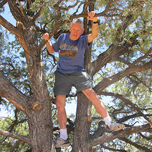 Mike is getting up in the world. [photo by Cyd] |
 Wendy is sitting right on the edge of Point Sublime. [photo by Cyd] |
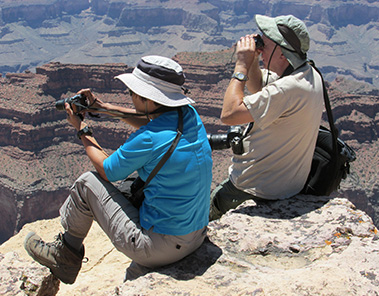 Chuck the spotter and Quy the photographer. [photo by Cyd] |
|
On our drive back to the campground on Highway 67 we come across this small herd of buffalo peacefully grazing in the large meadow running alongside the road. The current herd of hybrid bison within the park, or beefalo as they are commonly referred to, is the result of experimental breeding of buffalo and cattle on the Kaibab Plateau dating back nearly a century in time. Although the original experiments failed, they were successful in later years and resulted in a hybrid breed of buffalo that has thrived for decades in House Rock Valley to the northeast of the park’s North Rim boundary. |
 A small herd of hybrid bison grazes peacefully by the roadside. [photo by Chuck] |
|
But in recent years their numbers have swelled to an estimated 300 animals, which have since crossed over into the National Park and are wrecking havoc on the environment since they are not native to the area and now seem to have taken up permanent residence. Several different agencies are at loggerheads on how to deal with them, while the National Park Service just wants them removed from the park. The animals are currently owned by the state and managed by the Arizona Game & Fish Department. Admittedly, they are fun and interesting to watch and photograph, but were never native to the Kaibab Plateau and because of that probably should be removed from the area and relocated. |
| Flowers are some of Quy’s favorite subjects: | |
 Manzanita in full bloom. |
 Blue lupine nods in the breeze. |
 Cliff Rose. |
 Skyrocket |
 Bees are busy pollinating here. |
 Moths are the pollinators of these plants. |
|
After Point Sublime, we arrive back at the campground early Saturday afternoon with plenty of time to kick back and relax for a change with absolutely nothing on the agenda for the rest of the day except to finish off our potluck dinner from yesterday. And there is certainly more than enough of that left over for everyone. Since no one wants to take it back home with them, whatever we still have left over from tonight will show up on tomorrow’s menu as well. One way or the other we will finish off this food ... |
 Ken and Diana enjoy their time among the pines. [photo by Quy] |
 Mike relaxes with a hot cup of Joe. [photo by Quy] |
 Rudy catches up on the news. [photo by Quy] |
 Karen, this is what I call a camp chair. [photo by Cyd] |
 Michael tries out Cyd’s new Frogg Togg chill pad. [photo by Cyd] |
 The Great Saturday Afternoon Watermelon-Seed-Spitting Contest. [photo by Quy] |
 Cyd and Chuck take turns splitting wood for the evening campfire. [photo by Quy] |
|
But for now some of us are eager to dive into Gary M.’s spiked watermelon. Gary had cut a plug out of the melon earlier in the day and poured in about half a bottle of Jamaican rum to give it plenty of time to soak in. No matches or lighters around this melon please! We certainly don’t want a flaming watermelon with all of these trees around. After consuming more than our share of the spiked melon, Rudy, Mike, and I engage in an old-fashioned watermelon seed spitting contest. I had both of them on distance, but I believe Rudy was the champ on marksmanship. Thanks to Lisa for being our target adjuster and for being a good sport after becoming a target herself a few times when she accidentally got in the line of fire. |
 Making preparations for the Saturday night potluck. [photo by Cyd] |
 Trailblazers enjoying another great potluck meal. [photo by John] |
 Trailblazers sitting around the evening campfire. [photo by John] |
 Rudy shares one of his many off-color jokes. [photo by John] |
|
Sunday morning, our last full day on the North Rim, dawns bright and clear just like the last two days. For some reason (perhaps anticipating Quy rattling my tent again in hopes of going out for one last canyon sunrise?) I awoke at about 3:30 AM. When I looked at my tent thermometer I was surprised to see the temperature sitting at 65 degrees, our warmest night time temperature yet. Looks like this is record-breaking weather on the North Rim for both day and night time temperatures. The nights have been so warm, most of us hardly need sleeping bags at all or at least certainly don’t need to zipper them all the way up. Especially interesting since the NOAA weather forecast I pulled up just before our departure for the canyon predicted night time lows in the mid-40s for the North Rim. I guess we can just chalk it up to a heat wave. After breakfast at the campground, sixteen of us pile into three vehicles for the scenic Rim Drive, first out to Point Imperial and then down to Cape Royal, the furthermost point on the drive. The road out to Point Imperial contours along the southeastern edge of the Kaibab Plateau out to the highest viewpoint on the North Rim at 8,803 feet. The road to Cape Royal hugs the eastern edge of the Walhalla Plateau overlooking the Grand Canyon. From Cape Royal we will slowly work our way back north, stopping at several more scenic viewpoints along the way, including a two-mile trek out to Cape Final. Then we cap it all off with a lunch stop at the North Kaibab Lodge dining room. |
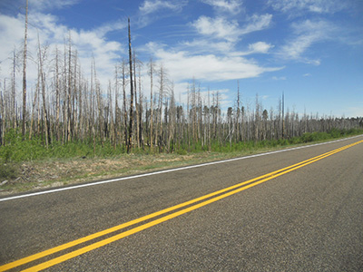 Aftermath of the May, 2000, Outlet Fire on the road to Point Imperial. [photo by John] In May, 2000, a prescribed fire (later called the Outlet Fire) blew out of control on the North Rim and burned through 14,500 acres of forest within Grand Canyon National Park, including the trees around Point Imperial and Saddle Mountain before it was fully contained. This picture taken by John along the road out to Point Imperial still shows the aftermath of that fire 13 years later. Then in June, 2006, a lightning caused fire (later called the Warm Fire) torched nearly 60,000 acres of the Kaibab National Forest, most of it north of the national park boundary. Now, seven years later, we can still see the wide-spread devastation from that fire while driving along Highway 67 on the way into the park. During one of the several ranger talks we attended at the campground amphitheater we were reminded that in the event of a wildfire anywhere along Highway 67, the only escape route for everyone trapped on the North Rim would be right over the edge of the canyon by way of the North Kaibab Trail. Of course that would mean leaving everything behind and at the mercy of the fire – all of our vehicles, supplies, and camping gear. The only thing we could carry down the trail would be whatever we could put on our backs. “From the southernmost point of this tableland the view of the canyon left the beholder solemn with the sense of awe . . . The dawn and the evening twilight were brooding mysteries over the dusk of the abyss; night shrouded its immensity, but did not hide it.” |
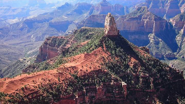 Mount Hayden from Point Imperial. [photo by Quy] |
 Saddle Mountain from Point Imperial. [photo by Chuck] |
 Angels Window on the approach to Cape Royal. [photo by Chuck] |
 Wotans Throne from Cape Royal. [photo by Chuck] |
 Vishnu Temple from Cape Royal. [photo by Chuck] |
 Dottie and John take a break near Angels Window. [photo by Quy] |
 Monika at the Cape Royal Lookout. [photo by Quy] |
 Scott at Cape Royal Lookout. [photo by Cyd] |
 Gary G. at Cape Royal Lookout. [photo by Cyd] |
 Chuck and Quy try to capture Mount Hayden. [photo by John] |
 Trailblazers gather at the Cape Royal Lookout. [photo by John] |
|
Talk about a labyrinth of photographers! In this classic shot John is taking a picture of Diana taking a picture of Cyd taking a picture of four Trailblazers in the following picture. Poor Mark observes dejectedly since he doesn’t have a matching T-shirt and was therefore summarily rejected from the group picture. |
 The Trailblazers Fab Four sporting their spiffy matching North Rim T-shirts. [photo by Cyd] |
Get the T-shirt next time, Mark! Note the San Francisco Peaks in the far distance directly behind Monika. Although at least fifty miles away to the south, we can still clearly see large patches of snow on the peak’s high North Slope. In June of last year we had 27 hikers (six of them also on this trip) on the slopes of Mt. Humphreys. Twenty-one made it all the way to the summit. |
 Close-up shot of the Colorado River and Unkar Wash rapids. [photo by John] |
 Parting shot from Cape Royal. [photo by Chuck] |
|
It’s almost 11:30 by the time we finally arrive at the Cape Final Trailhead and already pretty darned warm. We take a quick vote, and the overwhelming consensus is to bag the hike and head back to camp instead to clean up and gather the rest of our group who elected to stay at camp and then make the short drive to the lodge for lunch. |
|
I take full responsibility here since we should have done the hike first thing in the morning, knowing how warm it has been on this entire trip. But Cape Final will be at the very top of the list on our next visit to the North Rim, especially since we’ve missed it now on two consecutive trips. That, along with several other objectives, will be our primary incentive to return to the North Rim (not that we really need that much incentive to come back here). |
 Timeless words of wisdom from our 26th President. [photo by John] |
 The view from Walhalla Overlook. [photo by Chuck] |
 Cyd captures all of us in a single shot. [photo by Cyd] |
 The Trailblazers Fab Four all gravitate to the same table. Priceless! [photo by John] |
 No more leftovers for us! [photo by John] |
 Detailed view of the dining room’s post & beam ceiling with chandeliers. [photo by Cyd] |
|
After a leisurely lunch at the lodge, we head back to the campground. Later in the evening we finish off most of the remaining potluck leftovers and enjoy one last evening sitting around the campfire together, with a good supply of firewood left over for the next group of campers. After breakfast on Monday morning, we start the long ordeal of breaking down camp and trying to reload all of our gear back into the vehicles. For some strange reason, things never seem to go back in quite like they did at the beginning of the trip. Sort of like trying to stuff a new tent back into its original box, I suppose. |
 Trailblazers pose for one last group picture near the lodge. [photo by John] |
|
After finally packing everything away, we look around one last time to make sure nothing is left behind, bid our goodbyes to one another, and hit the road for the long drive back to our homes in the Valley of the Sun. Mark and Mike will be heading back to their homes in Cottonwood, while John and Dottie are extending their trip for a few more days to Lake Powell and southern Utah. Eight of us – Scott and I, along with Cyd, Lisa, Gary G., Gary M., Ken and Diana – are taking the short side trip out to Lee’s Ferry on the way back since it’s right off Highway 89A just before the Navajo Bridge crossing. Those pictures are posted at the end of this report. Critters of the North Rim: |
 Basking in the sun at the Walhalla Overlook. [photo by Chuck] |
 Basking in the sun at an undisclosed location. [photo by Quy] |
 This little porker is seeking shade in the Lee’s Ferry area. [photo by Cyd] |
 Looks like this little guy hit the jackpot as he tries to haul away his prize. [photo by Quy] |
|
The tassel-eared Kaibab Squirrel, with its dark charcoal head and body and snow-white tail, is a unique sub-species of tree squirrel found only on the Kaibab Plateau. As a final footnote, I want to thank all of you once again for your participation in the June, 2013 North Rim Grand Canyon trip and especially thank Cyd, Quy, and John for sharing their pictures, many of which I used in this trip report, along with some of my own. Hopefully the words and pictures within this report will help preserve the memories and the good times we all shared together at the North Rim of the Grand Canyon in 2013 for many years to come. And may all of our paths converge once again on the amazing trails of Arizona. This one is for you, Wendy Rennert. I hope I did a good job with it. Happy Trails and God speed, dear friend. |
 Cyd takes a break by the Colorado River near Lee’s Ferry. [photo by Lisa] |
 Lisa and Cyd at Paria Beach near Lee’s Ferry. [photo by Cyd] |
 River rafters passing beneath the Navajo Bridge. [photo by Cyd] |
|
After you turn off Highway 89A just west of the Navajo Bridge, it’s a short and scenic six-mile drive to Lee’s Ferry on the Colorado River. This two-mile stretch of the river forms the junction where the Colorado emerges from Glen Canyon and joins forces with the Paria River, before plunging into Marble Canyon. This marks the starting point, or Mile Zero, of the river’s 277-mile long run through the Grand Canyon and therefore becomes the primary reference point from which all other points on the Colorado River are measured. With its ease of access to the river, Lee’s Ferry has also been the major launching point for river rafting expeditions through the Grand Canyon for many decades. |
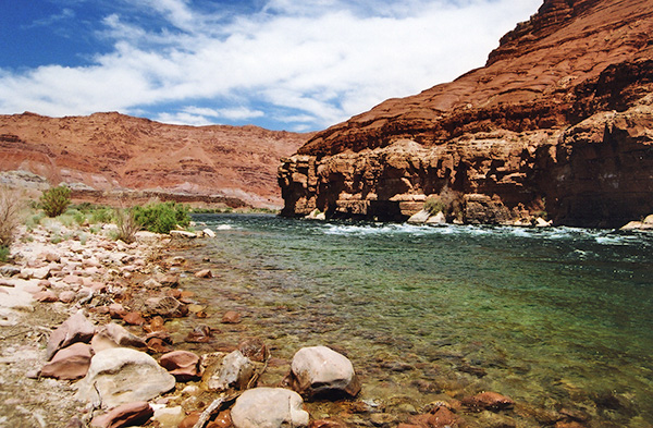 Colorado River and Paria Riffle from Paria Beach. [photo by Chuck] |
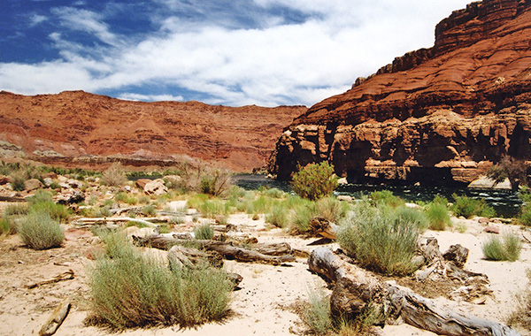 Paria Beach with its large collection of driftwood. [photo by Chuck] |
 Rafting party departing from Lee’s Ferry. [photo by Chuck] |
|
John D. Lee, a Mormon and a practicing polygamist in his time, settled here in 1871 and started a ferry service in 1873. The ferry service changed hands several times over the years and continued operating until 1929, when the original Navajo Bridge opened to traffic. Nearby, Lee built several stone and wooden houses for two of the families that lived with him at the time, as well as a small dam and irrigation system for farming. The original 160 acres of land owned by Lee was later renamed Lonely Dell Ranch because of its extreme remoteness. A number of different families lived at the ranch over the years until the property was finally deeded to the National Park Service in 1974. Unfortunately, due to major flooding of the Paria River and later razing of some of the buildings, very few of the original structures remain today at Lonely Dell Ranch. |
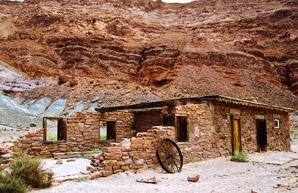 Lee’s Ferry Fort. [photo by Chuck] |
 Lonely Dell Ranch House. [photo by Chuck] |
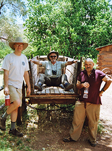 Scott, Gary G., and Gary M. by the old ranch wagon. [photo by Chuck] |
 Remains of the Charles H. Spencer, sunk in 1914. [photo by Chuck] |
 Top of Page
Arizona Trailblazers Hiking Club, Phoenix, Arizona
Comments? Send them to the AZHC .
updated September 4, 2017