Outdoor Links
Hike Arizona
Trip Planning Guide
Trip Report Index
Calendar of Events
Library
|
Picacho Peak Day Hike Tucson March 2, 2013 by Chuck Parsons |
|
 Arizona Trailblazers prepare to hike the Hunter Trail. [photo by Wayne] |
|
On all previous Picacho Peak hikes with both the Motorola Hiking Club and its successor, the Arizona Trailblazers, we have always hiked the Hunter Trail from the north end of the park’s Barrett Loop to the top of Picacho Peak and then returned back to the trailhead on the same trail. |
 Arizona Trailblazers gather around the Hunter Trailhead sign. [photo by Bill] Front Row: Ceci, Anikó, Quy, Bill, Ajay, Monika, and Wayne. Back Row: Ted, Chuck, Andy, Rudy, Lori, George, Mark, and David. |
|
This time for a change of pace I thought we would return on the longer Sunset Vista Trail along the south side of Picacho to Sunset Vista Trailhead. That will increase the hiking distance from 4 miles to 5.1 miles and also give us a completely different view on the return hike. But since the two trailheads are two miles apart and would require walking back along a narrow road with no shoulders, we will have to shuttle three vehicles out to the Sunset Vista end to ferry us back to the Hunter Trailhead at the end of the hike. |
 Fifteen Trailblazers strike out for Picacho Peak. [photo by Wayne] What a contrast from our Barnhardt Trail hike in the Mazatzals just days earlier on Sunday, February 24th, when we were all bundled under several layers and shivering in 35-degree weather at the trailhead. We were hiking in snow and ice over a foot deep along the upper stretches of the trail and witnessing, much to our disbelief, several large frozen waterfalls high above the trail before finally reaching Big Kahuna Falls which was surprisingly still flowing. The high for the day was a balmy 45 degrees, but the occasional Arctic blasts of frigid wind would drive the wind chill factor down into the low teens before the day was over. That day brought back fond memories of Minnesota to one of its native daughters, Eileen, and reminded her more of her former state than her current one here in the desert. Priceless! Only in Arizona. The Hunter Trail begins climbing almost immediately from our 2,000-foot starting point as it traverses numerous steep switchbacks through typical Sonoran Desert vegetation of creosote, ocotillos, chollas, palo verdes, and scattered saguaros and gradually winds its way up the steep northern slope of Picacho Mountain. After a half-mile of steady elevation gain, we finally reach the cliff base, prominently seen from the trailhead in the first two group pictures. Leveling off along the base of the cliff for awhile, the trail then goes into another series of ascending switchbacks all the way up to the saddle at 2,960 feet. |
 Sweeping panoramas cheer us on our way up to the saddle. [photo by Ted] |
|
The saddle marks the halfway point to Picacho Peak. We have climbed almost one thousand vertical feet in one mile of hiking by the time we finally reach it. I didn’t have the heart to tell our first time Picacho hikers that this was actually the easy part. The really serious stuff comes after the saddle. The saddle also marks our first rendezvous point on today’s hike, and the Vanguard Ten takes a break while they wait on the remaining five from our group and admire the surrounding desert scenery, now much greener and lusher than in the past few years, courtesy of the plentiful winter rains that have fallen across parched desert terrain over the last few months. So far we’ve only seen a few scattered Mexican gold poppies along the trail, but it may still be a little early in the season. |
 Anikó makes her way up to the saddle as other hikers head back down. [photo by Ajay] |
 Mark, Ajay, and Wayne celebrate the day. [photo by Wayne] |
 Ten Trailblazers pause at the Picacho Mountain Saddle. [photo by Wayne] |
|
Picacho Mountain is volcanic in origin, the result of numerous sequential lava flows dating back 22 million years in time. Although most of it is weathered and highly eroded volcanic rock (primarily basalt), a great block of Precambrian granite whose origins are still unclear to many of today’s geologists lies near the summit. Although the term is rarely used today, Picacho Peak was once widely referred to as the “Ship of the Desert” because of its prominence as a well-used landmark by generations of explorers and travelers passing through this area over many years. Arizona’s only Civil War battle was fought at the base of this peak on April 15, 1862, resulting in three Union casualties in a ninety-minute skirmish that is re-enacted here every year in mid-March. |
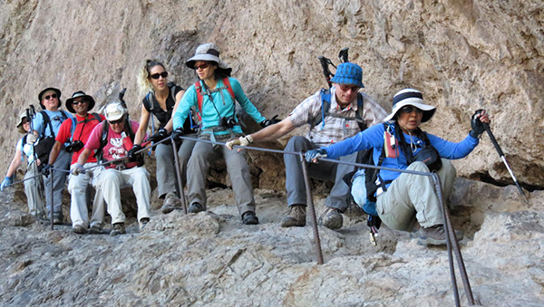 Trailblazers make their first cable-assisted descent after the saddle. [photo by Wayne] |
 The terrain gets rougher as Trailblazers negotiate still more cables. [photo by Wayne] |
 Chuck and Ajay are hanging on. [photo by Monika] The steel cable supports provide a critical handhold at this point, providing both safer footing and greater stability on the steep and slippery bare rock surface, as we slowly and carefully make our descent down the backside of Picacho and relinquish much of our previously hard-earned elevation gain. |
 The first major double-cable climb is a busy place today. [photo by Ajay] |
 Bill scrambles up a steep rock pile. [photo by Quy] |
 Anikó and Mark climb the double-cable. [photo by Ajay] |
 Andy is almost to the top, but not the summit. [photo by Wayne] |
 Anikó and Andy take a cave break. [photo by Ajay] Two critical factors come into play here: (1) with the help of leather gloves, get a good solid grip on the steel cables to avoid slipping and (2) be very careful where you place your feet for maximum traction and support while moving up or down on the cables. This is one of the few trails in Arizona that provide both an upper and lower body workout, as we have to literally strong-arm our way up numerous steep and rocky approaches to the summit. |
 Quy makes her way up the double-cable support. [photo by Wayne]  I’m staying right here and you can’t make me move. [photo by Ajay] |
Although you don’t notice it right away, at some point you become aware of the absence of traffic noise, a constant reminder of the steady stream of cars and trucks speeding by on the busy interstate below Picacho Peak. On descending from the saddle, the mountain itself now serves as a natural noise barrier, absorbing the cacophony of man-made noises on the north side and replacing them with the soothing and relaxing sounds of nature on the south side. One of the first things I hear is the rush of beating wings as dozens of fast-moving cliff swallows dart in and out of the area around the cliff face where they build their nests. Next I hear the unmistakable descending notes of the canyon wren drifting on the soft breezes blowing up from the desert floor far below us. |
| Photos by Ajay: |
 Wayne hams it up for the camera. |
 A rare stretch of flat trail on the back side of Picacho. |
 Ajay is on top of the world! |
|
At this point Monika decides to forego the remainder of the climb to the summit and meet up with Ted, who had announced earlier that he was going to bail out and head back on the Sunset Vista Trail to our waiting vehicles. |

|

|
| Monika makes a steep descent on the trail, then looks back. [photos by Ajay] | |
|
Shortly afterward I hear from both Ted and Monika over the TalkAbout radios that they have joined up and will be hiking back together to the Sunset Vista Trailhead. By now some of the rest of us may be thinking the same thing. Perhaps we should bail out ourselves and head back with them but we stubbornly press on, determined more than ever to get to the top of Picacho Peak. It’s got to be up there somewhere. |
 13 Trailblazers high atop Picacho Peak. [photo by Ajay] |
 Victory! [photo by Quy] |
 Chuck and Wayne – don’t back up! [photo by Ajay] |
|
By 11:00 all of us are finally assembled at our destination for the day for one last group picture. Here we are standing on Picacho Peak at an elevation of 3,374 feet. From the top of this peak it’s a sheer drop of nearly 1400 feet to the desert floor far beneath our precarious perch, where busy Saturday morning traffic streams by on Interstate 10, totally oblivious to this motley crew of hikers assembled high above it. We sit down to enjoy a well-deserved rest and lunch break as we observe the surrounding scenery. Some forty miles to the southeast snow can still be seen in the majestic Santa Catalina Range just north of Tucson. |
 Sweeping view of I-10 and parallel train tracks from the summit. [photo by Chuck] |
 Close up view of the park entrance and Barrett Loop. [photo by Ajay] |

|

|
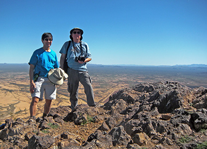
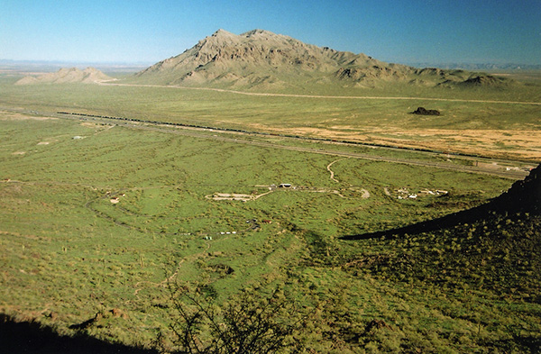
| Two views of Picacho Peak from its sister peak. [photos by Chuck] | |
|
As we’re heading back down from Picacho Peak a number of us decide to take the short spur trail off the Hunter Trail that leads to the top of Picacho Peak’s lower sister peak to the northeast. This lower peak provides the hiker with unique views of Picacho Peak seen nowhere else on the trail. Ajay, Wayne, and I explore the area a bit longer than expected and as a result we are the last three Trailblazers to head back down on the Hunter Trail. |
 Human traffic jam on the Hunter Trail. [photo by Ajay] |
We are making good time until we come to a screeching halt at the head of the double cable descent where we have to queue up behind about 16 other hikers ahead of us also waiting to go down. In the meantime we all have to first wait for about a dozen other hikers making their way up the cables. It’s Grand Central Station on Picacho. By the time all the traffic clears, it takes us close to twenty minutes to get to the bottom of the cables. Note to self: make sure to schedule this hike on a weekday next time. |
 Bill and Mark make the tricky descent on the Sunset Vista Trail twin cable. [photo by Quy] |
 Chuck and Ajay are the last two on these longest and steepest cables. [photo by Wayne] |
|
After making the junction, we’re just a few hundred yards into the Sunset Vista Trail when we come across this diabolical looking device that could almost pass for a torture rack. The longest and steepest cable network on Picacho, this cable system is about 70 feet long and hangs precariously onto the rock face at close to an 80 degree pitch. If you lose your grip here, it’s a fast trip to the bottom and a very hard landing when you arrive about ten milliseconds later – hopefully all in one piece. Thankfully, we all make it safely down without mishap and continue on the trail. |
 Looking back along the Sunset Vista Trail. [photo by Chuck] |
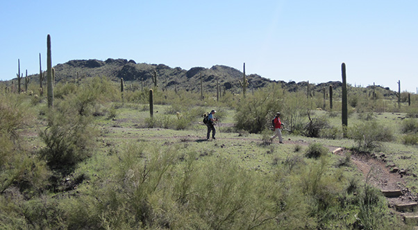
 Trailblazers make their way along the Sunset Vista Trail. [photo by Quy] |
 Desert bells. [photo by Quy] |
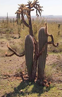
 Triplets. [photo by Chuck] |
 Sea of saguaros from the Sunset Vista Trail. [photo by Wayne] |
 This saguaro has bit the dust. [photo by Ajay] Apparently his reports were not coming in from the Sunset Vista Trail, since all of the wildflower pictures in this report were taken along that trail on our hike back to Sunset Vista Trailhead. |
 Desert Chicory. [photo by Quy] |
 Desert Bells. [photo by Wayne] |
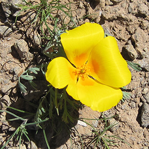
 Mexican gold poppies blanket this hillside. [photo by Ajay] |
 A field of Mexican gold poppies. [photo by Wayne] |
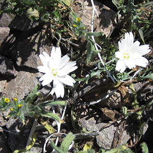
 What is this? [photo by Quy] |
|
The plentiful winter rains and recent warm weather across the desert have done their job and done it well. Millions of long dormant seeds are now germinating and springing to life, giving birth to a new generation of colorful wildflowers that will soon explode in a riot of spring colors slowly advancing across thousands of acres of the vast Sonoran Desert of southern Arizona. |
 Waiting ... and waiting ... and waiting. [photo by Monika] |
 Britches Blowout. [photo by Bill] |
|
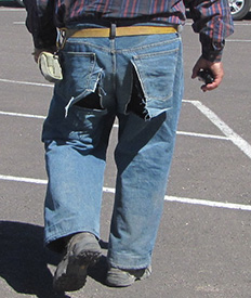
Ted has his own story on this, but here is what I think really happened. Two renegade ostriches, recently escaped from the Rooster Cogburn Ostrich Farm just down the road from Picacho Peak and considered armed and dangerous with their jeans-ripping beaks and feet especially designed for major butt-kicking, just happened to be in the vicinity of the Sunset Vista Trail on the south side of Picacho where they were scouting out potential hiding places to elude their searchers. They took immediate notice of Ted when he bent over to pick up something on the trail, saw their opportunity, and quickly moved in for some prime butt-kicking. Luckily, Ted narrowly escaped the marauding big birds, but with beaks snapping as they charged after him the renegades managed to do a number on the backside of his britches as he was running pell-mell down the trail for his life. Thankfully Ted is OK, although his pants made the ultimate sacrifice. Now for Ted’s somewhat more factual version of what happened, please read his supplemental report immediately following this. |
 Chuck and Ajay finish the hike on the Sunset Vista Trail. [photo by Ted] |
 Post-hike libations and critique. [photo by Quy] |
|
Per Mark’s suggestion, after the hike some of us stopped off at the Taste of Greece Greek Festival at St. Katherine Greek Orthodox Church in Chandler on North Dobson Road just south of Elliot Road. There we watched several colorful dances, including this one with children in full Greek dress, and sampled a variety of tasty Greek dishes including stuffed grape leaves, pastisto, moussaka, spanakopita, dolmathes, loukaumades, and baklava. A great way to finish off a great day of hiking. |
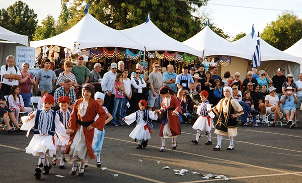 Dancers performing at the Greek Festival in Chandler. [photo by Chuck] |
|
Supplemental Report by Ted Tenny RRRRRRRRIP! Oh-oh. The highest part of the Sunset Vista Trail is a very steep boulder-scramble, almost straight up and down, with steel cables on both sides so you can hang on for dear life. I’d made it almost to the bottom, where the cables end right above a 6-foot drop. A’down we go. But the cable support had other ideas. The right rear pocket of my jeans was just too tempting. So it snagged the pocket, causing part of my jeans to stay behind as my considerable momentum carried me safely to the bottom. Monika was with me, saw it happen, and was much more careful getting herself down that last 6-foot drop. She offered to let me wear her jacket around my waist as a cover-up for the obvious wardrobe malfunction. But I figured my jeans were already ruined; why risk ruining her jacket as well? |
 Rafinesquia neomexicana - Desert Chicory |
 Lichens love these volcanic rocks. |

|
|
| Desert bells and Mexican gold poppies brighten the Sunset Vista Trail. | |
|
Took me forever to climb up to the saddle on the Hunter Trail. When I remembered to turn on my 2-way radio, Chuck was trying to reach me. “I’m going to bail out on the Sunset Vista Trail,” I explained. “Don’t wait for me.” There was a troop of Boy Scouts climbing up the trail at the same time. One of the scouts was having some difficulties. It brought back memories. My first hike ever was with the Boy Scouts in 1957, when I was 12 years old. Troop 10 in Blackwell, Oklahoma. But it was nothing like the Hunter Trail: we just walked 5 miles on a dirt road west of town. From the saddle I caught one last glimpse of the other Trailblazers, about to round the bend as they made their way down, very steeply, on the diagonal rock scramble, holding on to steel cables. But I wasn’t alone. Other hikers passed me going both ways, some of them uncertain of which way to go where the trail braids. On the way up to the junction, a radio transmission informed me that Monika was also going to bail out on the Sunset Vista Trail. Then I saw her waiting up ahead. |
 Gentle waves, fields of desert bells and golden poppies mark the Sunset Vista Trail. |
|
We started making our way down the steepest part of the trail, ever so cautiously ... |
 Teddy Bears look back fondly on Picacho Peak. With the shortcut we arrived at Sunset Vista Trailhead before the others. Anikó and Rudy were the first of the peak climbers to get there, followed by hikers in small groups until everyone had arrived. I wasn’t fit to be seen anywhere. So, after dropping off my passengers at Einstein’s Bagels, I headed straight home. You should have seen my wife’s expression when I got there. |
|
Form, Form, Riflemen Form! . . . Look to your butts, and take good aims! |
| from Riflemen Form! by Alfred Lord Tennyson, 1859. |
 Top of Page
Arizona Trailblazers Hiking Club, Phoenix, Arizona
Comments? Send them to the AZHC .
updated August 18, 2017