Outdoor Links
Hike Arizona
Trip Planning Guide
Trip Report Index
Calendar of Events
Library
|
Pine Canyon Day Hike Mogollon Rim April 20, 2013 by Chuck Parsons |
|
 Front Row: Wendy, Anikó, Quy, and Gary. Back Row: Cathy, Chuck, George, Arturo, Cyd, Jim. [photo by Monika] |
 Front Row: Anikó, Quy, and Gary. Back Row: Chuck, George, Arturo, Monika, Jim, Michael. [photo by Cyd] |
 Trailblazers start the long descent. [Monika] |
It’s 9:30 AM on another beautiful Saturday morning in late April, with clear blue skies overhead and a light breeze blowing out of the west. The air temperature stands at a perfect 75 degrees as 12 Arizona Trailblazers gather for a group picture near the Cinch Hook Trailhead located high atop the Mogollon Rim at 7,243 feet. Today’s hike is a one-way car shuttle from Cinch Hook to Pine Trailhead at 5,392 feet near the base of the rim. We had earlier left two vehicles at the lower trailhead and shuttled all hikers up to Cinch Hook for the beginning of the hike. Overall elevation change on the hike is +1,000'/-2,900', so it is primarily an 8.3 mile downhill trek today by way of Pine Canyon Trail #26. |
|
Pine Canyon Trail, like many trails on the rim, initially begins as a dirt road before eventually transitioning into a real trail. |
|
Much of the upper trail is steep and rocky and slow going for a while until we adjust to the trail conditions. But we also can’t afford to become overconfident and move too fast on this type of terrain either; otherwise you risk a wipeout and potential injury. Our hike leaders always carry a First-Aid kit as added insurance, but fortunately it is rarely utilized since the Trailblazers have an excellent track record in that area. Hmmm — We’re not quite sure what to make of this rather puzzling sign. Much of the upper section of Pine Canyon Trail traverses the west rim of its namesake Pine Canyon. Thankfully, the pine trees that inhabit this canyon seem to be very healthy for now, so far escaping the pine bark beetles that have laid waste to millions of acres of drought-stricken pine forests across Arizona and throughout the Southwest. |
 Huh?? Straddling switchbacks?? Say what?? [photo by Cyd]  View of Pine Canyon’s East Rim from the trail. [photo by Cyd] |
|
Let’s hope the destructive bark beetles don’t discover this pristine canyon any time soon. |
 View looking down Pine Canyon from the trail. [photo by Quy] |
 Trailblazers take a moment to admire the view. [photo by Quy] |
|
Pine Creek flows unseen far below us in the bottom of the canyon, running a serpentine course from its headwaters on the Rim near Cinch Hook Butte, through The Narrows and beneath Tonto Natural Bridge to its junction with Rock Creek, before finally emptying its waters into the East Verde River. |
 Down, down, down we go. Where we stop nobody knows. [photo by Cyd] |
Cathy, Gary, Chuck, and Jim carefully navigate down the steep rocky slopes of the upper trail. You have to admire the scenery here from time to time, but you also have to concentrate on where you place your feet. So the key along this stretch of trail is to do your admiring while at a dead stop. From Ted’s description of the Pine Canyon Trail: “There will be shade, but there may also be fallen trees on the trail.“ That certainly hit the nail squarely on the head, because there are dozens and dozens of fallen trees across the trail on today’s hike. Some like this one are small enough to simply step over or straddle (now I wonder if that’s what the earlier sign meant?), while others require maneuvering underneath as seen in the following picture. For some, the best solution is to just detour around them. One thing is certain: some sections of this trail provide great training in obstacle course navigation. |
 Trail block, dead ahead! [photo by Cyd] |
 Monika ducks under fallen tree. [photo by Quy] |
 Trailblazers navigate a relatively level stretch of trail. [photo by Quy] |
|
A little over a mile from the trailhead and we have already descended almost 2,000 feet. This would be one heck of a cardio workout going the other way. But it’s certainly not going to be downhill all the way to Pine Trailhead. We’ll soon have to start making up for some of that lost elevation. Anikó is one of our more regular hikers as well as one of our faster hikers and often takes the lead on many hikes. She is also a recent devotee to geocaching, educating the rest of us along the way on this interesting topic. |
 Good Grief! We started way up there? [photo by Cyd] |
 Anikó and Gary take a short break from hiking. [photo by Cyd] |
|
At this point we still have most of the trail ahead of us, so we need to start putting it into overdrive to make up for lost time on that steep, rocky descent. Let’s move it out, Trailblazers! We still have a lot of hiking to do before this day is over, and we’re burning some serious daylight just thinking about it. |
 You kidding me? 3 miles to Dripping Springs? [photo by Cyd] |
 OK now. Who’s the wise guy? [photo by Cyd] |
 A mighty ponderosa lies in its final resting place. [photo by Cyd] |
|
I’m certainly glad I wasn’t around when this behemoth slammed into the ground. Any hikers within a hundred yards of that event would have been in for the surprise of their lives by the force of the impact. I actually did witness a large ponderosa about this size fall over and hit the ground just a little too close for comfort while hiking the West Fork Trail up Mt. Baldy in the White Mountains a number of years ago. It will definitely shake you up and make you rethink some of your priorities in life, at least for a while anyway. One of the closest calls I’ve ever had while hiking. |
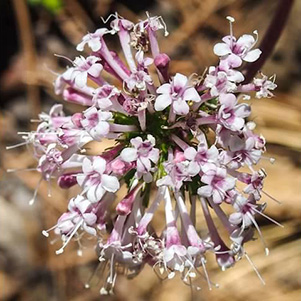
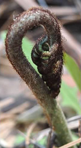
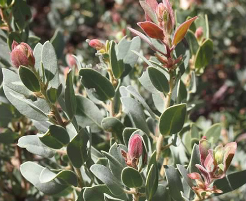
| Wildflowers abound, and Quy is ready for them: |

|

|
|

|
|

|

|
|
|
After about 2.5 miles of hiking we encounter Parsnip Spring, a lush green narrow corridor of what appears to be watercress, nourished by the running spring flowing gently beneath it. But search as we may, we fail to come across a single parsnip so we move on in search of Pine Creek instead. Quy asks me what a parsnip is and I try to describe it for her. I tell her it looks somewhat like a large yellowish carrot but tastes nothing like it. You either love parsnip or you hate it. It’s definitely an acquired taste. |
 Help! The tree is holding me prisoner! [Quy] |
 Success at last for Geo Anikó! [photo by Quy] |
 Lunch in the pines. [photo by Quy] |
 Arturo gets his point across to Jim. [photo by Quy] The forest is green and healthy through here, as it is over the course of the entire trail, but we continue to encounter numerous fallen trees across the trail which slows our progress. Work crews with large chainsaws periodically remove the sections of tree trunk lying across the trail, but apparently the numbers in recent months have been more than they can keep up with. With a permit and a few strong backs you can haul an unlimited supply of firewood out of here. |
 Camp Lo Mia in the pines. [photo by Quy] |
|
Camp Lo Mia is a summer camp built by the LDS Church for Mormon girls. It looks like a great place to spend a week or two during the summer months and reminds me a lot of the Presbyterian Church summer camp I spent time at in Shelby Forest during several idyllic summers while growing up in Memphis, Tennessee. I’m sure many of us have similar fond memories of church camp in our younger days. |
 Trailblazers continue to make their way to Dripping Springs. [photo by Quy] |
|
Most of the 1,000 feet of ascent on the Pine Canyon Trail seems to be concentrated into a roughly one-mile stretch of steep, rocky, and uneven trail relentlessly grinding its way uphill to Dripping Springs. It’s always better to get the serious climbing out of the way earlier in the day when you’re fresher, but in this case we don’t have a choice. And after miles of downhill and level stretches of trail it’s a bit of a challenge to suddenly have to adapt to going uphill and fighting gravity for a change. Then again, it’s certainly not the Humphreys Peak Trail or packing out of the Grand Canyon on the South Kaibab Trail. |
 Making the crossing at Pine Creek. [photo by Quy] |
|
Pine Canyon Trail runs parallel to Pine Creek for about 1.5 miles, with the creek flowing a little below normal for this time of year but also making for very easy creek crossings as seen in this picture. |
 Arturo, WB7ATA, gets a message over his radio. [photo by Cyd]  These shoes are made for mud slogging. [photo by Cyd] |
As usual, Arturo is staying in touch with some of his ham radio friends on his ever-present radio and at some point on the hike back to the trailhead he conveys an urgent message to the rest of us over our TalkAbout radios about an accident and resulting traffic backup on Highway 87. Hopefully things will clear up by the time we all arrive at the trailhead and hit the road ourselves. Unfortunately for Cyd, she makes the mistake of going through muddy Dripping Springs instead of bypassing it by going across the logs along the side of the springs. When we finally arrive at the much-anticipated Dripping Springs we’re a little disappointed to discover that it’s certainly nothing to write home about. It’s more of a mud bog than anything else and yet another obstacle in the trail to maneuver around. |
|
With a good water filter, clean cold drinking water is available at either Parsnip Springs or in Pine Creek itself, but one would be hard-pressed to get very much good drinking water out of Dripping Springs except during abnormally wet years when a lot more water would be coming out of the ground than we are seeing today. |
 The town of Pine lies below this section of the Pine Canyon Trail. [photo by Monika] |
|
Somewhere below Dripping Springs the town of Pine becomes visible to our right as it emerges out of the forest along the west side of Pine Canyon Trail. Once you see that you know you’re on the right track back to Pine Trailhead. George is about a quarter-mile ahead of me when I ask him over the radio if he can spot his cabin in Pine from the trail. He replies that he probably could with a good pair of binoculars, but doesn’t have his with him today. George has graciously invited all of us over to his cabin for a burger cookout after the hike, so that provides a major incentive for us to hot foot it down to Pine Trailhead so we can get to the cabin and chow down on burgers, beans, and potato salad after a long day of hiking.
|
|
The two-mile stretch of trail from Dripping Springs to Pine Trailhead is mostly downhill, although there are more than a few ups and downs thrown in for extra measure along the way. At one point the trail meets an old road that we follow for a half-mile or so before reverting back to a regular trail once again. There are also a few official and unofficial side trails that branch off from the main trail and create a bit of confusion from time to time for some of our hikers. As with many trail systems in Arizona, Pine Canyon Trail #26 could benefit from a few more clearly marked trail signs, particularly at the junctions with the branch trails. Despite my best efforts to keep everyone heading south on the main trail, a couple of hikers inadvertently detoured off the trail at the second set of cabins at trailside and wound up in a small residential neighborhood before realizing their mistake. But all in all the hike went off pretty much without a hitch and everyone had a great time. |
 Arturo is coming down the home stretch. [Cyd] |
 Pine Trailhead comes into view at last. [photo by Cyd] |
|
After 8.3 miles of hiking (although several hikers’ GPS mileage readings show anywhere from 8.5 to 9.4 miles), a dozen Trailblazers arrive at Pine Trailhead between 3:30 and 4:00 PM in the afternoon. Monika, George, and Michael drive back up to Cinch Hook in her vehicle to retrieve our remaining two vehicles, while the rest of us wait for them to return. From here we will all head to George’s nearby cabin for a much-anticipated BBQ cookout. And boy are we famished! |
 Now this is my idea of a cabin in the woods. [photo by Quy] |
|
George spent a total of seven years, most of it while he was still working full time at General Dynamics in Scottsdale, working on his cabin in Pine and did most of the work himself. Now all those years of hard work, sweat, and tears have finally paid off for him and his wife, and the cabin certainly reflects the dedication, pride, and precision craftsmanship that he put into the project. Great job George! You have created a home in the pines that you and your family will be proud of for many, many years to come. |
 Sleeping Beauty at rest on the front porch. [photo by Monika] |
 Cyd kicks back and hoists a cold one. [photo by Quy] |
 Looks like Gary has made a new friend. [photo by Quy] |
 Grill master George checks the burgers. [Quy] |
 Michael lends a hand at the grill. [Monika] |
 Making final preparations. Come and get it! [photo by Monika] |
 Twelve hungry Trailblazers chow down. [photo by Quy] |
 Trailblazers with Jack the Lab pose on the front steps. [photo by Quy] |
 George and his friendly black lab, Jack. [photo by Quy] |
 Top of Page
Arizona Trailblazers Hiking Club, Phoenix, Arizona
Comments? Send them to the AZHC .
updated May 25, 2020