Outdoor Links
Hike Arizona
Trip Planning Guide
Trip Report Index
Calendar of Events
Library
|
Ponderosa Car Camp Little Green Valley May 17-19, 2013 by Bill Zimmermann |
|
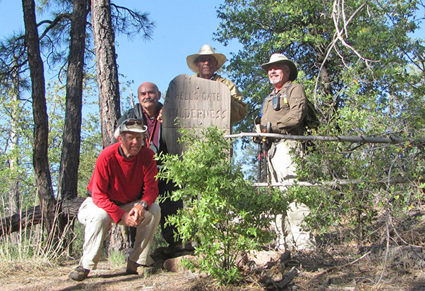 Bill, Gary M., Rudy, Gary G. |
|
With two Garys, I took initiative to clarify communication by assigning a nickname to one Gary. Gary Meyers good-naturedly accepted, a.k.a. GM, a.k.a. Pontiac. On Friday Bill, Gary G. and Gary M. car-caravanned up to McDonalds in Payson, were we met Rudy. We drove to the campground, where we were some of the earlier campers to set up. |
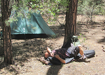 Gary M. rests by the Taj Mahal. 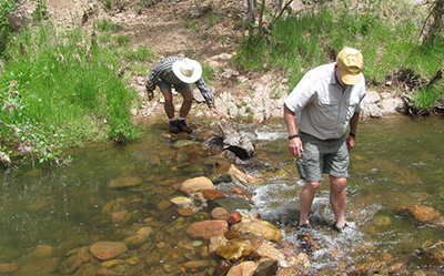 We bouldered a path to cross Tonto Creek. |
After Gary G. set up his Taj Mahal (big tent), he joined Rudy and Bill on a trial drive to the Bear Flat Trailhead. Gary M. stayed back adjusting his body clock. In preparation for Saturday’s hike we bouldered a path to cross Tonto Creek. Gary G. prepared a scrumptious meal for all to share (green and red peppers onions, rice, mushrooms). Campfire chat, then off to sleep. Gary M. went tentless, turning down Bill’s offer to share his tent. We left camp at 7:00 and were walking at 7:30. The aggressive goal was to hike #178 Bear Flat to Gordon Trailhead and back (est. 14+ miles, 3100 feet) and then Sunday hike #186 Mescal Ridge (est. 7 miles, 1600 feet). Bill had also plotted GPS waypoints for #177 Big Ridge. |
|
All trails branch off of Bear Flat. The first half mile provided 600 feet of vertical gain without switchbacks. Just up. A few eyebrows twitched when Bill mentioned in order to hike one of the other trails Sunday we would have to repeat the same start. |
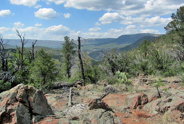
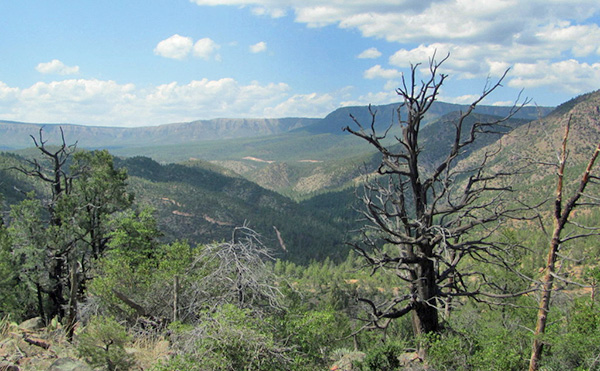
 Mountains of the Transition Zone await our exploration. |
 Gary G. finds a place to hang his hat. |
 Rudy finds a bench by the alligator juniper. |
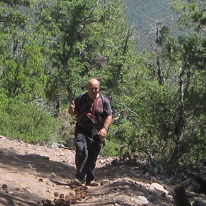 Gary M. climbs the steep trail. |
As we left the wilderness the trail widened as we walked an old jeep road with more tree cover. At 4 miles we arrived at the intersection with Big Ridge Trail. We reassessed our water situation as one hiker used nearly half of his supply and another had a slight leak in his Camelbak bladder. So we changed plans. We opted to take Big Ridge 2.6 miles to South Mountain Horse Tank verses continuing 3.9 miles on Bear Flat to Gordon Trailhead. |
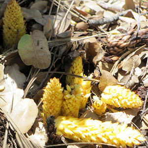
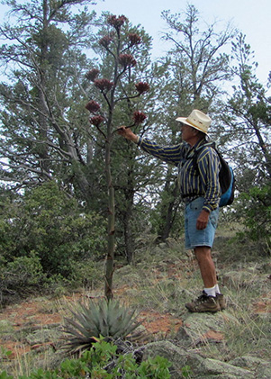
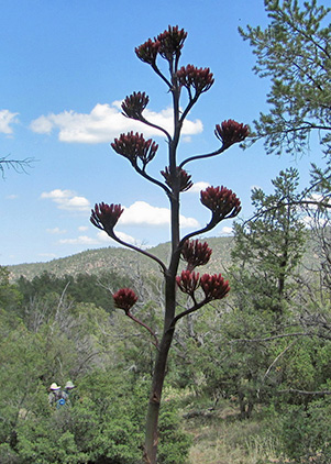
 Stay back. The bees don’t want to share this. We took a closer look at the corral and red colored tank for animal tracks. Rudy spotted a strange mushroom. We saw several agaves starting to bloom, and a bee colony working over some tasty dung. |
 Burroweed brightens the forest carpet. |
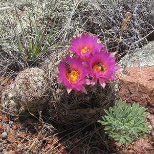 Bees pollinate a pincushion cactus. |
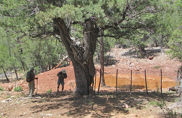 Gary G. and Rudy find a stock watering pond. |
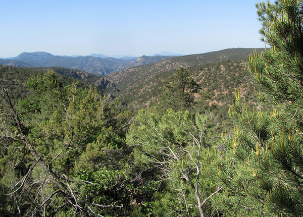
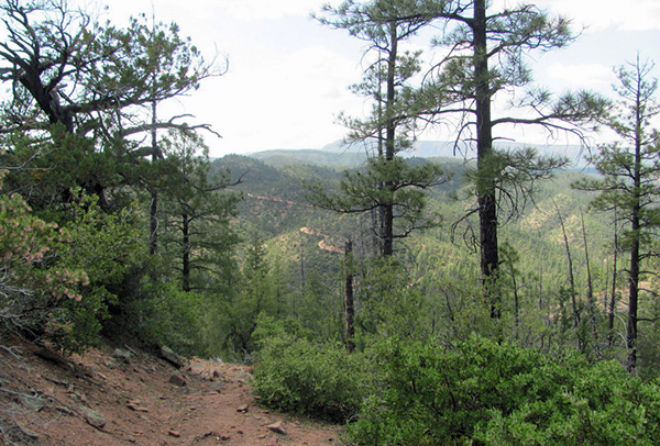
 Mescal Ridge offers many panoramic views. |
|
|
Clear skies were giving way to puffy white scattered clouds. When we returned to the Mescal Trail intersection we decided take it a mile or so, since there was no excitement to repeat the “big up” on Sunday. More bees at work, this time on pretty red flowering cactus. The Mescal Ridge provided some great scenic views of the Mogollon Rim. Going down the big up was slow. It took patience and/or a good set of poles. Bear Flat Trail had no bears and was not flat (13.7 miles, 2920 feet). |
|
|
| Rudy finds an agave that will soon be in bloom. | |
 Bear Flat is down the trail, that-a-way. |
|
Back at the campsite Gary M. crashed hard, sleeping thru until morning, missing supper and the campfire chat. Unbeknownst to Bill and others, medication for his back pain may have been a contributing factor. |
 Top of Page
Arizona Trailblazers Hiking Club, Phoenix, Arizona
Comments? Send them to the AZHC .
updated June 26, 2020