Outdoor Links
Hike Arizona
Trip Planning Guide
Trip Report Index
Calendar of Events
Library
|
Wishbone Junction Day Hike Goldfield Mountains January 12, 2013 by Ted Tenny |
|
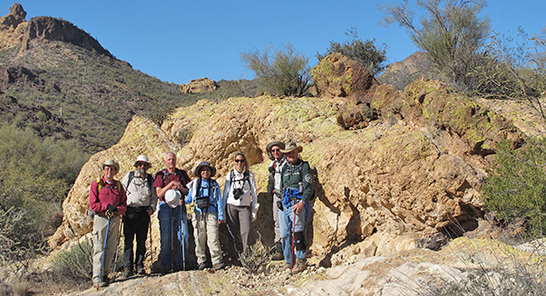
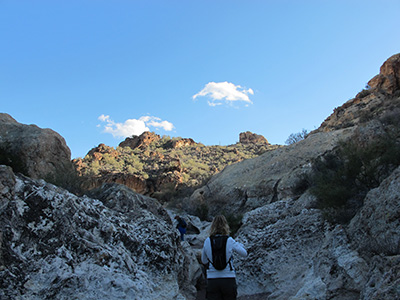
 Bruce, Quy, Peter, Lori, Don, Dave, Jim — on the ridge at 2402. |
|
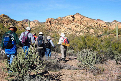
Eight enlightened Trailblazers, dressed for winter hiking, set out from Willow Springs Trailhead for an adventure in the Goldfield Mountains. Ted’s car thermometer read 26° on the way in to the trailhead, so we keep the introductions short and start walking briskly down the road to Willow Springs Canyon. Our first climb is to the pass at 2264. You can’t see the pass until you’re almost there, so several rock outcroppings and a couple of washes serve as landmarks on the way. Try to angle your way up so that you come out at the same elevation as the pass. |
 We made it to the pass at 2264. |

|

|
| Mining claim markers and quartz line our route. [photos by Bruce] | |
|
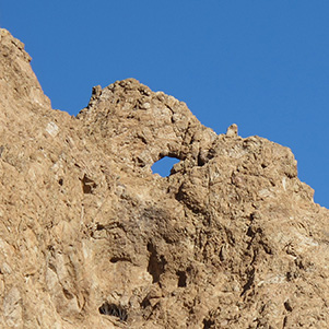
The pass features mine diggings, markers, and sweeping views in all directions. Three of the Goldfield Mines are nearby: Gold Bond, Gold Strike, and Lazy Doc. Quartz, but no gold, we find here. To learn more about the Goldfield Mining District, read Goldfield Mining District Geology and Ore Deposits by John D. Wilburn, General Business & Industrial Printing, Apache Junction, AZ, 1997. To the west is our first view of the IQ Arch. The rocks spell “IQ” upside down – something to be noticed by hikers with a high IQ. |
 IQ Arch, from the pass at 2264. |
 IQ Arch, from the ridge at 2402. |
|

|
| Two unexpected arches grace our passage. | |
|
We proceed across the valley and climb to the right of hill 2437 to get up on the ridge. Near the top, a game trail takes us part of the way. The animals sure know their trails! The southern part of the ridge is lined with buttes which we have to get around, usually on the right. We top out at 2402 and enjoy wide, expansive views in all directions. The weather and sunlight cooperate for pictures. |
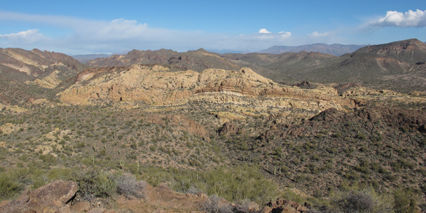 Helmet Rock, Disaster Ridge, and peak 2881 from the ridge at 2402. |
 We approach the valley on a game treail. [photo by Quy] We bail out westward to the creek and make our way north to the Bright Golden Valley, following a game trail part of the way. There are several golden lookouts on the north side of the valley, and more on the south side. Ted doesn’t choose the one where he got cliffed out on an exploratory hike. So we decide to try another of the lookouts on the north side. If there is a good way up to that lookout, it eludes us. |
 Golden Dome, from the Bright Golden Valley. |
 Daring hikers top out on a perilous golden lookout. |
 The view from the top. [photo by Quy] |
|
Most of the Trailblazers get up there on a challenging slickrock climb and an even more challenging descent. We re-convene on the lower slopes and walk an easy canyon until it ends west of Helmet Rock. |
 Helmet rock from the slopes of the golden lookout. |
|
“Those hiking routes will become trails,” a ranger advised Ted years ago. Sure enough, the stream to Wishbone Junction now has trails and cairns to mark the way. There was nothing when Ted first hiked the route, with John Helm leading. We stop for another group picture at the great stone lizard, then proceed to Wishbone Junction and beyond. |
 Bruce, Jim, Don, Quy, Lori, Peter, Dave, and the great stone lizard — nearing Wishbone Junction. |
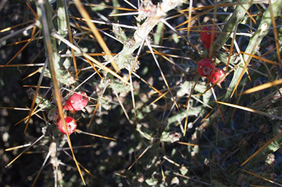 Bright berries adorn a Christmas cactus. [photo by Quy] |
The afternoon is waning. This is no place to be hiking after dark, so we don’t spend much time at the overlook above Wishbone Junction. The road goes back to the trailhead, more or less, so we skip Willow Springs Basin Tank for today and just walk the road. |
 Gonzales Needle is still sunlit as Lori finds her way through the shadows of Willow Springs Canyon. In its heyday this area was used for mining and cattle ranching. There are water pipes, hooks in the rock walls, steel cables, and metates in Willow Springs Canyon. We emerge from the shadows at Willow Springs Well. From here on the canyon is easy walking. Just south of the well, the road meets the canyon. Everyone breathes a sigh of relief as we walk the road and re-trace our steps that began the hike. |
 Almost there. Trailblazers troop the road back to Willow Springs Trailhead. |
|
There’s still daylight as the hike ends back at Willow Springs Trailhead. Methinks Ken’s golden lookout was on south side of the valley. I do remember it was easy climbing up and climbing down. We’ll try the south side next time. |
|
→ More pictures and a GPS map, by Peter Yanover. |
 Top of Page
Arizona Trailblazers Hiking Club, Phoenix, Arizona
Comments? Send them to the AZHC .
updated November 8, 2017