Outdoor Links
Hike Arizona
Trip Planning Guide
Trip Report Index
Calendar of Events
Library
|
Bulldog Canyon Loop Day Hike Goldfield Mountains December 27, 2014 by Ted Tenny |
|
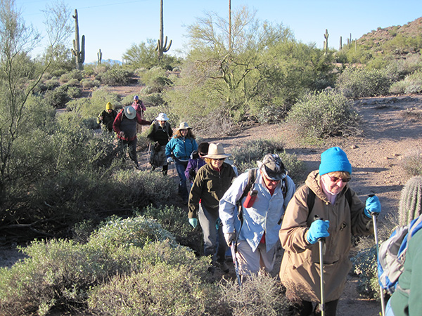
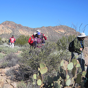
 Trailblazers pass muster on Forest Road 10. [photo by Bill] |
| Kim, Becky, Eileen, Lise, Rick, Linda, Duane, Monika, Bill, Tina Ted, Jim, Chuck |
|
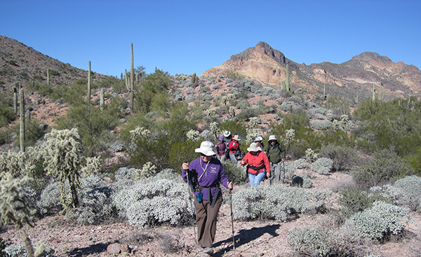
13 lucky Trailblazers set out from Dome Mountain Trailhead on a cold December morning. We start northwest on the Powerline Trail then turn northeast on the Wolverine Pass Trail. Like most trails in the Goldfield Mountains, the Wolverine Pass Trail is unmarked. Fortunately a horse has been there, leaving horseshoe prints that are easy to follow. |
 A horse’s tracks help us follow the Wolverine Pass Trail. |
|
When we get to Forest Road 10, Ted points out various peaks of the southern Goldfields. Only Dome Mountain is named on the USGS topographic map, so other peaks are identified by their elevation in feet above sea level (such as Peak 3269) or by a name hikers have given them (such as Panorama Peak, 3325', second highest in the Goldfields). |
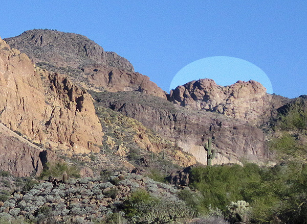 Dome Mountain and the frog, from Forest Road 10. |
|
Farther down the road a mystery is solved, according to Ted. Peak 3269 and Dome Mountain are identified as the “Frog Peaks” on N.C. McFarland’s 1883 map of Arizona Territory. But where would he ever get a name like that? Well, there’s a butte southeast of Dome Mountain that is shaped like a frog. It can be seen from the road, the horse trail, and many other locations. |
 Idaho-Bulldog Arch |
At a wash we leave the road and bushwhack our way northwest. Pieces of a trail appear here and there, but it’s mostly sand-slogging. We pass the Idaho-Bulldog Arch, though you can’t see through it from the trail. Looks like a cave. “Thought I was the first one to see it,” Ted explains, “But when I went up there and looked inside, there were beer cans.” Soon we pick up the Bulldog Canyon Trail, which parallels the canyon for about a mile and dips down into it in several places. There’s good scenery all along. We find ice in pools of water in the slickrock section. |
 Ice in Bulldog Canyon. |
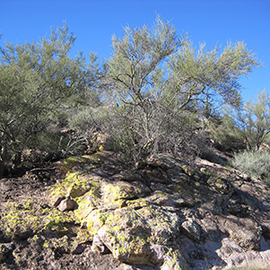 Ted’s favorite tree grows out of a bright boulder. |
|
When we get to the Pyroclastic Cave, Duane, Tina, Bill, and Becky decide to go up and explore it. An arch is nearby, but you can’t see the arch without climbing up to the cave. It’s a short but steep bushwhack. |
 Trailblazers explore the Pyroclastic Cave. |
 Duane at the Pyroclastic Arch. |
 [photos by Bill] Wild and woolly Peak 3269. |
 Bulldog Ridge, a volcanic dyke from the Miocene epoch. |
 Easing our way down a steep section of the Bulldog Canyon Trail. |
|
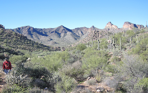
Farther upstream we enjoy a distant view of the Trumpet Arch below Peak 3089, and then several sweeping panoramas of Bulldog Ridge, behind us to the west. We meet a group of hikers going the other way on the trail. It isn’t an organized hike, they inform us, so Jim gives them Arizona Trailblazers key rings. The club bought 1000 key rings a few years ago. We still have 600 to give away. “Make your own way up to the ridge,” Ted advises as we leave the trail. Bulldog Wash Ridge parallels the wash, the horse trail, and FR 1356. The north end has a thicket of chain fruit cholla, which we carefully detour around. |

|

|
| It gets plenty rocky on the way up. [photos by Bill] | |
 Trailblazers on Bulldog Wash Ridge. [photo by Bill] |
| Chuck, Tina, Duane, Jim, Bill, Rick, Linda, Lise, Ted, Kim, Eileen, Becky, Monika |
 Thicket of chain fruit cholla. |
 Peak 3134 Ridgeline. |
|

|
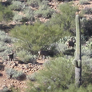
| Better be quick! Those deer can move fast. | |
|
Although we have the ridge to ourselves we spot some deer to the west, across the horse trail. They are moving quickly. Farther south the topography gets more interesting but the vegetation changes to mostly jojoba and brittlebush. At first we can’t see a good way down, but Ted assures us there is one. |
 Golden Hill 2726 points to the Four Peaks of Peril. |
 Kim appreciates the many fine views from the ridge. |
 Yes, there is a good way down from here. |
 Blue Ridge, the Superstitions, and hill 2307, from FR 10. |
|
Soon we are walking on the road, FR 1356, then FR 10, then we arrive back at Dome Mountain Trailhead. The morning chill is long gone as we finish our hike at mid-day. Thanks to all of you for going on this hike and being world-class companions on the trail! |
 Top of Page
Arizona Trailblazers Hiking Club, Phoenix, Arizona
Comments? Send them to the AZHC .
updated January 11, 2018