Outdoor Links
Hike Arizona
Trip Planning Guide
Trip Report Index
Calendar of Events
Library
|
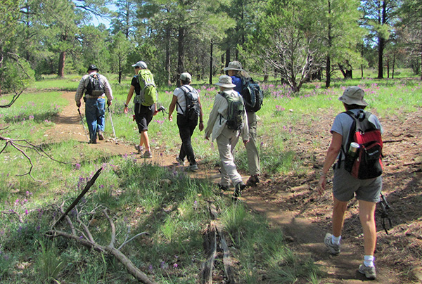
Campbell Mesa Day Hike Flagstaff September 6, 2014 by Ted Tenny |
|
 Bill, Linda, Andy, Ted, Sana, Susan, Diana, Karen [photo by Bill] |
|
Eight excellent Trailblazers set out from Campbell Mesa Trailhead at 9:30, hoping to enjoy the cool morning and finish the hike before it rained. We were successful at both. |
 Clouds start moving in as we leave the Forest Service road. [photo by Sana] |
 Ted, Diana, Sana, Karen, Susan, Linda. [photo by Bill] |
|
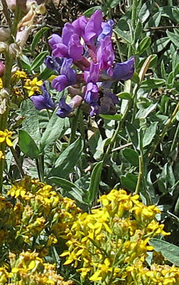
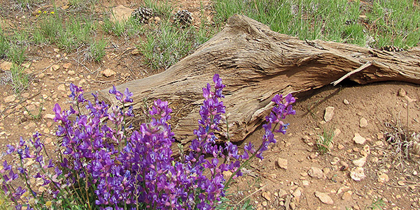
Recent rains had settled the dust and brought out summer wildflowers in colorful profusion. “Woolly worm” caterpillars were also out, crossing the trail as they foraged for yummy plants. Recent rain seemed to be localized, with wet trails and lots of flowers on the west side, drier trails and fewer flowers on the east side. |
 Penstemon glaber - Sawsepal penstemon |
 Cleome isomeris - Bladderpod |
 Viguiera deltoidea var. parishii - Parish’s Goldeneye |
 Castilleja integra - Wholeleaf Indian Paintbrush |
 Lupinus arizonicus - Arizona Lupine |
 Oncosiphon piluliferum - Globe Chamomile |
 Penstemon strictus - Rocky Mountain Penstemon |
 Sphaeralcea emoryi - Emory’s Globemallow |
 Dieteria canescens - Hoary Tansyaster |
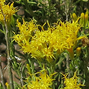 Senecio flaccidus var. monoensis - Groundsel |
 Erigeron divergens - Fleabane |
 Camphorweed and Fleabane peacefully coexist. |
 A riot of color by the trail! |
We took the southern branch of the Anasazi Loop on our walk eastward as Ted assured everyone, “The scenery is a little better this way.” Soon we got to the first of several junctions, where the Campbell Mesa Loop Trail heads eastward. When scouting the hike in June, Ted found that the most important trail junction is poorly marked. “Loop Trail,” the sign says. But that trail goes east to an I-40 underpass. The Campbell Mesa Loop is unmarked, but it continues south. So we made the right turn. From here on the junctions are well marked, so no one needs the hike leader to show them the way. That’s fine. Ted was quite content to sweep and take pictures for the rest of the hike. We finished around 1:00 PM. What next? |
 Penstemon brightens a fallen log. [photo by Bill] |
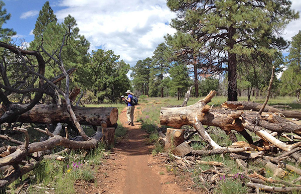 Susan finds the way clear where sawyers have severed a tree. [photo by Sana] |
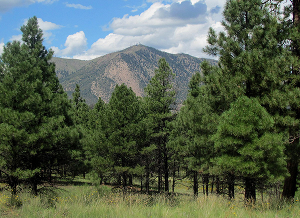 Towers and clouds top Mt. Elden through the forest. [photo by Bill] |
|
Everyone had worked up an appetite on the trail, so we drove into Flagstaff for lunch. Well, not this time. With classes starting at NAU there were students, teachers and parents everywhere, with long wait times. So we headed for La Fonda, on Horseshoe Bend Drive west of Camp Verde. There we enjoyed a fine Mexican dinner. Rain, which had graciously waited until our hike was over, really poured as we started south on I-17. But the sun was shining from Cordes Junction on in to Phoenix. |
 Top of Page
Arizona Trailblazers Hiking Club, Phoenix, Arizona
Comments? Send them to the AZHC .
updated June 16, 2018