
Outdoor Links
Hike Arizona
Trip Planning Guide
Trip Report Index
Calendar of Events
Library
|
Chalk Canyon Day Hike Cave Creek, AZ December 20, 2014 by Jim Buyens |
|
Indian ruins have always been a fascination for me. It’s amazing to think about these determined people making their lives in our harsh desert climate, especially without most of the things we think of as necessary today: running water, electricity, grocery stores, transportation, and all the rest. How did they do it? What was life like back then?
Authorities tell us that Indian ruins are widespread in Arizona but most remain unpublished and secret. The dangers of disturbance, destruction, looting, and theft are simply too great. So imagine my delight when I discovered a book titled, “Hiking Ruins Seldom Seen – A Guide to 36 Sites Across the Southwest,” by Dave Wilson! And I was even more elated that two of the sites are in or near Spur Cross Conservation Area, one of my favorite places to hike near Cave Creek!
 Jim, Molly, Michael, Diana, Gabrielle, Dave, Linda, Scott, David, Stacy, and Quy get ready to start out. [photo by Quy] |
One set of ruins is at Chalk Canyon in Tonto National Forest, 2.7 miles north of the conservation area on FS 48. The other is on Elephant Mountain which is in the conservation area itself. So our planned route from the Spur Cross trailhead consisted of:
| 1.3 | miles north on the Spur Cross trail. |
| 2.3 | miles north on FR 48, which is in Tonto National Forest. |
| 0.5 | miles off-trail and up a bluff that appears at this point. The ruins are atop the bluff |
| 1.5 | miles south on FS 48 to a trail junction with a corral. |
| 2.9 | miles west on TR 252 to the Elephant Mountain trail which is within the conservation area. |
| 2.2 |
miles southwest on the Elephant Mountain trail to a saddle. The ruins are visible from this spot. |
| 0.8 | miles south on the on the Elephant Mountain trail. |
| 3.2 | miles east on the Spur Cross trail, back to the trailhead. |
| 14.7 | miles total |
I knew that might be a bit aggressive but I wasn't worried. The route provided two shortcuts home that we could take if necessary.
 This was the first of several creek crossings. Cave Creek generally flows all year. [photo by Quy] |
Eleven Trailblazers started out from the Spur Cross trailhead and up the Spur Cross trail. The weather was sunny, temperatures were brisk, and the scenery was lush (at least for the desert).
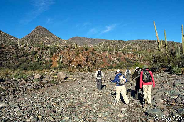 Heading up the creek, which flows underground at this point. [photo by Quy] |
 I never get tired of seeing water in the desert. [photo by Quy] |
Finding water in the desert is always a treat but Cave Creek is exceptional. Water builds up in the porous rock behind the Mogollon Rim and then slowly seeps out all year, feeding the creek. Everyone got plenty of practice rock-hopping across the many crossings.
 Here I am crossing the creek again. Everyone stayed dry for the entire hike. [photo by Dave] |
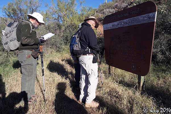 I check Dave's location while he checks his. [photo by Quy] |
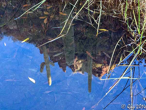 Cactus reflections in a smooth clear pond. [photo by Quy] |
 Here I am making yet another successful water crossing, [photo by Quy] |
One challenge when hiking off trail is, of course, the lack of any trail markings. Furthermore, our book author Dave Wilson didn’t supply the GPS coordinates of the best place to start up the bluff. He only said that if we found a No Trespassing sign posted by 6L Ranch we’d gone too far.
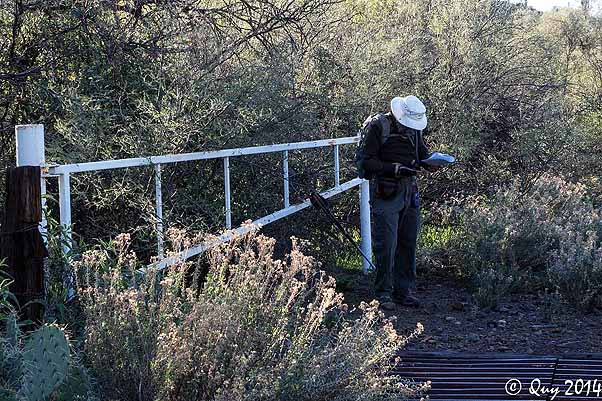 The guide says if you reach this point you've gone too far. Hmm.. [photo by Quy] |
Well, we found the sign all right, and so we backtracked about half a mile and started up the slope. The climb was only about 300 feet and the top of the bluff was a mesa. The book did conveniently supply the GPS coordinates of the ruins and with eleven people looking, we found them without too much trouble.
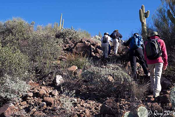 Climbing the bluff off-trail to reach the ruins. [photo by Quy] |
 Nearing the top of our climb to the bluff. Some view in the distance there, eh? No wonder the Indians chose this spot. [photo by Quy] |
The ruins included about thirty rooms and was rich in petroglyphs and pottery chards. It was occupied around the year 1300 and given the number of rooms, was probably used mostly for habitation. The reliable source of water from Care Creek no doubt contributed to the site’s selection, as did the excellent lookout and defensive position. Hauling creek water up the bluff to the village must have been a real chore, though.
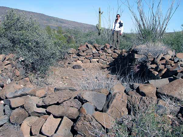 Stacy checks out one of the rooms. |
 This was way too small to be a door; it was more like a cubbyhole. [photo by Quy] |
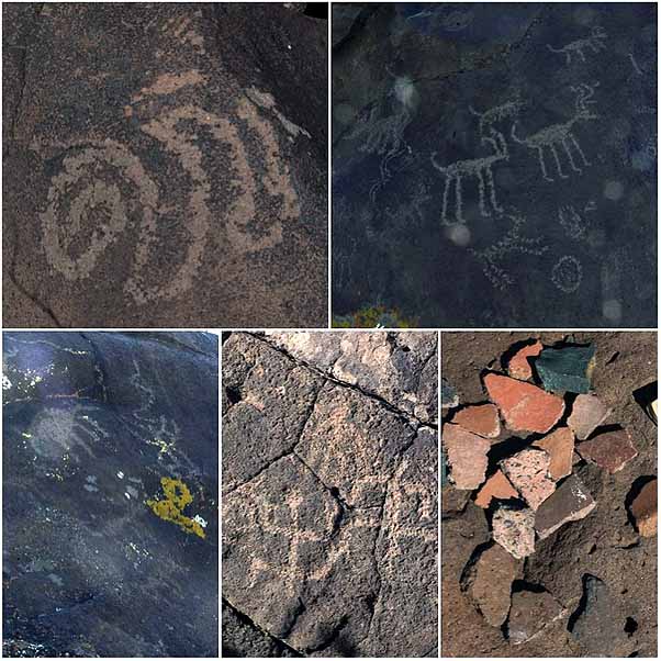 A collection of petroglyphs and pottery chards. This is as we found them. [photos by Quy] |
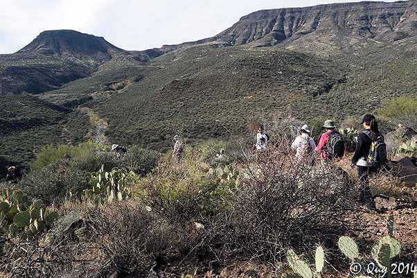 We descended from the ruins the same way we came up: by foot. Our route was the same as coming up, only backwards. [photo by Quy] |
We descended the bluff using the same general line that we’d used to climb it. Once at the bottom we followed the trail south along the creek to the junction with TR 252 and stopped for lunch. It was a treat to sit along the shore and listen to the trickling waterfalls.
 Lunching on the waterfront with the quiet rush of little waterfalls. [photo by Quy] |
After lunch Michael and Gabriele decided they needed to get home, and so they returned the way we’d come. The rest of us started hiking up TR 252 en route to the Elephant Mountain trail and then to the second set of ruins.
TR 252 is listed as a primitive trail - meaning it’s not maintained - but even so it’s not hard to follow. It is a bit rough and rocky though, and it rises about 500 feet in the first mile. But from there it’s all downhill to the Elephant Mountain trail junction
 The second part of the hike was more like Central Arizona: cactus, brush, rocks, and mountains. [photo by Quy] |
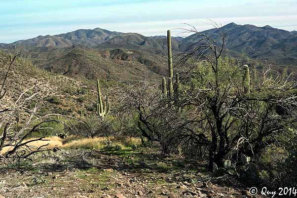 Cave Creek keeps the Spur Cross Recreation Area greener than most. [photo by Quy] |
 TR 252 is a little rugged in places but long on scenery. [photo by Quy] |
When we got to the Elephant Mountain trail junction there was much more enthusiasm for heading straight home than taking the full hike to the second set of ruins. In addition, the sun was getting close to the horizon. So instead of taking the Elephant Mountain trail west, we took it south until it merged with the Tortuga trail, and then took the Tortuga trail back to the trailhead.
Well, sort of. The main group had pulled ahead of Dave and me and, being anxious to get home, didn't wait for us at the Tortuga junction. Instead they took a wrong turn, enjoyed a bit more of Arizona than they expected, but did finally make it back to the trailhead.
Dave and I, by contrast, took a different wrong turn down a wash. After a while we knew something was wrong, but we didn't feel like going back and the wash ran between two fairly high and steep walls. So we kept going. Eventually, though, we came to a stretch where the east wall wasn't so high and we climbed up to look around. From there we could see the trailhead and of course that's where we headed.
So despite the abbreviated and exciting finish it was still a great hike. And after all, I had stated in the hike description that it was exploratory.
|
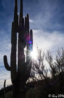 A late afternoon sun lights our way home. [photo by Quy] |
|||||||||||||||||||||||||||||||||||||||||||||||||
 Top of Page
Arizona Trailblazers Hiking Club, Phoenix, Arizona
Comments? Send them to the AZHC .
updated October 29, 2018