Outdoor Links
Hike Arizona
Trip Planning Guide
Trip Report Index
Calendar of Events
Library
|
Horton Creek Loop Day Hike Mogollon Rim April 5, 2014 by Chuck Parsons |
|
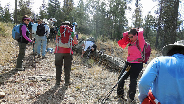
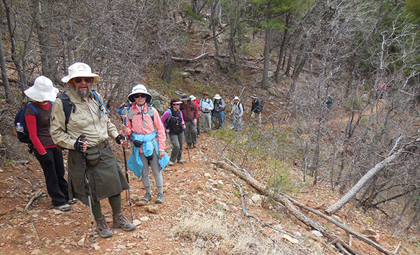
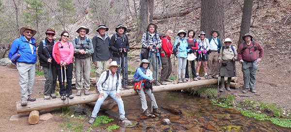
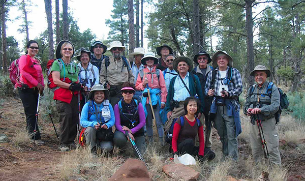 Sixteen Arizona Trailblazers gather near the trailhead. [photo by Quy] |
||||
|
||||
|
The weather forecast for the past couple of days in the Horton Creek area we will be hiking has been calling for a 30% chance of rain showers, possible snow showers above 6,000 feet, potential for lightning and thunder, winds gusting to 22 MPH, and a high of only 51 degrees for the day as another storm front pushes its way across Northern Arizona. Such a questionable forecast always poses a dilemma for the hike leader. What to do? Cancel the hike? Postpone the hike to a later date? Call everyone signed up and try to get a general consensus? Or just totally ignore the weather forecast altogether and go with your gut instinct? The forecast could be completely wrong, and it might be a great day for hiking after all, which has happened in this hiking club on a number of occasions. On the other hand, we’ve also been caught out in pounding rainstorms that could drown a gaggle of geese, terrifying lightning with ground-shaking thunder, and high winds that could peel the paint off a barn when the forecast wasn’t threatening at all with perhaps only a 10% chance of rain predicted. Arizona weather is quirky to say the least, and despite the latest forecast models, state-of-the-art equipment, and a fleet of weather satellites orbiting the earth, the forecast can still be totally inaccurate and the weather can be as capricious as the wind on a hot summer afternoon in the desert. |
||||
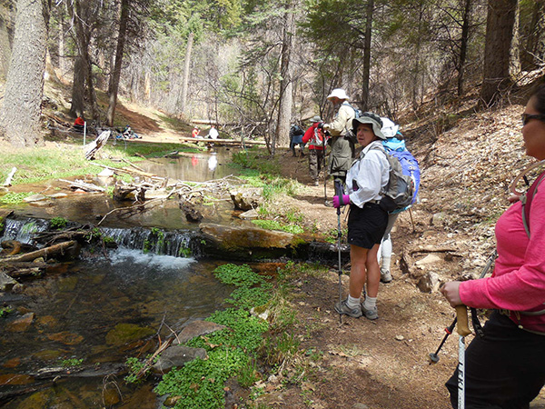
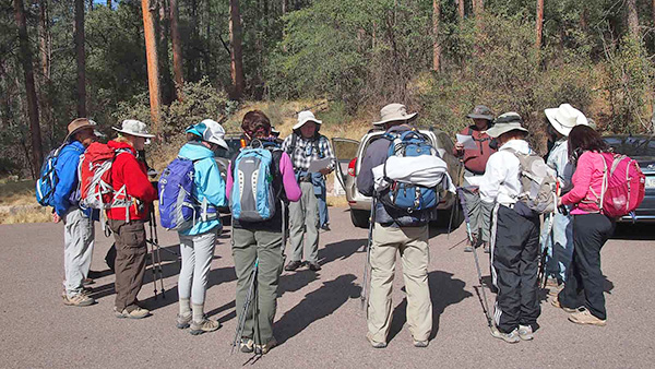 Round of introductions and a review of the trail map. [photo by Quy] |
||||
|
So the day before the hike I send everyone signed up two of the latest weather forecasts I’ve pulled up online, tell them to make sure they bring raingear, an extra layer of clothes to stay warm, and strongly recommend hiking poles to navigate the steeper sections of the trail that could turn slippery and treacherous in the event of rain or snow. Then I cross my fingers, swallow hard, say a silent prayer, and hope for the best. But I also have an ace up my sleeve (at least I hope so) in the form of a gut instinct that tells me the weather will probably not be nearly as bad as predicted for today. And if worse comes to worse after we start hiking, we can always opt for an easier trail with less elevation and hopefully less potential for bad weather. |
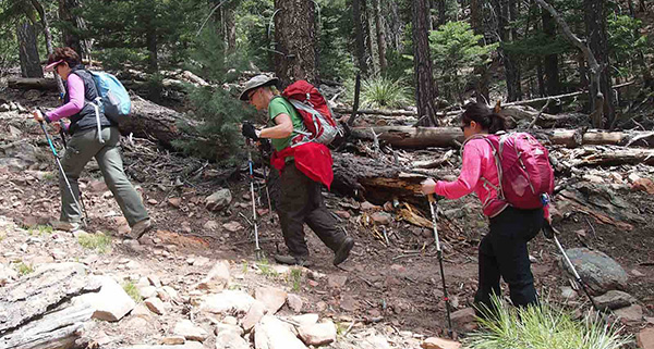
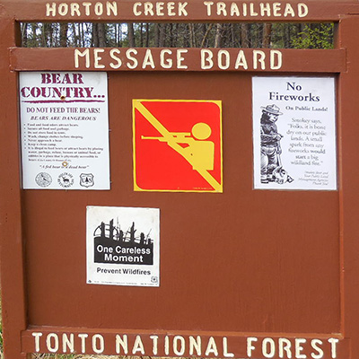 Bear Country ... Bears are Dangerous! [photo by John] Mt. Graham in southeastern Arizona has the highest concentration of black bears in the state. So there is always the possibility, slim as it is, of encountering big bruin lumbering across the trail on one of our high country hikes. Typically, though, they steer clear of humans and all we normally see are their calling cards in the form of scat piles on the trail or long scars on downed or standing trees where a bear has stopped to sharpen its 3" claws. We strike out from the Horton Spring Trailhead parking lot at exactly 9:30 AM on a cool (48 degrees) and very cloudy Saturday morning in early April. A light breeze is blowing out of the northwest as we hike up the road in search of the access trail that will link us with the Derrick Trail. We are doing a counter-clockwise loop hike today, hiking up the Derrick and Highline trails to Horton Spring and then returning to the trailhead on the Horton Creek Trail. After a bit of a false start, we reverse course and head back down the road to a rocky and unmarked trail leading uphill into the forest. No signs at all, but this trail has to connect us with the Derrick Trail at some point since that’s the only other trail in the area besides the Horton Creek Trail that we normally hike to the spring. |
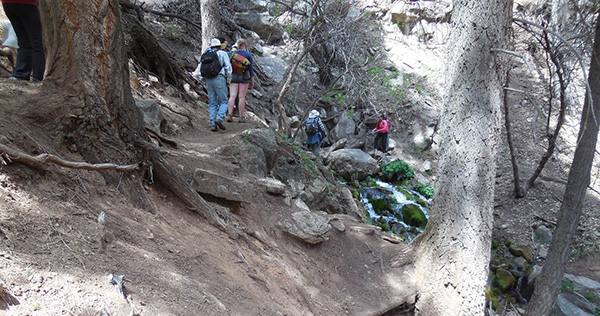
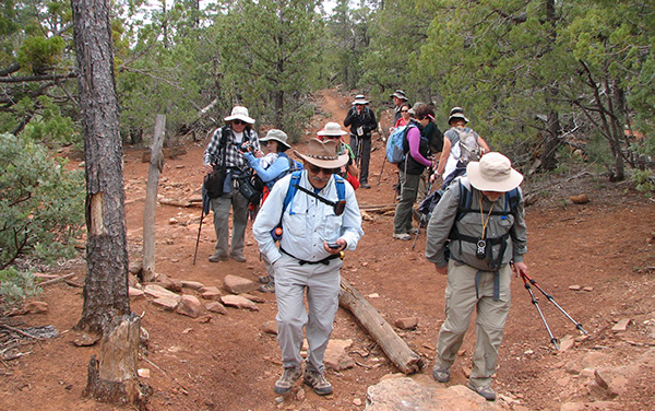 Arizona Trailblazers are on the move. [photo by Jim] |
 Trailblazers pause for a short break. [photo by John] |
|
It’s not too long before we begin a serious cardio workout on this stretch of trail that starts climbing almost right out of the starting gate. Up, up, and away we go. Where we stop, no one knows. Well, actually, our first major stop will hopefully be Horton Spring where we plan to break for lunch. But for now we forge onward and upward through a forest of ponderosa pine and juniper, with the trail leveling off from time to time. Although there is fairly thick cloud cover overhead, so far there are no serious threats of rain. Will my gut instinct about the weather play out after all? Is there a chance we might actually finish this hike without rain or snow? Only time will tell. |
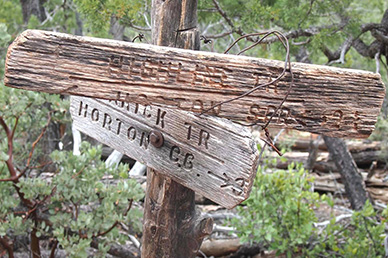 This trail sign is definitely showing its age. [photo by Quy] Between all the climbing and the sun peeking out from behind the cloud cover from time to time, it’s beginning to feel surprisingly warm for 6,000+ feet in early April. We follow the Derrick Trail east to its eventual junction with the Highline National Recreation Trail. The Derrick Trail levels off for a while before beginning a gradual ascent through more forests of pine and juniper. |
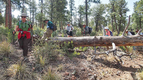 Trailblazers maneuver around another fallen tree. [photo by Quy] |
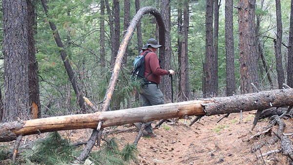 Michael passes through Pine Arch. [photo by Quy] |
 He ain’t heavy. He’s my brother. [photo by Quy] |
|
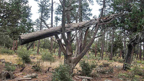
Typical of most of our forest hikes, we encounter large fallen trees like the one seen in this picture blocking the trail, forcing us to maneuver over, under, or around to continue on. Trail crews have cut out small trail-width sections from some of these downed trees to allow clear passage along the trail, but apparently the trees fall down faster than the crews can keep up with them. The pine arch was created when a large pine tree fell across a smaller tree near its crown, pinning it to the ground in a death grip. If we had the time and the inclination, we might be able to turn this situation into an interesting catapult project just to see how far we could fling a small boulder. No, not a very safe idea at all, but interesting to think about. |
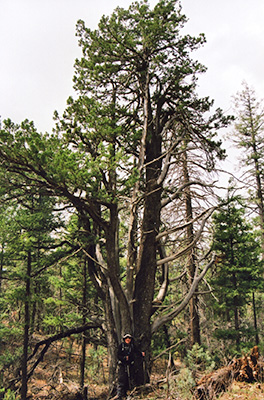 Barry shrinks in comparison to this forest giant. [photo by Chuck] |
After 1.4 miles of trekking the Derrick Trail, we finally reach the junction with the Highline Trail where we will start hiking north toward Horton Spring. This is the most critical trail junction of the entire loop because a wrong turn here will keep you heading east on the Highline Trail where you will eventually come out on the Two-Sixty Trailhead, the eastern terminus of the fifty-mile long Highline National Recreation Trail. So we wait here until everyone catches up before heading out once again. This three-mile stretch of the Highline Trail is the most challenging segment of the entire Horton Creek Loop, with close to 1,000 feet of elevation gain from the junction to the spring. In places the trail almost seems like hiking a roller coaster through the forest, with more ups and downs than a shaky stock market struggling to make a post-recession recovery. Bruce Grubbs quite accurately sums up the trail in his book Best Loop Hikes Arizona: |
“The Highline Trail harks back to the pioneer days of Arizona, when trails were a means of point-to-point travel rather than recreational routes. Although the Highline Trail generally contours, it has an inordinate amount of short climbs and descents, a giveaway that it was laid out ‘on the fly’ by horsemen rather than planned and built by the Forest Service.” Nevertheless, this is also a beautiful stretch of trail lying just beneath the steep ramparts of the Mogollon Rim and along the west side of the imposing Promontory Butte, while traversing through an ancient forest of large ponderosa pine, towering Douglas fir, huge alligator juniper, and great thickets of some of the largest Manzanita we have ever seen. I ask Barry to stand in front of what may well be the largest alligator juniper I have ever seen anywhere in Arizona so we can appreciate the enormous size of this impressive tree that must be six feet or more in diameter at its base and fifty or more feet in height. A juniper this size is probably 200 years or more in age, already a mature tree of fifty or so when America was still engulfed in a raging Civil War and Abraham Lincoln was President and Commander in Chief. |
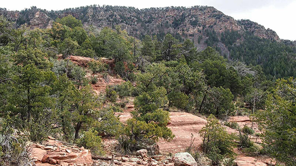 The spectacular Mogollon Rim dominates the skyline. [photo by Quy] |
 Monika, Dottie, and Diane tackle yet another hill. [photo by Quy] |
 Trailblazers head up a long and steep incline. [photo by John] |
 A dense forest of Manzanita. [photo by John] |
 The telltale smooth red bark of the Manzanita. [photo by Quy] |
|
We press onward and upward, determined to reach Horton Spring where we plan to take a well-deserved rest and lunch break. But every time I think we have finally tackled our last hill and enjoy a flat stretch of trail for a change of pace, yet another long incline steeper than the last one awaits us, and then another and still another. Are they ever going to end? On the bright side though we have still managed to dodge the bullet on inclement weather and are even seeing blue patches of sky from time to time through the forest canopy. Finally, hunger and fatigue overcomes most of the group and we decide to break for lunch in a large open meadow with plenty of logs and boulders for seating. Horton Spring will have to wait a bit longer. Horton Creek and Horton Spring both take their name from early pioneer and homesteader L. J. Horton, who came to Arizona in 1881 and settled beneath the Mogollon Rim along the creek that today bears his name. By 1888 Horton had built up a thriving cattle ranch with up to 200 head of cattle. Things were going well, and there was certainly never a shortage of water for the ranch. But after returning from an out-of-state trip one day, Horton discovered to his dismay that rustlers had made off with his entire herd, essentially forcing him out of business. |
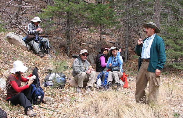
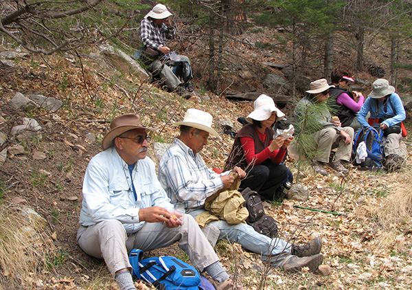 Trailblazers break for lunch. [photo by Jim] |
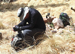
 Arturo stays in communication with the outside world. [photo by Jim] |
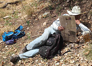 Rudy catches up on the daily news. [photo by Quy] |
 A penny for your thoughts, Barry. [photo by Quy] |
|
It’s always tough to get started again after sitting down to a relaxing lunch break. Although I told everyone a mile back that we were getting close, Horton Spring can’t be too much further away, so we hit the trail for one final push to the water. But first we have to navigate a few more hills, cross one large open meadow filled with bunch grass, climb one last steep incline, and then begin a steep and somewhat treacherous descent into the headwaters of Horton Creek. We hear the creek running long before actually seeing it and after making one last bend in the trail we finally see it flowing below us. |
 Horton Creek at last! [photo by John] |
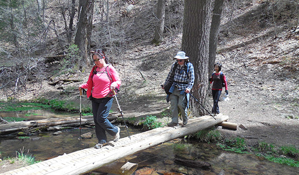 Diane leads the way across the narrow foot bridge. [photo by John] |
|
Down to creek level at last, we duck under a wire fence (watch out for those nasty barbs!) put in place to keep livestock out of the spring area and hike parallel to the creek for a short distance to a narrow foot bridge spanning the water. From here, we cross the creek and make our way up one more hill to see where Horton Spring literally gushes from a steep, boulder-filled hillside. |
|
Long ago I remember hearing someone referring to the Mogollon Rim as a giant sponge absorbing millions of gallons of rainwater and Horton Spring as one of its primary faucets. That’s actually a pretty good analogy since the spring runs continuously throughout the year and is the major water source for Horton Creek. We investigate the spring, take lots of pictures, pose for one last group shot on the foot bridge, and finally begin the four-mile hike back to the trailhead on Horton Creek Trail which runs parallel to the creek for the entire distance. But for the best views of the many picturesque waterfalls and pools along the creek, we’ll hike the lower trail that runs much closer to the creek for as far as it will take us. And since we’re going with the flow of the creek, the trek back to the trailhead is virtually all downhill. |
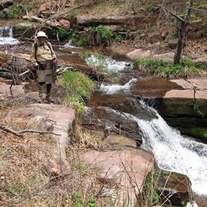
 Horton Spring gushes from a steep hillside. [photo by Chuck] |
 Sixteen Trailblazers test the load capacity of the foot bridge. [photo by John] |
 Trailblazers make the crossing above Horton Spring. [photo by John] |
|
Horton Creek temporarily disappears beneath the ground about a half mile from the trailhead, only to re-emerge once again near the bridge adjacent to the trailhead parking area and continue on its journey to the rugged Hellsgate Wilderness area to the south. That half-mile stretch of dry creek bed is one of several places along its course where the creek runs beneath the surface of the ground through a series of connecting limestone caverns. |
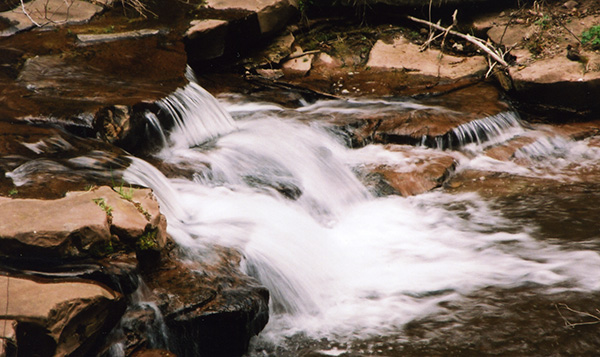
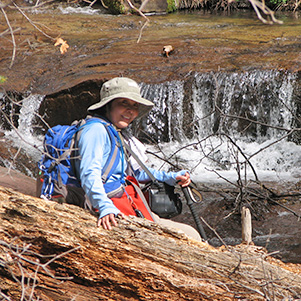 Quy poses next to one of many waterfalls along the creek. [photo by Jim] |
 Jim picks an even larger waterfall for his picture. [photo by Quy] |
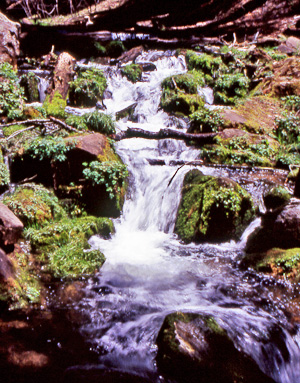
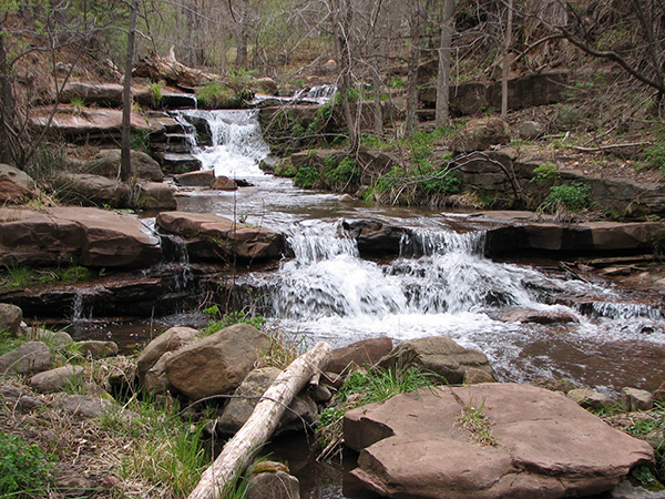 A series of idyllic cascades along Horton Creek. [photo by Jim] |
 One of many stair step cascades along Horton Creek. [photo by Chuck] |
 Water, water everywhere. [photo by Chuck] |
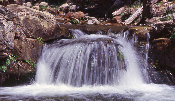 One last waterfall along the creek. [photo by Chuck] |
|
And finally, no trip report would be complete without a collection of Quy’s outstanding flower photos. |
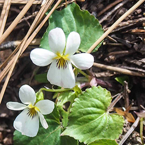 Canadian White Violet |
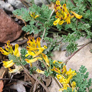 Trefoil |
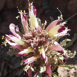 Sun Spurge |
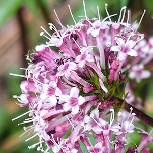 Brownfoot |
|
Most of us arrive back at the trailhead around 3:45 in the afternoon, a little over six hours from our start time. Since two different GPS readings show ten miles, that will be our official hiking distance for the day. Despite the foreboding weather forecast, this has turned out to be a perfect day for hiking with ideal temperatures, no rain, no snow, no thunder or lightning, and no high winds. Once again we manage to completely dodge the weather bullet, with a dash of pure luck thrown in for extra measure. We can’t always pull this off, but thankfully everything worked out great this time. |
 Trailblazers moving out on the Horton Creek Trail. [photo by John] |
|
And here John and I were looking forward to building a snowman alongside the trail and perhaps even skiing down to the spring. Maybe next time, John. Meanwhile, the next big decision is where to eat dinner. It quickly boils down to either Mexican or Thai. Ayothaya Thai Café in Payson has become one of our favorite places in the past year or two and emerges as the clear winner once again. Three in our group decide to call it a day and head back home, while the rest of us head down the road for some great Thai cuisine. |
Trailblazers enjoy dinner at Ayothaya Thai Café. [photos by John]
 
|
|
Thanks to all of you who braved the weather forecast and joined me on this hike, and a special thanks to Quy, John, and Jim for all of your great pictures that were used throughout this report, along with a few of my own. |
Hike Statistics, by Jim Buyens
|
|
 Top of Page
Arizona Trailblazers Hiking Club, Phoenix, Arizona
Comments? Send them to the AZHC .
updated April 17, 2019