Outdoor Links
Hike Arizona
Trip Planning Guide
Trip Report Index
Calendar of Events
Library
|
Arizona Mineral Belt Day Hike Flagstaff August 30, 2014 by Scott Green |
|
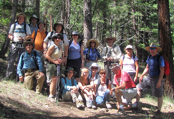 Sweet 16 Trailblazers on the slopes of Mormon Mountain. [photo by Bill] |
|
Chuck, Andy, Lance, Michael, Biljana, Heather, Scott, Sana, Gary Arturo, Linda, Gabrielle, Diane, Monika, Karen, Bill |
|
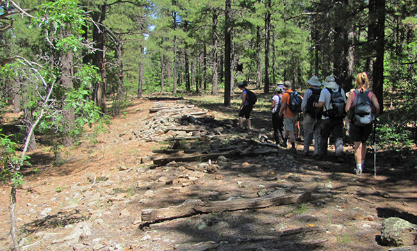
A special shout-out to the two new members, Diane and Biljana, and one guest with the anticipation of becoming a full member. After leaving Phoenix on time and with high enthusiasm, we headed north once again this summer towards Flagstaff to the higher elevation and the promise of sub-80 degree temperatures. Picking up a couple of hikers along the way and regrouping just south of Flagstaff, we headed to the end point of today’s hike. Due to the one-way hike direction, we left a car, thank you Karen, at the Arizona National Scenic Trail (AZT) parking lot. After the hike, this car will provide the other drivers transportation to their vehicles at the starting point enabling them to return and pick up the ‘stranded’ hikers. As we all rode toward Mormon Lake and turned off Lake Mary Road onto the Mormon Lake Road, we soon found ourselves at the entrance of Double Springs Campground where we met our last hiker, bringing our total to 16 for the day. After parking and a short walk into the campground, we circled up to introduce ourselves and learn about today’s trek: a 10 mile portion of the full 800+ mile AZT between Mexico and Utah. With the leader taking the ‘tail’ to ensure a complete count of 16 throughout the day, others took turns leading us throughout the day as we periodically passed AZT trail markers. |
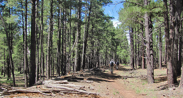
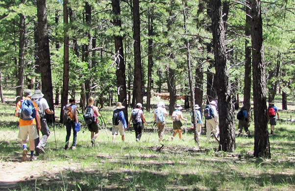 The Arizona Trail passes through forested areas. [photo by Bill] |
|
We began the hike from the campground with a little adjustment nudge to the left. After a 2 mile steady gentle climb, we found ourselves at a four-way intersection where the Mormon Mountain Trail perpendicularly crosses the AZT from the Dairy Springs Campground down on the right, up to Mormon Mountain to the left. A location which provided an excellent picture opportunity. |
|

|
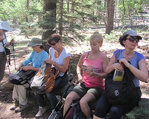
| Snack break along the trail. [photos by Bill] | |
|
Continuing on, we were offered sliver views of Mormon Lake through the trees, confirming our continuing elevation gain. Also, we were all starting to appreciate the many blossomed wildflowers. This combination of beauty was almost a total distraction for a few anxious hikers who were looking for any credible evidence of bears. Fortunately, their distress was unsound and was loosely based on wild tales from some fellow hikers whose names will be untold but also not forgotten. After a pleasant lunch in the shade of trees and welcoming breeze, we continued on looking forward to the surprises ahead. |
 Yes, a railroad was built through here. [photo by Bill] |
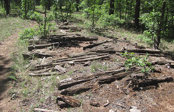 Looks like these ties would have to be replaced. [photo by Bill] |
 The Arizona Trail follows the railroad grade. [photo by Bill] |
|
The non-native evidence of earlier industrial work soon was seen in the form of a handful of hand-sawed parallel wooden beams laying on the ground in a linear fashion. It was odd to see something like this in the middle of the forest until we looked around and noticed the manmade earthen mound which the beams laid upon. This was the beginning of our trek along an old logging railroad. For 3.4 miles, the trail followed the abandoned Arizona Mineral Belt (AMB) railroad. From the United States Department of the Interior National Park Service National Register of Historic Places Continuation Sheet, following are some edited excerpts: In the summer of 1887, Colonel James W. Eddy’s Arizona Mineral Belt Railroad began service between Flagstaff and Mormon Lake. Eddy’s plan was to build a railroad connecting the mining community of Globe with the A & P at Flagstaff, but financial difficulties precluded completion of the line. Denis Matthew (“Matt”) Riordan, saw an additional opportunity offered by the Mineral Belt: if completed, it could deliver not only timber to mill, but also lumber to market. Riordan had been trying, with limited success, to compete against California lumber companies for business in southern Arizona Territory. A railroad from Flagstaff to Globe and on to the Southern Pacific Railroad would give him a decided marketing edge. Therefore, when the Mineral Belt faltered in 1887-1888 because of a major backer’s (A & P’s) refusal to reimburse construction costs, Riordan and associate Francis Hinckley quickly moved to acquire the line. Riordan was on rather financially shaky ground himself in those days. He had recently bought Ayer’s operation and formed the Arizona Lumber Company (Cline 1976: 199; Kuhn 1981: 96) but he nonetheless persisted in his plan and completed acquisition of the Mineral Belt by the end of 1888. Although it never was extended to southern Arizona as Riordan planned, the carrier served him well. Soon a small network of railroad spur lines radiated from the main line to harvest timber south of Clark Valley (now Lake Mary). Thus was born the first logging railroad in the study area. Riordan’s line signaled the wave of the future for the timber industry. For the following fifty years, all large-scale lumber operations in the study area would build and depend on logging railroads to get timber from forest to mill. Logging camps were massive fueling and repair centers for workers, locomotives, and, in many instances, horses. It would be difficult to overstate the amount of eating that went on in these encampments. Of necessity, workers ate a lot in order to survive the caloric demands of incredible exertion and cold winters. One food historian estimates that the average caloric intake of a logger was 7,610 per day. Chopping a tree with an axe burned about 10 calories per minute. Bucking it with a cross-saw required about 8.6 calories/minute, while topping and de-limbing required about 8.4 calories/minute. Additional calories were burned just to stay warm on the job. Mormon Mountain In 1923, the Flagstaff Lumber Company started construction of an extension of the Lake Mary (Anderson Mesa) line, south to Mormon Lake (Figure 18). The line was built to access the Mormon Lake and Sawmill Springs timber units, purchased that year from the USDA Forest Service at a price of $2.25 per thousand feet. The unit included 80,000,000 board feet and covered 28,000. The extension followed the course of the Arizona Mineral Belt Railroad of the 1880s. From Clark Valley, it ran along the west side of Walnut Creek and then skirted the west side of Mormon Lake, terminating at Coyote Basin. The Mormon Lake extension was viewed with great anticipation by the locals, who believed that rail service would open Mormon Lake as a tourist destination. Although it was never the FLC’s intent to be a common carrier, it sometimes found itself with as many as 300 passengers on a weekend. The use of Mormon Lake as a recreational area began in this era. It had saved the worst until last, and now faced the difficult task of accessing timber on Mormon Mountain. Moving north from Fulton Canyon, the company built a seven-mile branch to the summit of the peak. The line had a steep grade and no turning facility at the top, so locomotives were faced to use the hazardous expedient of heading up and backing down. Because of the expense and danger involved, the lumber company exhibited little enthusiasm for logging the mountain, but the Forest Service made it clear that it would negotiate no new sales with the company until it had completed timber harvesting there. Mormon Mountain became the company’s Waterloo. A slump in the lumber industry, coupled with the expense of the Mormon Mountain operation, caused the company to close its Flagstaff operation in October of 1927. |
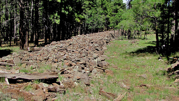 Ballast from the former railroad track. [photo by Bill] |
 Plenty of local rocks to fill in. [photo by Bill] |
 Spikes to fasten the rails to the ties. [photo by Bill] |
 The AZT continues on by the railroad grade. [photo by Bill] |
 Onward! Pinegrove Campground is this-a-way. [photo by Bill] |
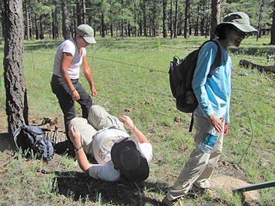
Michael goes snake-eyes to get under a fence. [photo by Bill]
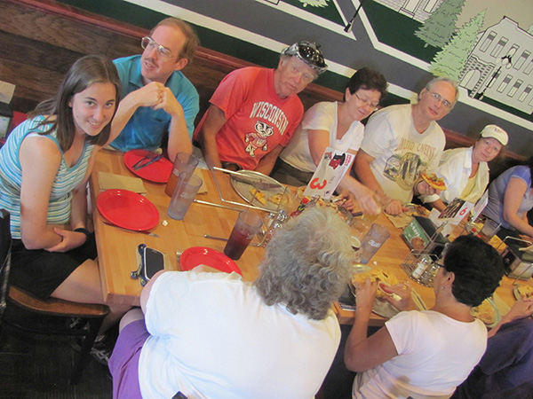
A few hundred yards from the waiting car left earlier, four hikers extended their miles by completing their hike via the Pinegrove Campground and then down to the AZT parking lot. Since the shuttle drivers didn’t deviate, they efficiently retrieved their vehicles thanks to Karen and returned to the aforementioned ‘stranded’ hikers who eagerly awaited a meal in Flagstaff. We backtracked towards Flagstaff and consumed copious amounts of pizza and drink at Fratelli Pizza. |
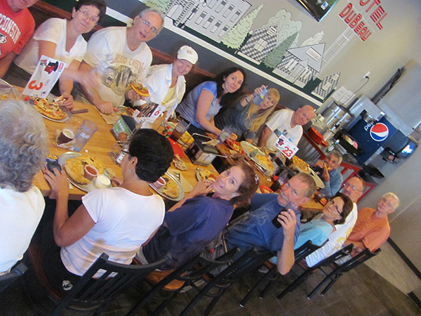 Enjoying pizza and drink at Fratelli Pizza. [photos by Bill] |
|
|
After our fill, we bid adieu for the downhill trip once again to the heat and home. |
| Hikers | 16 |
| Start time | 10:00 AM |
| Finish time | 3:00 PM |
| Hiking time | 4 hours |
| Stopped time | 1 hour |
| Weather | clear skies, slight breeze, warm in the sun, almost cool in the shade |
| Hiking distance | 10.2 miles |
| Moving average | 2.9 miles/hour |
 Top of Page
Arizona Trailblazers Hiking Club, Phoenix, Arizona
Comments? Send them to the AZHC .
updated August 31, 2014