Outdoor Links
Hike Arizona
Trip Planning Guide
Trip Report Index
Calendar of Events
Library
|
Willow Lake Day Hike Prescott October 18, 2014 by John Richa |
|
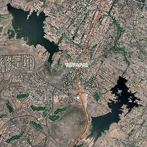 Both lakes, from the air. |
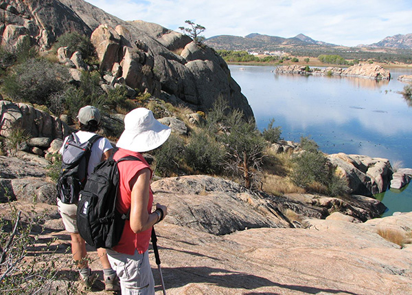
A search of our website did not result in any hike undertaken around Willow Lake, north of Prescott. We’ve done two hikes in recent years at Watson Lake, a sister man-made lake. Both lakes are adjacent to each other, separated only by highway 89A. Willow Lake is the larger of the two lakes. So, it was decided to undertake such a hike and to add it to our website inventory of “done hikes”. This is a loop hike around the lake. The pictures in this report capture some unusual rock formations tempered by the blue azure lake waters and blue skies with scattered high clouds. The weather was ideal: high in the low 70’s and low in the mid 40’s, a typical fall day in Prescott. |
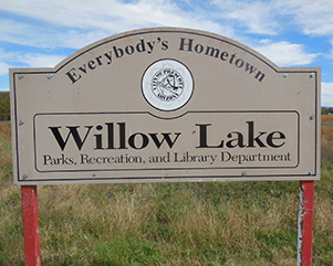 Everybody’s Hometown [photo by John] |
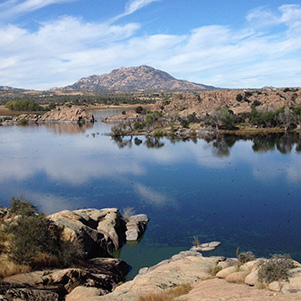
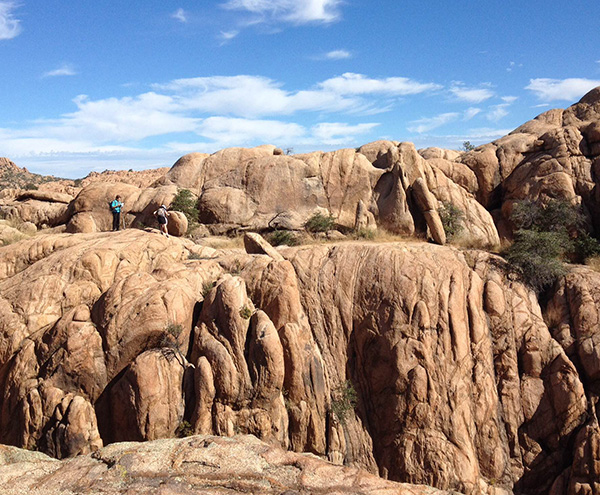
 Mighty fine rocks they have here. [photo by John] |
 Just right for climbing! [photo by Sana] |
 Head for the hills? Another day. [photo by Biljana] |
 Wonder how long the shoreline is? [photo by Sana] |
|
In order to appreciate the rock formations, it will be necessary to explain their origins and formation. |
 Trail takes us by the Great Stone Caterpillar. [photo by Sandra] |
 Hey, let’s climb the Caterpillar! [photo by Dave] |
 I don’t know, it’s kind of steep. [photo by Dave] |
 What magnificent rocks you have! [photo by Sana] |
 Tread lightly, and stay on the trail. [photo by John] |
|
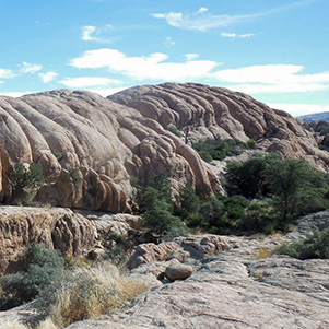
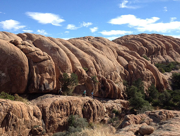
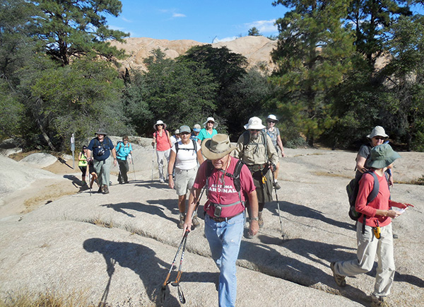
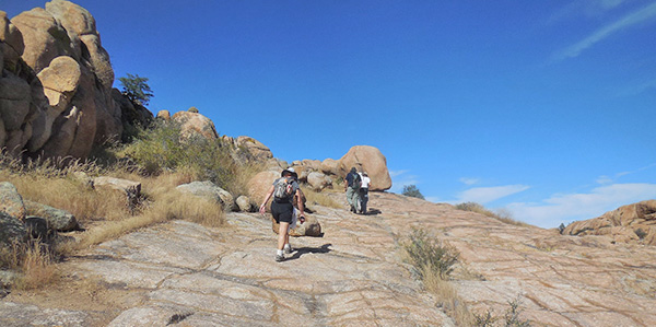
The Granite Dells, a geological feature north of Prescott, Arizona, consist of exposed bedrock and large boulders of granite that have eroded into an unusual lumpy, rippled appearance. Willow Lake is a small man-made reservoir in this formation. This, combined with numerous hiking and biking trails and rock climbing routes, makes it a popular outdoor recreation area in the region. Geologically speaking: the Precambrian Dells’ granite has been dated at 1.4 billion years old. Its plutonic rock was intruded at a depth of around one or two miles. These cover rocks have since been eroded away. Weathering along joints produced the rounded boulders and other unusual rock formations that characterize the Granite Dells. This process is called “spheroidal weathering,” and is common in granitic terrains. Hiking in Prescott’s Granite Dell is like getting lost in a Stone Age labyrinth. The network of paths, on the north shore of Willow Lake, coil through hulking quartz-studded granite buttes squeezing in and out on the paths in heaving accordion style. The rugged meandering loop trails move seamlessly from claustrophobically tight spaces to airy exposed promontories with unobstructed vista. The trail follows spray painted white dots on these rocks and serve as directional beacons. |
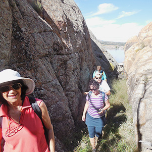 Sure, we can go between the rocks. [photo by John] |
 Watch your step on the down grade. [photo by John] |
|
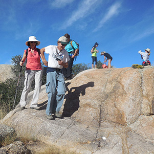
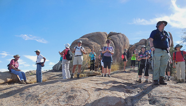
At 7:00 AM, 17 Trailblazers hikers met at Fry’s parking lot on I-17 and Bell Road. Dave French, our 18th star hiker was to meet us at the intersection of Rts. 169 & 69. He was driving from his summer abode near Flagstaff. Carpools arrangements completed, we headed north to Prescott but not before our usual midpoint stop at Cordes Junction. Maps in hand, we navigate through the streets of Prescott and enter the trailhead parking lot at a lake side northern parking lot. We saddle up and pose for our traditional group picture. At about 9:30 AM we start our hike of 5.8 miles. |
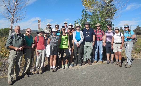 All together now ... [photo by John] |
|
Front row: L to R : John, Dottie, Gabrielle, Karen, Linda, Heidi, Heather,
Monika, Debbie, Michael, Dave, Biljana, Sana, Sandy. Back row: L to R : Jim, Denise, Yanis, Vanessa. |
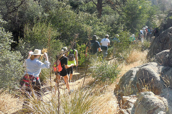 This section of the trail is a walk in the woods. [photo by John] |
 There’s plenty of scenery to admire. [photo by John] |
 Moving on down the trail. [photo by John] |
|
The official elevation range was from a low of 5,073 feet to a high of 5,225 feet. Some would rate this loop trail as easy and others, easy to moderate. Mind you that elevation hiking, when not accustomed, is more difficult due to the rarefaction of oxygen in the air. The hiker would feel fatigued much more readily and would thirst more. Hydration, when hiking, is very important. |
 The next part of our hike is a rock climb. [photo by Jim] |
 Hmmm ... think I’ll try the trail on this side. [photo by Jim] |
|
We chose to follow the most scenic trails which hugged the water front. Our first trail was the Willow Lake Trail which connected us to the Approach Trail, which crossed the Red Bridge, yes, a real Red Bridge. Michael had to test the strength of the bridge. OK signal. Now everybody crosses the bridge. |
 Step right out there, Michael. [photo by John] |
 Why, this bridge can hold four of us. [photo by John] |
 On second thought, maybe we should just go a few at a time. [photo by John] |
 Oh, what the heck, let’s all go. [photo by John] |
|
The trail then looped down behind the dam where we come upon a patch of thick foliage of various shrubs and trees but most notably huge cottonwood trees. Three of us, Michael, Linda and John, ignore the “no trespassing” posted sign and proceed to get closer to the base of the dam to investigate its structure. No leaks or cracks. It is a sound dam. This is a very small dam by all standards; however, we were dwarfed by its height. |
 This means you. [photo by John] |
 That dam trail looks OK to me. [photo by John] |
 Some autumn color. [photo by John] |
 Moving right along ... [photo by John] |
 Onward and upward. [photo by John] |
|
In past years, water used to flow out at the base of the dam and hence the large cottonwood trees. But in recent years, the park services rerouted the flow of water. The reservoir water level was 6 to 7 feet below its high point. Look carefully at the water markings on the dell rocks forming the shore line. From the base of the dam, we climbed some 70 to 100 man-made steps that led us to the top of the dell rock formation where we rejoined our fellow hikers. We just climbed the “Steps” as the map indicates. At the top we connect with the East Bay Trail, a water front trail and very scenic. It seems that about half the time we were climbing or descending rock formations. These rock formations were smooth, full of crevasses and treacherous. One misstep and you could find yourself tumbling down the side of the rock formations with plenty of scrapes and bruises to show for it. |
 Taking a breather on the rocks. [photo by John] |
 This is a respectable climb, after all. [photo by John] |
 Are we topping out? Not quite. [photo by John] |
 Now I’m sure this trail is on the up and up ... [photo by John] |
 Slickrock isn’t slick when it’s dry. [photo by John] |
 What a slope! What a hike! [photo by John] |
 Once we get above the rocks, there’s more vegetation. [photo by Dave] |
|
Fortunately, no one slipped or fell or had a scratch. The old adage still holds true that “whatever goes up must come down” and we had plenty of both. |
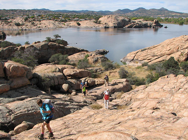
 Here we have a fine view of the lake. [photo by Dave] |
 So, we’re not done climbing yet. [Sandra] |
 Step lively to get past those pools of water. [photo by Sana] |
 Dave, the quintessential Cardinal. [photo by Jim] |
 I see a white spot, right here. [photo by Sandra] |
 I thought it would be easier on the down slope. [photo by Sana] |
 Watch your step on those rocks. [photo by Jim] |
 You see, it’s all about your point of view. [photo by Jim] |
 We’re high above the lake on this part of the trail. [photo by Jim] |
 Did you hear the one about “Granite Dells”? ... [photo by John] |
 See, the trails are marked. [photo by John] |
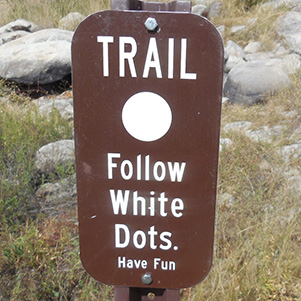 What the white dots are for. [photo by John] |
|
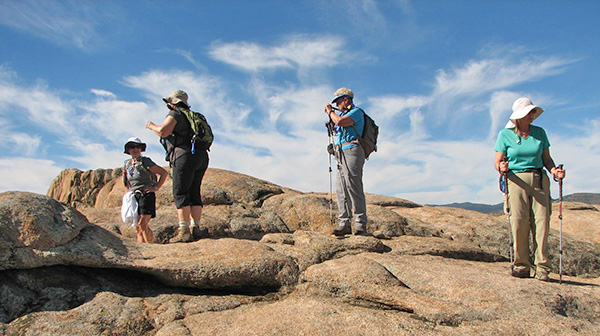
It makes you wonder how one can navigate on the rocks, when there is no traditional dirt trails to follow? Thanks to the ingenuity of the Park Services and maybe with some divine intervention, someone came up with the idea of painting on the rock “White Dots” three inches in diameter and interspaced every 15 feet or so apart. They were quite visible on the brown, red or gray dell granite rock formations. Besides the White Dots markings, at various trail intersections there were posted map signs of the lake and the trail with a highlighted large “dot” indicating our current position on the trail. This was sort of stationary GPS for hikers. |
 Willow Lake is teeming with life. [photo by Dave] |
 Let me tell you about the real Duck Dynasty. [photo by John] |
 Rock of ages, high above the waters. [photo by Dave] |
 We get an aerial view of the dam. [photo by John] |
|
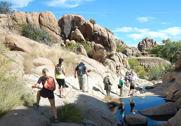
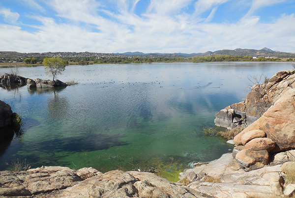
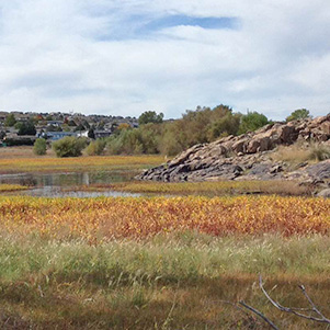
The lake waters looked blue, azure, however, near the shoreline, one could easily see the green algae. Ruddy ducks, Coots, Cinnamon and Green-winged Teals, double-crested and Neotropic Cormorants seemed to like floating close to the shoreline where they feed on algae or small marine creatures and fish. |
 Picnic on top of the world. [photo by John] |
 This is the life for me! [photo by John] |
|
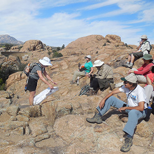
About 2 miles into our hike, at the highest point above the dam, we stopped for a short rest to hydrate and eat our lunch or snacks. |
 We’re down now, but not back to the trailhead. [photo by John] |
 At a lower elevation, we enter the wetlands. [photo by Dave] |
 Are you sure we can get across with dry feet? [photo by John] |
 Aha! There is a way! [photo by Sana] |
 It still looks kind of muddy. [photo by John] |
|
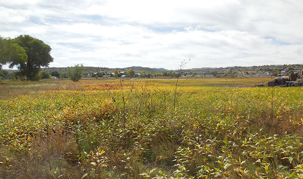
After the lunch break we proceeded to make our last descent from the dell rock formations and headed towards a prairie that formed the southern part of the lake perimeter. Hereinafter, the trail becomes flat and our pace picks up speed. A few weeks ago, the summer monsoon rains raised the dam water level. At the southern end of the lake, the land is flat and shallow thus creating a marsh with plenty of suitable lush marshy vegetation of broad leaves plants and tall grass. Since then, however, the water receded but part of the original loop trail was still inundated by the lake water. Hikers have created a new quasi trail further south amidst the tall grass. How tall is the grass? See for yourself. |
 Definitely on the home stretch. [photo by John] |
 Easy trail, from here on in. [photo by Jim] |

|

|
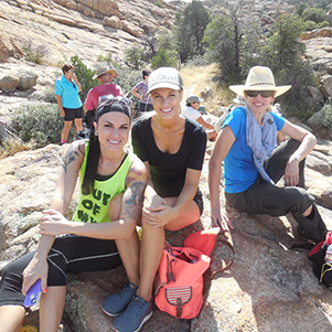
| Are these ladies “Charlie’s Angels”? [photos by Jim] | |
|
With the onset of the fall season, the marsh plants started to turn into colorful red, brown yellow and orange. After crossing the marsh land, we linked up with the Willow Lake Trail, a flat and fairly wide trail which will take us around the southern and eastern banks of the lake and back to our parking lot at the trailhead. |
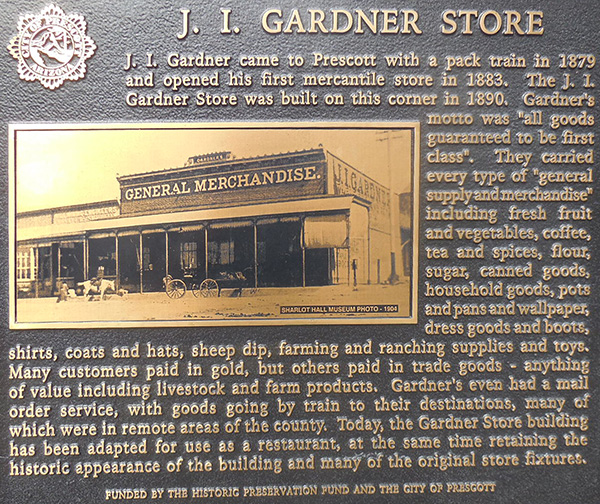 History comes alive in Prescott. [photo by John] |
 Food! Let’s go! [photo by John] |
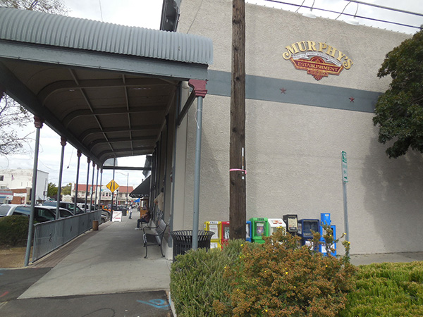
 Murphy’s Restaurant, now that’s the place. [photo by John] |
|
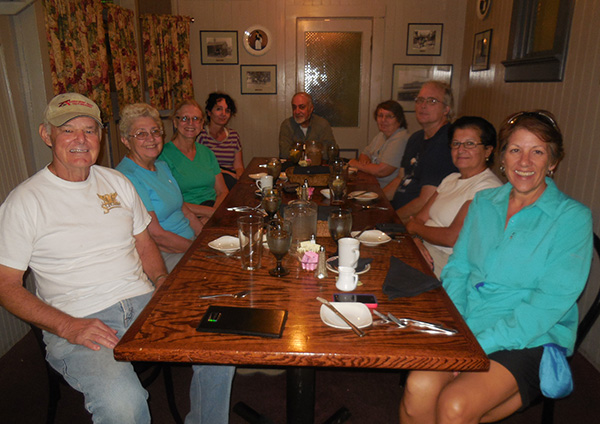
Out of the 18 hikers, nine of us had to get back early to Phoenix. We bid our good byes and the remainder 9 hikers capped off the day’s activity with our traditional late lunch or early dinner at Murphy’s Restaurant in downtown Prescott. The restaurant building is on the Historic Preservation list of the City of Prescott as the plaque attests to it. It was a fun-filled day, with great weather, cardio exercises, camaraderie, and we conquered another new trail to be added to our repertoire of trails hiked by the Arizona Trailblazers Hiking Club. Everyone made it home safely. |
||||||||||||||||||||||||||||||||
|
 Top of Page
Arizona Trailblazers Hiking Club, Phoenix, Arizona
Comments? Send them to the AZHC .
updated February 18, 2016