
Outdoor Links
Hike Arizona
Trip Planning Guide
Trip Report Index
Calendar of Events
Library
|
Bryce & Zion National Parks Car Camping Trip Utah September 7-13, 2014 by Chuck Parsons |
|
Early Sunday morning, September 7, 2014, and the beginning of another sweltering day in Phoenix. Eighteen Arizona Trailblazers are bound for Zion National Park, Utah. It’s time to hit the road and get out of Dodge. We will be camping for six nights in Watchman Campground located just to the north of The Watchman, one of Zion’s most prominent and iconic landmarks, rising to 6,545 feet in elevation. This will be the longest camping trip in the 18-year combined history of the Arizona Trailblazers Hiking Club and its predecessor, the Motorola Hiking Club, and we are up for the challenge. The weather forecast is a bit questionable, with a 60% chance of heavy rains and thunderstorms predicted for both Monday and Tuesday. But we’re keeping our fingers crossed and hoping for the best. This is the same hurricane-driven storm system that hammered southern Arizona a day earlier with record-breaking amounts of rainfall. But even if we do get rained out for two days, what better place to hunker down and ride it out than what is arguably the most beautiful National Park in the state of Utah (home to five National Parks and seven National Monuments) and one of the most scenic in the entire country? An added bonus—at least two days of cool relief from the endless desert heat of southern Arizona. |
 Trailblazers set up camp at Watchman Campground. [photo by John R.] |
 Gary inflates his air mattress with an industrial-size air pump. [photo by John R.] |
 Moving day for Dan’s tent. Dan, are you still in there? [photo by John R.] |
 Trailblazers relax for a quick dinner at camp. [photo by John R.] Clockwise: K.G, Kim, Dottie, John S., Sandy, Chuck, Wayne. |
 Group Site E005, our home at Watchman Campground for 5 days and 6 nights. [photo by Wayne] |
|
It’s a long 400-mile drive from the Phoenix area to Zion National Park, but there’s also a lot of beautiful scenery along the way to break the monotony. I had earlier proposed two alternate routes from Highway 89 out of Flagstaff and figured most drivers would probably drive one route to Zion and then return home on the other route. Option “A” involves crossing the Colorado River at Marble Canyon and continuing on ALT 89, heading west along the base of the spectacular Vermilion Cliffs and through Jacob Lake to Fredonia and then north on Highway 89 into Kanab, Utah. Zion is about an hour’s drive from Kanab. |
 The Watchman stands guard over Watchman Campground. [photo by Chuck] |
|
Option “B” involves turning off onto US 89T at The Gap, about 17 miles north of the US 160 junction (Tuba City exit). This is the newly completed bypass route around the damaged landslide section of Highway 89 northeast of Bitter Springs and runs parallel to Highway 89 from The Gap to LeChee, just south of Page. US 89T rejoins Highway 89 in Page. Continue on Highway 89 northwest past the west end of Lake Powell and through the Grand Staircase-Escalante National Monument in Utah. Continue heading west on Highway 89 to Kanab, Utah. |
 Karen describes the Emerald Pools Trail for us. [photo by John R.] |
|
Monday morning at Watchman Campground, and it’s not raining! In fact, the skies are mostly blue with only a few scattered clouds on the horizon. Could that ominous sounding weather forecast be wrong after all? Are we going to escape the weather bullet at least one more time? Only time will tell, but for now we’re going to take advantage of the good weather and do some serious hiking while we can. So for today, Karen suggests the Emerald Pools Trail and the Grotto Trail. It’s time to put boots on the ground, Trailblazers. |
 Trailblazers are ready to start their first hike of the trip. [photo by John R.] |
 First group picture on Monday by the Virgin River. [photo by Bill] |
|
Left Side, front to back: K.G., Wayne, John S., Rudy, Kathy, Monika, Dottie, Chuck. Right Side, front to back: John R., Sandy, Debbie, Karen, Kim, Gary, Edith, Dan, Michael. |
|
After breakfast we load up our hiking gear and make the half-mile walk over to the Zion Canyon Visitor Center, where we take the park shuttle to the Zion Lodge. The Emerald Pools Trail begins just across the road from the lodge. Walking to the Visitor Center and riding the park shuttle to our destination will be our daily routine for the remainder of the week. The Zion shuttle system was started in 2000 to ease major traffic congestion along Zion Canyon Road between Canyon Junction and the Temple of Sinawava at the north end of the road. During busy summer seasons prior to 2000 several thousand vehicles clogged this short stretch of road almost daily, competing for about 250 parking spaces. Today, it’s hard to imagine what that frustration must have been like for pre-2000 visitors to Zion. |
 A fine spray of water cascades down on the Emerald Pools Trail. [photo by Chuck] |
 Trailblazers squeeze through a narrow place on the trail. [photo by Michael] |
|
Unfortunately, that pattern has become the norm for most of our more popular National Parks across the country. We are simply loving them to death in overwhelming numbers. The Zion shuttles run throughout the day and we never have to wait more than five minutes for the next one to come along at any of the numerous stops. A much better alternative to sitting in long lines of snarled traffic to go anywhere in the park. Not to mention the air pollution and frayed tempers involved. |
 View looking upstream on the Virgin River from the bridge. Within hours this serene river will become virtually unrecognizable. [photo by Chuck] |
 Apparently someone was bored with hiking at this point [photo by John S.] |
 Dottie, Gary, Karen, and Kathy take a break on the trail [photo by Bill] |
 Second falls along the Emerald Pools Trail. [photo by John S.] |
 Trailblazers finally reach the Upper Pool. [photo by John S.] |
 Now what can these hikers be looking at? [photo by Bill] |
 Reflections: Upper Emerald Pool. [photo by Wayne] |
 Soaring cliffs of Navajo Sandstone reach for the sky. [photo by Chuck] |
|
After a few group pictures at the Zion Lodge shuttle stop, we make our way across the road and head for the trailhead. The Emerald Pools Trail links with the Kayenta Trail near the Upper Emerald Pool and then with the Grotto Trail to complete a 2.5 mile loop. Total elevation gain to the upper pool is about 450 feet. The trail to the lower pool is paved all the way, but turns to sand and rock as it winds its way ever upward to the middle and upper pools, with several small waterfalls along the way cascading from sheer cliffs high overhead. This is the place to be after a heavy rainfall. Today the falls are reduced to a mere trickle of fine spray showering down on the trail, a great place to get wet and cool off on a hot day. After the hike, part of the group decides to head back to camp, while the rest of us opt for lunch at the Zion Lodge Café where we sit down to break bread on the outdoor patio. After a relaxing lunch, I decide to join Karen and Edith for the easy two-mile Parus Trail that parallels the river back to the campground. The trail provides great views of both Zion Canyon and the Virgin River, still leisurely flowing along at its normal pace of 30-50 CFS (cubic feet per second). Little do we realize how soon that’s about to change, although a mere glimpse of the ominous and increasingly dark cloud cover overhead should be ample warning. We’re just hoping we can make it back to camp before the heavy stuff catches up with us. |
 Canyon view along the Grotto Trail. [photo by John R.] |
 Zion Canyon and the Virgin River from the Grotto Trail. [photo by Bill] |
 Waterfall on the Virgin River near the Grotto Trail. [photo by Wayne] |
 We’ve all heard of The Bridge on the River Kwai. Well, this is The Bridge on the River Virgin. [photo by Wayne] |
 Edith, Dan, Kathy, and Michael pause for a quick picture. [photo by Bill] |
 Storm clouds gather over Zion Canyon. [photo by Chuck] |
 Court of the Patriarchs: Abraham, Isaac, and Jacob Peaks. [photo by Chuck] |
|
Southern Paiutes called the river Parus, meaning “whirling waters”. Spanish priests later named it the Virgin River, since the river represented to them the miracle of a perennial source of water in the desert. The North Fork of the Virgin River begins thirty miles north of Zion near Cedar Breaks and Navajo Lake. The East Fork of the Virgin River has its headwaters near Long Valley Junction. The North Fork merges with the East Fork in Zion Canyon just outside the southern boundary of the park. The river continues flowing southwest before finally emptying its waters into the North Arm of Lake Mead, east of Valley of Fire State Park, Nevada. The Virgin River is relatively short at150 miles in length, but its life-sustaining waters and its major role in carving out this canyon make it the heart and soul of Zion National Park. Early Mormon settlers arriving in the area in the 1860s named this canyon Zion, meaning “promised land”, and the Virgin River was largely responsible for that name. |
 Karen and Edith pause at the Court of the Patriarchs view point. [photo by Chuck] |
 Water cascades down a boulder field in the river. [photo by Chuck] |
 Skies become increasingly dark and foreboding. The Virgin River rolls merrily along, oblivious. [photo by Chuck] |
After we all make it back to camp, it’s time to start thinking about our Monday Night Potluck Extravaganza. And from the looks of this weather, we better stop thinking and start taking action pronto. That 60% chance of rain is finally catching up with us. Looks like the weather forecasters may have nailed this one. So John S. is Johnny-on-the-spot with his pork loins since they will take the longest to prepare. The rest of us step up to the task as well in a desperate attempt to beat the rain. But to no avail, as the skies open up and that 60% quickly becomes 100%. We all break out our rain gear and get ready to batten down the hatches. First a light shower and then a steady downpour. Thankfully we have enough rain shelters in place to provide cover for all 18 of us, with room to spare. We came prepared for this trip. With everything finally ready to go, despite the steady rainfall, we all sit down to a delicious potluck dinner. |
|
Tonight’s menu includes an astounding variety of food—grilled pork loins with mashed potatoes, baked beans, BBQ meatballs, beef stew, marinated chicken breasts, deviled eggs, cold spaghetti salad, fresh veggies & dip, cactus pad salad, Frito tacos, Mac & cheese, veggie chips & chunk cheese, and let’s not forget Rudy’s rattlesnake delight. For dessert there’s fruit salad, watermelon (regular or spiked), chocolate chip cookies, brownies, and enough assorted cookies from Bill and Kathy to feed a platoon. Come and get it! |
 The weather is closing in fast now. Get ready to batten down the hatches. [photo by John R.] |
 Rudy and his trash bag rain gear. [photo by Wayne] |
 John S. tends to his pork loins. Rain or not, we have to eat. [photo by John R.] |
 Sandy keeps the pork loins warmed up. [photo by John R.] |
 Rain, rain, go away and don’t come back ’til we’re all away. [photo by Karen] |
 It’s raining – ping pong balls? [photo by John R.] |
 Gary and Debbie exchange a furtive glance. [photo by John R.] |
 Who cares about the rain—we have shelter. [photo by John R.] |
|
After dinner the rain becomes intermittent and then finally stops for a while. But everything is so wet there will be no campfire tonight. After most people have retired to their tents for the evening, several of us stay up for a while longer. And in the quiet of the night it soon becomes apparent that what we had earlier thought was wind blowing through the tree canopy is in fact the sounds of the Virgin River, flowing fast and flowing hard. We were unable to hear the river running at all earlier, since it’s about a quarter-mile from our campsite. But now it’s obvious there must be a lot more water flowing down the river. Dan suggests that we go down to take a look at the river and I agree. So, equipped with headlamps and flashlights, Dan, Michael, Karen, and I carefully make our way in the dark down to the edge of the river and we’re both shocked and amazed by what we see. What was only hours earlier a lazy, peaceful stream just inches deep in most places has been dramatically transformed into a raging, angry torrent of chocolate-brown water probably 4-6 feet deep in the middle by now. We watch, spellbound, as an occasional log up to six feet long or a large tree limb races by in the swift-moving water that we estimate to be flowing at least 15-20 MPH. If any of us were to accidentally fall into the river at this point, we would be instantly swept away and likely not live to tell about it. No human or animal is strong enough to swim and survive in fast-moving flash flood water carrying lots of debris like this. Incredibly, as we watch, the river actually appears to be rising a little as it inches ever closer to where we’re standing. To reach the river’s edge, we crossed a dry channel about 4-6 feet wide that had earlier seen flowing water since the sand was still wet and hard-packed. No sooner do we notice this slight rise in the river’s level, when Karen screams out a warning to the rest of us that water is surging back down the dry channel we had crossed just minutes earlier – and it’s moving fast! An increase in the river’s volume, likely due to all the heavy rain for miles upstream, is causing the flow to increase and the river to rise in a matter of minutes. We all run like crazy to get back across the dry channel before our escape route is cut off. What was dry ground just minutes earlier becomes another raging torrent within seconds, and we barely make it back across. Where we were standing by river’s edge seconds earlier is now covered in a foot or more of fast-moving, swirling muddy water, as the previously dry channel and the river begin to merge into one. Lesson learned: Never underestimate the power and the danger of a river at flash flood stage. No matter how safe you think you are while in the vicinity of a flash-flooding river, think twice before going anywhere near such dangerous waters. Things can change in an instant, something the four of us are all too painfully aware of. The water level can rise and the flow can increase dramatically in just minutes because of unseen rainfall many miles upstream. Or the river can suddenly shift course and send flood waters surging across a previously dry area. The safest view point is from a sturdy and secure steel bridge, which is exactly what several of us do on Tuesday to capture some amazing images of the raging Virgin River. It seems that it has rained throughout most of the night, as we all lie in our hopefully dry tents and sleeping bags and listen to the steady drum beat of rainfall against the tents, hoping and praying that the seams hold up and the water doesn’t start coming through. We also pray that the creek don’t rise enough to wash us away. Poor Debbie actually confesses to just such a nightmare during the night – that we’re all rushing around like crazy in the dark to gather up our belongings and evacuate the campground because of surging flood waters. It’s been a restless night at best for many of us. |
 We awaken Tuesday to a soggy and flooded campground. [photo by Sandy] |
 Low-hanging clouds are down to treetop level. [photo by Chuck] |
 Towers of rock rise into the mist. [photo by Bill] |
|
The rains hold off long enough for us to fix a quick breakfast, assess for any damages (at least two tents have collected small puddles of water inside), and discuss our options for the day. |
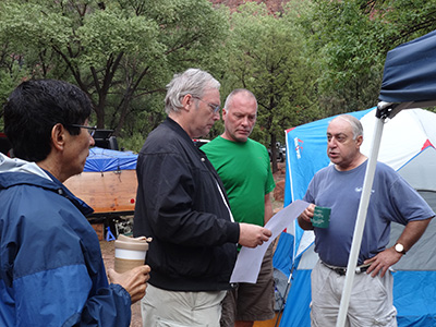 Michael discusses plans for Bryce with Wayne, Bill B., and John R. [photo by Karen] So 15 Trailblazers, under Michael’s leadership, pull out of camp to begin their two-hour road trip to Bryce. Meanwhile, Karen, Sandy, and I stay behind to hold down the fort at Zion in hopes of doing some additional hiking and later taking the park shuttle up the canyon to see some of the numerous waterfalls that must be flowing everywhere now with all this rain. Check out Michael’s supplemental report on Bryce Canyon at the end of this report. |
 Trailblazers break out rain gear for the Mossy Cave hike. [photo by John R.] |
 Crossing the bridge over Mossy Creek. [photo by Wayne] |
 Overview shot of waterfall and Mossy Creek. [photo by John S.] |
|
 Close-up view of the falls. [photo by Wayne] |
|
 Mossy Creek is flowing after heavy rains. [photo by Wayne] |
|
 Panoramic view of Bryce Canyon. [photo by John S.] |
|
 Second panoramic view of Bryce Canyon. [photo by Bill] |
|
 An army of hoodoos in the canyon. [photo by Wayne] |
|
 The fascinating colors of Bryce Canyon. [photo by Bill] |
 A sea of colorful hoodoos. [photo by Bill] |
 Close-up shot of new Bristlecone needles and cones. [photo by John S.] |
 Breathtaking overview of Bryce Canyon. [photo by Wayne] |
 The Flying Buttresses of Bryce Canyon. [photo by Wayne] |
 Second overview shot of Bryce Canyon. [photo by Wayne] |
 A riot of colors in Bryce Canyon. [photo by Wayne] |
|
As the Bryce crew heads out, the three of us begin making plans for the day as heavy rains move back in. We stand under one of the shelters in pounding rain for about fifteen minutes, as we watch the water sheeting across the entire campsite and wonder how many tents are going to be flooded. After the rain finally stops, my own tent at the far end of the campsite seems to be in the gravest danger. So I quickly scrape out a shallow trench to drain off the flowing water collecting all around the base of the tent and all seems to be well for now. At least we haven’t all been washed away yet. Unfortunately, Mother Nature has thwarted our plans for the day and has placed Zion on virtual lock-down for much of the day. A rockslide on Highway 9 coming into Zion through the East Entrance has shut down the road for hours. Shuttle service has been suspended indefinitely, and virtually all trailheads are closed due to the extreme danger of flash flooding throughout Zion Canyon. The Virgin River is running at near-record levels due to all the rain upstream. Later in the afternoon the river would crest at almost 4,800 CFS (or 36,000 gallons per second), the third highest flow ever recorded from summer rains in the 100 year history of the park. The all-time record for the river is 9,100 CFS. I can’t even imagine what that must have looked like. The Narrows has also been closed to entry for at least the next couple of days, so that won’t be an option for us until Thursday or Friday. What to do now? Since one cubic foot of water contains 7.5 gallons, 4,800 CFS equates to 36,000 gallons of water flowing by a given point every single second. That in turn equates to an astonishing 2,160,000 gallons of water flowing by every minute. Any way you look at it, that is a lot of water coming down the river. |
 The tumultuous Virgin River piles up against obstacles in its way. [photo by Chuck] |
 Large logs are being carried down the raging river by Tuesday afternoon. [photo by Chuck] |
 Kayak run for the suicidal. [photo by Karen] |
 The rain-swollen Virgin River on Tuesday morning. [photo by Chuck] |
After the rain finally lets up, we decide to walk to the Visitor Center and check out the river from the bridge that links the town of Springdale to the park. This will be our first good look at the river since last night’s close encounter. Here are some of the pictures we took from the bridge on both Tuesday morning and later in the afternoon close to the river’s peak flow. This is a Virgin River that few people ever get to see at Zion and a unique opportunity to witness a river at flash flood stage, so that in itself makes all the rain worthwhile. Karen informs us that this is the first time she has seen this phenomenon in at least eight previous trips to Zion. The three of us spend quite a bit of time hanging around the river, taking lots of pictures (mostly from the safe vantage point of the bridge). Be sure to check out Karen’s amazing video clips of the river as well. |
|
We then walk around the picturesque little town of Springdale for a while, checking out a few of the many shops in town, before stopping for lunch at one of Karen’s favorite places, Cafe Soleil. Under partly cloudy skies the sun is shining, and we wonder if the rain is finally over. We also wonder how Michael and the rest of the Bryce hikers are doing on their trip and if they have had as much rain as we did earlier today at Zion. We’ll just have to wait for their return to get the full report. Later Sandy and I check out the IMAX feature, Zion Canyon: Treasure of the Gods, while Karen walks back to the campground. The IMAX feature is primarily about early human history in the area, but also showcases lots of stunning photography of the park, as only IMAX can. Wednesday morning at Zion dawns bright and clear and almost cloud-free. And Karen’s weather app shows clear conditions for the rest of the week, just as the earlier weather forecast I had sent out to everyone before we started this trip also predicted. No more rain! No more huddling under the rain shelters for protection! No more puddles in our tents! No more nightmares about being washed away by surging flood waters! Time to come out and play, and do some serious hiking. Today we are hiking the West Rim Trail to Scout Lookout and Angels Landing, with an option to continue for another mile or two up the trail beyond Scout Lookout. |
 We gather around Karen’s laptop to watch her video of kayakers on the flooded Virgin River. [John R.] |
 Nurse Sandy applies a special bandage to John’s ailing knee. [photo by Monika] |
 Wednesday morning—our only group picture with everyone present. [photo by Wayne] |
|
Front: K.G., Dan, Rudy, Edith, Wayne. Back: Michael, Chuck, Sandy, Debbie, Monika, Karen, John S., Gary, Kim, Dottie, John R., Bill, Kathy. |
|
So we load up our gear once again and walk (or I should say hike) over to the Visitor Center and take the park shuttle to The Grotto, where we pick up the West Rim Trailhead. This trail is quite the cardio workout, since we start gaining elevation almost right out of the starting gate. The trail continues to climb relentlessly, gaining nearly a thousand feet of elevation by the time it finally reaches Scout Landing. But before that we enjoy a long rest break in the cool and shady confines of Refrigerator Canyon, which certainly lives up to its name. After working up quite a sweat on the trail, it feels about 20 degrees cooler in the canyon and we don’t want to leave. |
 Starting out on the lower West Rim Trail. [photo by John S.] |
 View along the lower West Rim Trail. [photo by Chuck] |
|
But leave we must and then we soon hit the infamous Walters Wiggles, a series of 21 tight and torturous switchbacks that carry us higher and higher before finally depositing us at Scout Lookout, at least those of us who actually make it through the switchbacks alive. You have to wonder if the same person who came up with this diabolical scheme also designed the equally infamous Devil’s Corkscrew on the lower Bright Angel Trail in the Grand Canyon. Either of these would qualify hands down for the Hiking Switchbacks from Hell Award. |
 Hoofing it up the ever-steepening West Rim Trail. [photo by Karen] |
 Taking a break in the shade high above the canyon floor. [photo by Karen] |
 View looking down Zion Canyon from high atop the West Rim Trail. [photo by Chuck] |
 Switchbacks near the top. [photo by Chuck] |
|
We finally make it to Scout Landing and find plenty of company there. It’s close to Noon and this is about as perfect a lunch spot as we could hope for. So we park it in the shade and take a well-deserved lunch break here at the landing. We couldn’t ask for a more perfect day for hiking. The rains are outta here and life is good. But then again as long as we’re still upright and mobile, it’s always good and definitely better than the alternative. Right? |
 Looking down on Walters Wiggles. [photo by Chuck] |
 Gary, Sandy, and Monika take a breather before the final push to the top. [photo by John R.] |
 Scout Landing, the perfect lunch spot. [photo by John R.] |
 Charlie’s Angels take in the view from Scout Landing. But Charlie is nowhere to be seen. Could the Angels have possibly...? No—surely not.. [photo by John S.] |
 Warning! You can definitely fall and kill yourself beyond this point! [photo by John S.] |
 View from high on the West Rim Trail. [photo by Chuck] |
|
After lunch the Fearless Four—Rudy, Dan, Edith, and Wayne—decide to go for broke and brave Angels Landing. It’s do or die time. It’s now or never. They leave their credit cards, cash, and other ID with us, give us full power of attorney over their affairs, and sign their last wills & testaments with all of us as witnesses. Then they bravely wave goodbye and hike off into the unknown, totally uncertain of the outcome, but hopeful and confident nevertheless. Will we ever see our brave hiking companions again? Stay tuned and continue reading. |
 Gary, Chuck, Kathy, and Sandy take a short break. [photo by Bill] |
 The muddy Virgin River flows far below. [Bill] |
Meanwhile, several hikers within our group decide to head back down to the trailhead, while the rest of us continue hiking up the West Rim Trail for another mile or two. The higher we get, the better the views in virtually every direction. Camera shutters are working overtime, taking dozens of images. Memory cards are filling up. But in my case, I’m simply running out of film. Yes, I’m one of the last few people on earth still shooting film. We belong to a very exclusive club of non-digital shooters. After about thirty minutes or so we reach a small plateau-like area known as The Pulpit, with expansive and spectacular 360 degree views, including a great eye-level view of Angels Landing. Karen tells us this is her usual turnaround point. We take a long break here, shoot a number of pictures, and wait for the others to catch up, while cooling off in a nice breeze. |
|
Bill and Kathy take off for an even higher view point and are eventually joined by the Fearless Four (they all survived Angels Landing). After they all return, we gather forces and head back down the trail toward Scout Landing and then the trailhead. What a great day of hiking this has been! |
 Kathy, Karen, and Dottie on the West Rim Trail. [photo by Bill] |
 Chuck and Bill take in the spectacular views. [photo by Kathy] |
 Rudy likes to live life on the edge. Picture taken on Angels Landing. [photo by Wayne] |
 Rudy, Edith, and Wayne on Angels Landing. Dan is already on his way back down. [photo by Wayne] |
 Spectacular view from Angels Landing. [photo by Wayne] |
 Trailblazers push onward and upward on the West Rim Trail. [photo by Sandy] |
 Taking a rest break at The Pulpit. [photo by John R.] |
 Sandy, Dottie, Karen, and Gary catch a few winks. [photo by Sandy] |
 The imposing Angels Landing formation. [photo by Chuck] |
 The Fearless Four do a victory jump overlooking Angels Landing. [photo by Wayne] |
 Heading back down the West Rim Trail. [photo by Karen] |
 Hiking back down through Walters Wiggles is almost as tough as going up. [photo by Sandy] |
|
Long before the word even existed in the human language and in fact long before humans ever set foot in this area, what we know today as Zion National Park has over eons of time been one of the world’s greatest laboratories and proving grounds for biodiversity. |
 This Mexican Spotted Owl was photographed on the Hidden Canyon hike. [photo by Bill] Zion National Park contains 85% of all the plant and animal species found in the entire state of Utah – 800 plant species, 289 bird species, and 75 mammal species. Zion sprawls over 229 square miles of southwestern Utah’s Markagunt Plateau. Of Utah’s five National Parks, only Canyonlands is larger. The centerpiece and the showcase of the park is Zion Canyon, with its walls of Navajo Sandstone soaring between 2,000 and 3,000 feet above the canyon floor and its eclectic and kaleidoscopic collection of towers, mesas, domes, spires, temples, and buttes. This relatively narrow sliver of the park is what 99% of all visitors to Zion see, and it’s usually the only thing they see. Because 94% of Zion is designated wilderness and accessible only by horseback or on foot. “Nothing can exceed the wondrous beauty of Zion ... in the nobility and beauty of the sculptures there is no comparison. There is an eloquence to their forms which stirs the imagination with a singular power and kindles in the mind.” Geologist Clarence Dutton, 1880. |
 Two bighorn near the Zion-Mt. Carmel Tunnel. [photo by Karen] |
 A couple of deer rest right next to our campsite. [photo by Wayne] |
 Wild turkey foraging near the River Trail. [photo by Wayne] |
 Squirrel posing along the River Walk Trail. His tiny sign reads “I pose for food.” Seriously—Do Not Feed The Wildlife. [photo by Wayne] |
|
We finally finish off the last of the potluck on Wednesday evening before watching the sunset light up the cliffs adjacent to our campsite. Then we gather around a roaring campfire to discuss the day’s events as well as tomorrow’s agenda. We question the Fearless Four about their adventures on Angels Landing and hear some interesting stories. For Dan’s version of the Angels Landing hike, check out his thrilling personal account at the end of this report. Reading Dan’s story is the next best thing to actually being there. |
 The setting sun lights up the cliffs, while the moon rises on the left. [photo by Chuck] |
 We gather around the old campfire to spin yarns. It’s a Trailblazers’ tradition, after all. [photo by Wayne] |
 The spectacular night sky with the Big Dipper over Zion. [photo by Wayne] |
 Really big moon over Watchman Campground. (this is a night time timed exposure). [photo by Wayne] |
 Eleven Trailblazers on the Riverwalk Trail. [photo by John R.] |
 Taking a break at trail’s end. [photo by John R.] |
|
We’re still holding off on the Narrows until our last full day on Friday in hopes the river will clear up more by then. The water is still pretty murky and could result in difficult footing since we won’t be able to see the river bottom and all the obstacles to avoid. One of the earlier Narrows descriptions I read compared hiking in the Narrows to walking on a surface of wet bowling balls. That’s bad enough in clear waters, but really dicey in murky and muddy waters. So for tomorrow we plan on hiking the Echo Canyon and Hidden Canyon trails, accessed from the Weeping Rock shuttle stop. |
 “Now what did I just tell you about begging, Mr.?” [photo by Monika] |
Thursday morning at the Visitor Center and yet another monkey wrench gets thrown into our carefully made plans. Karen learns that both trails are closed for maintenance today and won’t be reopened until tomorrow. Now what? Six of the group, including Karen, Michael, Dan, Edith, Kathy, and Bill, decide to tackle the Narrows today, despite the questionable conditions. The rest of us will hike the Narrows tomorrow when we’ll have more time, especially since most of us haven’t even rented our gear yet. For now we’ll settle on doing the two-mile round trip River Walk to at least get a view of the Narrows entrance and then check out Weeping Rock. Later this afternoon Wayne and I plan on hiking the Watchman Trail, which starts near the Visitor Center. |
|
Karen’s great supplemental report on the Narrows hike is also located at the end of this report. |
 Dan, Michael, Dottie, and Kathy on the Echo Canyon Trail. [photo by Bill] |
 A trail of solid sandstone. [photo by Dan] |
 Kathy and Dottie wave for the camera. [Bill] |
 Dan finds the perfect cubby hole. [photo by Bill] |
 Dottie and Michael pause for a break in the canyon. [photo by Dan] |
 Horseshoe bend in the Virgin River. [photo by Bill] |
 These boots are made for hiking. [photo by Dan] |
 Trailblazers hike up a convenient stairwell in Hidden Canyon. [photo by Dan] |
 The trail gets a bit more treacherous here. [photo by Bill] |
 Dan and Bill celebrate beneath a massive arch. [photo by Dan] |
 Dottie and Michael are heading back down. [photo by Dan] |
 Watch that last step! [photo by Dan] |
 Anchored chains help provide support here. [photo by Bill] |
 Wayne, Sandy, Karen, Monika, Gary, Chuck, John S., and John R. Ready to head up the Narrows into the great unknown. [photo by Wayne] |
 Trailblazers Group 2 is in the river. [photo by Karen] |
 John R. leads the charge up the Narrows. [photo by Karen] |
 We hike around the water whenever possible. [photo by Wayne] |
 Wayne carefully probes the river bed for obstacles. [photo by Karen] |
 Virgin River rapids and hanging gardens. [photo by Wayne] |
 The Narrows are getting even narrower. [Wayne] |
 Hikers continue up the Narrows. [photo by Wayne] |
 John R. and Monika test the waters. [photo by Sandy] |
 Hiking the Narrows involves lots of boulder hopping. [photo by John R.] |
 Sandy is having a great time in the Narrows. [photo by Karen] |
 Sandy, Chuck, and Wayne find the perfect shady alcove. [photo by John R.] |
 Karen prefers the deep end of the pool. [photo by John R.] |
 Karen and Chuck discuss the exit strategy. Hike a bit further or turn back now? [photo by Wayne] |
 Breaking for lunch in the Narrows. [photo by John R.] |
 The scenery just keeps getting better. [photo by Wayne] |
 John S. exits the river. [photo by Karen] |
 Group Site E005 at Watchman Campground is nearly empty by late Saturday morning. And very lonely and forlorn looking. [photo by Wayne] |
 The spectacular Vermilion Cliffs along Highway 89A. [photo by Chuck] |
|
Far too soon our week at Zion is coming to an end, and after breakfast on Saturday morning we begin the long and arduous process of breaking camp and somehow, someway stowing all that gear back into our vehicles. At the beginning of the trip, packing gear into the vehicle always seems to go smoother than it does at the end of the trip. “How in the heck did we ever fit all this stuff in here?” I ask Sandy in frustration as we load our gear into the back of my Dodge Dakota. And we didn’t even bring a kitchen sink and a bathroom shower with us like Karen did. But somehow everything always manages to fit, and before long we’re all ready to bid one another goodbye and hit the road for the long drive back home. Most people are taking the alternate route from the one they drove coming up on Sunday. Sandy and I are driving back on Highway 89A past the Vermilion Cliffs and Marble Canyon. Dan and John S. are joining us in a mini caravan. We plan on making one last stop for a late lunch at the Cameron Trading Post in Cameron. Looking back on our special week together at Zion and all the many things we saw and accomplished together, it’s certainly not too difficult to understand or appreciate what draws Karen back to this place year after year after year. There is definitely something magical in the air here, something that pulls you in and makes you never want to leave. But when reality sets in and you do finally and only reluctantly leave, your immediate thoughts center on coming back again as soon as possible. You are now under the magical spell of Zion, and there is no escape. Nor should there be, because we all need a place like Zion to come back to from time to time, if only for a few days. May magical and special places like Zion always be there to nurture and enrich the human spirit within us—for this and for all future generations to follow. Perhaps John Muir said it best:“Thousands of tired, nerve-shaken, over-civilized people are beginning to find out that going to the mountains is going home; that wildness is a necessity; and that mountain parks and reservations are useful not only as fountains of timber and irrigating rivers, but as fountains of life. Awakening from the stupefying effects of the vice of over-industry and the deadly apathy of luxury, they are trying as best they can to mix and enrich their own little ongoings with those of Nature, and to get rid of rust and disease.” John Muir, Our National Parks Postscript: Over the five full days of hiking between Zion and Bryce, eighteen Arizona Trailblazers collectively hiked a total of 555.4 miles. That’s the equivalent of hiking from Phoenix to Zion and then going another 155 miles beyond. Fantastic job Trailblazers and one for the record books! After we all got back, Edith told me that she wore her pedometer whenever she was hiking, even in the Narrows, and racked up a total of 66,748 steps for the entire five days of hiking. That is a very impressive number. How many people walk that many steps in a month? |
|
Supplemental Report Hiking Bryce Canyon September 9, 2014 by Michael Humphrey |
 Trailblazers at the Mossy Creek Overlook. [photo by Bill] |
|
|
We get up in the morning and can see the wet ground around us, so we turn on our smart phones and see what the weather report is. It is not good, so we discuss what we could do if it rains like the forecast says. We decide to try out Bryce; it is north and east and may be out of the main storm path. So we leave, but do not get far. Just below the tunnel the road is covered by mud and rocks from a landslide. The road crew gets it cleaned up and we are on our way. As we travel though Zion there are many ephemeral waterfalls. |
|
 Ephemeral Waterfall |
|
|
Just on Sunday this was a dry patch of rock, today it is a river—big enough to take out a bus. When we drive back to Zion you would not know there had been a river flowing down the rocks. We continue on to Mossy Creek Cave where it is lightly raining. |
|
 Mossy Cave certainly lives up to its name. [photo by Wayne] |
|
|
This gives us a good trail to get our legs moving again. It is now time to get to the main part of Bryce, but first we stop for lunch. We get a call from Karen and she tells us that all the roads into Zion are blocked, so there is no need to hurry though the hike. After lunch we take the shuttle into Bryce. We could have taken the cars, but the shuttle will let us hike from shuttle stop to shuttle stop. |
|
 Beautiful overview of Bryce Canyon. [photo by Wayne] |
|
|
We get out at the far point of the shuttle and hike out to Bryce point. We then continue on the rim trail back toward the visitor center. The rim trail gives a complete view of the amphitheater of Bryce. The rim trail gives us a breathtaking view, as it runs on the very edge of Bryce Canyon. Bryce has bristlecone pine trees; they are the world’s oldest living things. |
|
 Debbie and Michael admire the view below. [photo by Bill] |
 John S. stands by the remains of a giant Bristlecone Pine. [photo by John S.] |
|
As we continue to hike the rim trail we can seen many of the arches that make up the area. Some are large and some are small and they come in many shapes and colors. |
 Heart Arch |
|
The rain has washed all the dirt off the rocks and the colors are spectator. We are now at the sunset shuttle spot and it is getting late, so we take the shuttle back to the visitor center and visit it for a while. We call Karen to see how the roads are doing and the roads into Zion are now open, so we can head back. |
 Exit Arch |
|
Bryce has many place we did not visit today, so we will have to come back some day. We end up having a good time, with no rain in the afternoon and plenty of spectacular views. |
|
Supplemental Report Angels Landing September 10, 2014 by Dan Smith |
|
From bottom to top this hike was fantastic. Good aerobic exercise up the switchbacks and such an adrenaline rush from Scout Lookout to Angels Landing. Earlier that day at camp I heard fellow hikers debating if they would attempt the hike to the top of Angels Landing. I felt like I had to see it in front of me to make that decision. After the 2.5 mile climb to Scout Lookout I stood looking up at the chains and the steep terrain and felt the excitement grow inside of me. Just then a Father and son were exiting the chains as I was about to begin my ascent. I asked the boy if he climbed to the top and how old he was. He replied with a big grin that he had made it to the top and that he was 10 years old. My confidence grew: if he could do it, surely I could. I high-fived him and up I went. From the moment I got on the first chain portion I had tunnel vision. All senses on alert. Sweaty palms, strong grip on the chain, white knuckles. Up I go. The chain portions are not continuous. First section of the chain my knees feel weak, uneasy feeling in the pit of my stomach. I look for the safety of the next set of chains. I walk steady but waste little time in between chains. Trail narrows to just a couple of feet across, cliff edge to the right with 1000 foot drop, rock wall with chain anchored on the left. Heart rate elevated, excited, scared. I tell myself to calm down; your feet are on solid ground. I concentrate on the trail, watch where I step. Up I go. At times I wait for groups of descending climbers to clear the chains – too narrow to pass at the same time. I wait my turn. Near the top a tight turn to the right. Pull myself up the chain onto another narrow ledge and another 1000 foot drop. Feel a pain in my lower back and the start of a spasm. Almost to the top. I must keep going. I reach an open area about 30 feet wide. Great views, not the top, more chains ahead. Up I go. Continue up less than 5 minutes from this point. Made it to the top! I look around, quite a few people up here. Back pain continues but less. I decide not to sit, don’t want to get stuck on top with back spasms. Enjoy the amazing views both up and down the canyon. I feel like an Angel truly blessed to be here. I turn around and descend. No rest, adrenaline pumping. Going down is easier. The terrain is now familiar to me. I concentrate on footing and grip less tightly on to the chain. Looking forward to reaching the safety of Scout Lookout. Reach the bottom in half the time it took to go up. I did it. Amazing Hike! Yes, I would do it again. Next time I would have less fear of the unknown. Take it at a slower pace. Take in more views, but never lose respect for this climb. Dan |
|
Supplemental Report Hiking the Narrows September 11-12, 2014 by Karen Larson |
|
I was very excited to be able to lead fellow Trailblazers through my, so far, most favorite place to hike: The Narrows in Zion National Park, Utah. Prior to this trip, I had hiked the 8 mile round trip section of this hike 7 times since 2005. After years of extolling the virtues of this incredible place, it was exhilarating to be able to share it with friends; most whom got to experience it for the first time on this trip. The Narrows refers to a 16 mile corridor that follows the Virgin River into Zion Canyon. Smoothly carved sandstone walls, beautifully fluted, twisting slots and towering walls greet brave hikers. These walls tower 1500-2500 feet high and squeeze down to 25-30 feet in breadth at the section aptly named “Wall Street”. For this hike, we chose the “up and back” 8 mile day hike. As I told my “pack”; you WILL get wet on this hike so it is best to be well prepared. This hike involves walking up river and over rocks, through currents, making many river crossings and often times walking straight up the center of the river. Proper gear is essential for this water hike so everyone came prepared with proper boots, neoprene socks and sturdy poles for stability. Some have described this experience like walking on wet bowling balls that you can’t see. So it was very slow going for most of it. Our original plan was for the entire group to hike the Narrows on our first full day at Zion. However, heavy rains and flash flood warnings caused a change in plans. Each day we monitored the weather and checked the Narrows conditions posted at the park. Due to the flash flood that dramatically raised the water level and also turned the normally crystal clear water to a murky brown, we decided to hold off on this hike until Friday to give the water time to recede and clear up a bit. Our plan Thursday had to be abruptly adjusted, as I was not aware that the two trails we planned to hike were closed until Friday. Some of the group had to leave on Friday and didn’t want to miss this world famous hike, so we decided to go ahead and do the Narrows, even though we would only have half a day to do so. I jumped at the opportunity to experience this hike 2 days in one trip. Thus, Bill, Kathy, Dan, Edith, Michael and I got geared up and we entered the Narrows about 11:30 AM. I took great joy in watching and listening to my comrades enter the cold water and take in the sites and experiences for the first time. You could see and hear immediate and increasing awe and exhilaration as the beauty around and the caution of navigating over the rocks became apparent. The first section is relatively easy with the water level being only about knee deep and some easier walking sections. At this point, we saw less prepared hikers trying to navigate in tennis shoes, sandals and even bare feet and without support poles. These folks usually ended up turning back fairly quickly. But we were determined to make it to the “end”, 4 miles in, which basically is where you must swim to continue on. |
 Trailblazers Group 1 is ready for the Narrows. [photo by Michael] Bill, Kathy, Edith, Karen, Dan, and Michael. |
 Entering the Virgin River and the Narrows. [photo by Monika] |
 Wading up the Narrows. [photo by Karen] |
 Kathy charges into the river, ready for action. [photo by Karen] |
|
Now, there is apparently a rumor that I “fell flat on my face” early on in this hike. Well, kinda sort of. We were in maybe the first 10 minutes of the hike and I was in the lead and I decided to demonstrate the real possibility of catching your foot on an undetected rock, thus, causing a plunge into the cold water. I landed on my left knee and elbow. Thankfully, no serious injury and I was able to quickly get up and keep going. Two weeks later I am still feeling the effects of the knee hitting a rock. What is a story without at least one “battle wound” tale? About ¼ mile in we come to the infamous “Mystery Falls” section. This is the first section where you must walk up river with no “shore” and the water got waist deep on some people depending on where they stepped. The water fall gliding down the canyon made for another good photo opportunity. As we continued on, we encountered numerous “corners” where the river makes a big turn and opens up yet another incredible view. The way the sun angles changed and varied the shadows, color and shading of the canyon walls provided continuous photo stops and oohs and ahhhs. There were some sections that I was familiar with and knew would have deeper water than the popular crossings. I advised my comrades to not necessarily follow me as I like to seek out deeper water and did make a couple crossings that were above waist deep. About ¾ of the way in we found ourselves at Orderville Junction. This is where a smaller, narrow canyon takes a side trip. Normally you can walk a few miles into this side canyon. However, with the recent rains, the trip was deterred by a deep pool that required swimming and climbing up over a rock fall. Our group opted to skip this challenge and continued on up through Wall Street. We did observe some brave souls that actually did take the plunge into the cold deep water and went exploring. At this point, I decided to wait for the group to go ahead through Wall Street, about another 30 minute round trip. With my swollen knee and knowing I would be doing this hike tomorrow, I figured I would not push myself. The rest of the group continued and returned about a half hour later reporting that they made it to the point of “swimming access only”. |
 Karen and Kathy carefully make their way up the canyon. [photo by Bill] |
 A narrow side canyon enters the Narrows at Orderville Junction. [photo by Michael] |
 Edith plunges in, steadfast and unafraid. [photo by Karen] |
 One of many lush hanging gardens throughout the Narrows. [photo by Michael] |
 Michael leads the charge up the Narrows. [photo by Karen] |
 Depending on water levels, dry land can be found in the Narrows. [photo by Karen] |
 Bill celebrates coming out of the Narrows. [photo by Michael] |
|
From here, we made the journey back. Going back took less time as we were walking downstream instead of against the current and by this time, we are more familiar and comfortable with navigating the river. Our hike took us 5 hours and with the one mile paved Riverwalk to and from the shuttle, we completed 10 miles. Everyone agreed this hike was on their “top hikes” list and we were glad we took the opportunity. Friday marked my 9th trip through the Narrows, this time with Chuck, Gary, Sandy, Monika, Wayne, John R. and John S. The water was a wee bit clearer but still not clear by this time. We entered the Narrows about 9:00 AM and as the group the day before, took our time and enjoyed the trip. We also reached our goal of the “end”. Upon reaching the “swim only” point, we did watch a group of backpackers come through that had started at the top and were into their second day in the Narrows. As we watched, we knew the challenge they were about to face and it was interesting to watch them try various options to get around and ultimately end up coming through the deep. We turned back and in a short distance opted to take a lunch break on “shore”. After about a half hour and becoming mostly dried off, we got up and re-entered the water and made our way back. We completed our 10 mile trek in just over 5 hours and once again, everyone agreed with the unique experience being one of their “top hikes”. It was my absolute pleasure to share this amazing trip with fellow Trailblazers. And now, I can’t wait to do it again! Karen |
| More pictures and videos, by Karen Larson. |
|
From Dottie: Thanks for another superbly planned and organized camping/hiking trip. The rain made it an especially memorable experience. I appreciated getting a lot of hiking miles in to prove to myself that I had not “lost it” despite relatively little hiking over the summer months. Thanks to Michael for giving us the chance to get to Bryce and do some hiking there as well as leading the Echo Canyon/Hidden Valley hikes. Thanks to Karen for leading two back-to-back Narrows trips. From Kim: Thank you so much for putting the trip together. I know it is a lot of work. I hope to be able to visit Zion again in the next year or two. I wish I could have done the Narrows! From John R.: Thanks for a wonderful camping trip. It is great that everybody was safe. I enjoyed very much the hike in the Narrows. How often does one wade in a river and not drown or twist an ankle? The water was cool and refreshing, and the view of the vertical rock formations and colors was fabulous. It is the first time for me ever. I am ready to do it again. Be well and take care. See you soon. Thanks again for all your work you do for the club. What a fun week we had despite Hurricane Norbert’s downpours. We were not phased a bit by the downpours. We endured, and outfoxed the rain. Not a day went to waste. We simply adapted and changed our schedule accordingly. But the heavy rains have forever left an indelible experience in our memories. To my fellow hikers/campers: you made this experience memorable. Thanks for sharing your food for the potluck dinners, your matches and hot water, and for helping erect and take down canopies, tents etc. All was greatly appreciated and I am glad all reached their homes safe and sound. From Karen: Hey Trailblazers! I just want to say a HUGE thank you to each of you for coming on this trip and contributing to a wonderful vacation. Enormous thanks to Chuck for all the organizing and communication. That was a lot of work! Thanks for being such great troopers with the weather and last minute plan changes. What is a trip if we don’t have stories to tell, right? This was, as always at Zion, an emotional, spiritual, and renewing trip for me. I was a bit concerned about sharing it with so many people and I’m glad I did. Thank you all! From Bill and Kathy: What a fantastic life long memorable trip we had! The scenery was extraordinary and the hikes incredible. Someone commented earlier about Kathy and Bill taking a leap in faith in joining a group of strangers for a week. We lived in our small community and experienced wonderful sights together. We both are extremely pleased we joined your group for this adventure. Everyone was very hospitable to us newbies and we appreciate your kindness and friendship. We enjoyed very much talking with each of you and getting to know you. It was all our pleasure. We look forward to meeting additional Trailblazer members as we join you for additional adventures. Thank you so much again for everything and allowing us to share in your adventure club! |
 Top of Page
Arizona Trailblazers Hiking Club, Phoenix, Arizona
Comments? Send them to the AZHC .
updated May 24, 2020