Outdoor Links
Hike Arizona
Trip Planning Guide
Trip Report Index
Calendar of Events
Library
|
Bill Williams Mountain Day Hike Kaibab National Forest, Williams September 5, 2015 by Chuck Parsons |
|
 12 Arizona Trailblazers pose by the Bill Williams Trail #21 sign. [photo by Bill] |
||||
|
||||
|
“Life is like a box of chocolates ... you never know what you’re gonna get.” When Forrest Gump uttered that classic line in the opening scene of the movie Forrest Gump, he could have just as easily been describing Arizona’s quirky and capricious summer monsoon weather. Despite the latest cutting edge technology in weather forecasting and numerous state-of-the-art weather satellites circling the earth, trying to accurately predict the weather during monsoon season in Arizona is at best comparable to shooting craps. On some of our previous summer hikes where the forecast was calling for a slight 10-20% chance of rain, we have been pounded and soaked by torrential downpours. On the other hand, we have remained high and dry on other hikes where the forecast was calling for a 60% chance of rain and thunderstorms. As Forrest so accurately puts it, “you never know what you’re gonna get.” Touché, Forrest Gump! I checked the latest NOAA weather forecast for the Williams area late Friday morning before sending out an update to everyone signed up for the Bill Williams Mountain hike on Saturday. That forecast called for a 20% chance of light rain and thunderstorms, mainly in the afternoon after 3:00 PM. As we gather at our I-17 & Bell Road meeting location on Saturday morning, Mike Wargel informs me the forecast is now showing a 50% chance of rain and thunderstorms. And from the looks of these ominous-looking clouds hanging over Phoenix this morning, that could just as well be the local forecast. |
 Mike is ready to hit the trail running. [photo by Mike] |
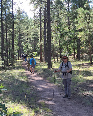 Trailblazers are moving out on the Bill Williams Trail. [photo by Mike] |
 Scenic trail through the pines. [photo by Shaun] |
|
Heading west on I-40 as we approach the Williams area, dark and towering cumulus clouds threaten to open up on us at any moment. Drawing closer to Williams, we catch our first glimpse of imposing Bill Williams Mountain looming to the south of Williams and shrouded in heavy cloud cover swirling about the summit area. We can only imagine what kind of weather must be slamming the summit right now. This is certainly not looking good, as I mentally try to come up with a good Plan B. But with rain and thunderstorms threatening the entire area, it looks like Plan B may be a washout as well. |
 Hiking in the sunshine. Today, Priceless! [photo by Bill] |
 The Triple Ds: Dave, Dave, and Dustin. [photo by Bill] |
|
However, by the time we gear up at the trailhead, take our group picture, and do a quick round of introductions, the threatening weather is actually beginning to clear up as ragged patches of bright blue sky start to break through the heavy overcast. |
 Cluster of purple asters along the trail. [photo by Bill] Situated on the north side of Bill Williams Mountain with a starting elevation of 7,000 feet, this trail was originally built as a toll trail in 1902. Although most hiking guide books describe the first mile of trail as “a gentle climb”, most hikers would probably beg to differ, other than hard-core endurance hikers who run up and down Camelback Mountain without breaking a sweat and think nothing of jogging rim-to-rim 22 miles across the Grand Canyon as a mere day outing. Except for a short stretch of relatively level ground at the beginning of the hike, the Bill Williams Trail starts climbing right out of the starting gate and never looks back. |
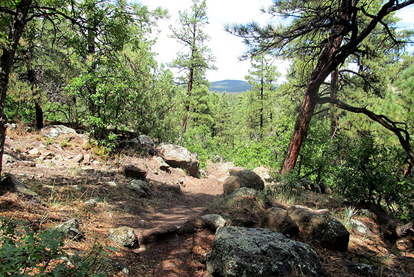 Climbing higher, the trail begins to open up. [photo by Bill] |
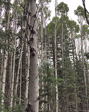 A thick grove of aspen higher up on the trail. [photo by Shaun] |
 Filtered sunlight penetrates this mixed grove of aspen and pine. [photo by Mike] |
 Bronze statue of Bill Williams in Bill Williams Monument Park. Not bad at all for a grizzled old mountain man from the 19th Century. One of the most colorful and eccentric characters of the Old West, countless legends and stories abound about the man known as “the greatest fur trapper of ’em all.” A hard-living and hard-drinking mountain man who miraculously survived numerous hair-raising adventures and misadventures, as well as dangerous forays deep into hostile Indian Territory to trade for pelts, Bill Williams finally met his demise at the hands of a renegade band of Ute warriors in March, 1849, near the headwaters of the mighty Rio Grande River in southern Colorado. He was 62 years old. If Bill Williams could come back today for only a brief visit to witness the monumental changes wrought by modern civilization throughout his beloved Old West, he would no doubt be quite firm in his conviction that he was born in exactly the right period of time and lived his life under exactly the right set of circumstances. He wouldn’t change a single thing. And who among us could possibly blame him? |
 Jazmin and Heather take a break near the summit. [photo by Bill] |
|
Above 8,000 feet we begin to encounter increasingly larger groves of tall aspen with their gleaming white trunks and massive Douglas fir with deeply furrowed trunks up to five feet in diameter and towering 80 feet or more into the sky. You know you’re getting higher on the mountain when you start seeing these forest behemoths which require both cooler temperatures and increased moisture levels, available only at these higher elevations. |
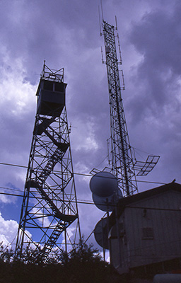
 Al and Shaun check the view from the lookout point. [photo by Bill] Most of the group makes a quick trip to the summit while they still can for the terrific views and then quickly returns to escape the heavy winds sweeping across the peak, as the brunt of this latest storm system bears down on us. On a previous hike to the summit in 2005 we were forced to beat a hasty retreat due to extremely strong wind gusts of up to 50 MPH that blasted through the numerous steel communication towers and the fire lookout tower, creating an ear-splitting and non-stop shrieking noise that could have awoken the dead. |
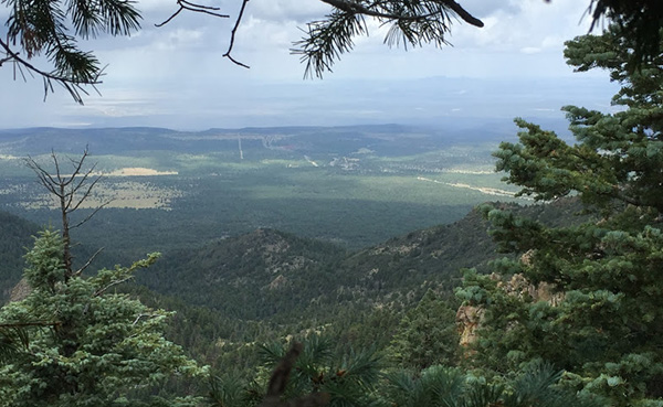
 Panoramic view from the lookout point. [photo by Shaun] |
 A solid line of rain approaches Bill Williams Mountain. [photo by Mike] |
 Another sweeping view from the lookout point. [photo by Christina] |
 Final approach to Bill Williams Summit. [photo by Mike] |
 Dave on the summit of Bill Williams Mountain. [photo by Dave] |
 Ominous storm clouds hang over the summit. [photo by Chuck] Mike and I are the last two hikers out and we’re barely a quarter mile down the trail when heavier rain showers catch up with us and force us to don our raingear. Rain at 9,000 feet is very cold at any time during the summer or fall months, dropping temperatures as much as 25 degrees in just a few minutes. Without proper raingear, hypothermia is a real threat to hikers caught by surprise. Fortunately we have all come prepared for rain today, as a dozen Arizona Trailblazers in colorful raingear carefully make their way back down the Bill Williams Trail. |
 Collection of jagged granite spires seen from the summit. [photo by Shaun] |
 The town of Williams lies at the base of the mountain. [photo by Jim] |
|
As we steadily drop in elevation on the trail, the capricious weather on Bill Williams Mountain changes once again as the sun comes out intermittently and large patches of blue sky begin to reappear. The rain appears to be over for now anyway, and we begin to sweat under our raingear. So off comes the raingear, in hopes the rain will hold off at least long enough to get back to the trailhead. |
 Parting view from the lookout point. [photo by Mike] |
 Standing water on the lower half of the trail. [photo by Bill] |
 Beaded raindrops stand out on shiny Gambel oak leaves. [photo by Bill] |
|
With all the standing water and muddy conditions along the trail, it looks like the lower half of the trail received most of the rainfall from this latest round. Washed clean by the rain, the air is now pure and cool and invigorating, as we make quick work of this lower stretch of trail and arrive safely back at the trailhead in less than two hours from the top. The time is 2:00 PM. We have completed the hike in just under five hours. |
 Cruiser’s Café 66 in Williams. [photo by Mike] |
|
After we put away our gear and clean up a bit, most of the group heads to Cruiser’s Café 66 located on Historic Route 66 in the heart of Williams. This always seems to be one of the most popular places to eat in Williams, even at 3:00 PM in the afternoon as seen in this picture. After lunch most of the group heads for home, while several of us opt for a short walking tour of historic Williams before heading back. This has certainly been an interesting day weather-wise. I’m sure Forrest Gump would have thought so as well and probably have said: “Life is like a box of chocolates ... you never know what you’re gonna get.” |
|
Supplemental Report by Jim Buyens |
|||||||||||||||||||||||||||||||||||||||||||||||||
|
It was great to see you all on the Bill Williams hike, and great to meet those of you who were new or long missing. I hope you had as great a time as I did. Hope you see you again, especially at our club meeting on Tuesday, September 15. Jim |
|||||||||||||||||||||||||||||||||||||||||||||||||
|

|
||||||||||||||||||||||||||||||||||||||||||||||||
 Top of Page
Arizona Trailblazers Hiking Club, Phoenix, Arizona
Comments? Send them to the AZHC .
updated January 20, 2020