Outdoor Links
Hike Arizona
Trip Planning Guide
Trip Report Index
Calendar of Events
Library
|
Dixie Mountain Day Hike Phoenix Sonoran Preserve October 24, 2015 by Gabe McConnell, Monika Hahues |
|
|
What a wonderful hidden hiking area we found close to town! The Desert Vista Trailhead is hidden behind a subdivision community center. If you didn’t know to look for it, not sure you would find it. This trailhead currently has no water or restrooms, but looks like they are building these amenities. This was a great morning for a hike, temperature was in the high 60s and it wasn’t forecast to rise above the mid eighties until after noon, by which time we would have completed the hike. Eight of us met at the trailhead and were on the trail by 7:20 AM. |
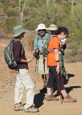
 The hiking group minus Monika. [photo by Monika] |
| Chuck, Jim, Gabe, Dana, Tamar, Rudy, Gary |
|
We started by taking the Hawks Nest Trail up to the Dixie Mountain Loop. Going clockwise on the Loop we were in the shade and got views of the houses below. The trail was well marked and quite popular as we passed and were passed by numerous other hikers. |
 On Dixie Mountain Loop. |
 Burned out car chassis on Dixie Loop. |
 Moving on from viewing the car chassis. |
|
Going around the loop, the view changed from houses to desert and finally we spotted a few hot air balloons. These are typically seen up in this area since there is plenty of room for them to launch and land. |
 Hot air balloons. |
|
Having gone about three quarters of the way around the Dixie Mountain Loop, we turned off on the Val Verde Trail. Then it was all downhill for the second part of the hike. This area of the trail system is less frequented, but there was some mountain bike activity. The trail was much smoother as we descended to the valley. |
 Turning off of Dixie Mountain to Val Verde. |
|
Coming down from Dixie Loop, we were back in the valley, but there views were beautiful, desert landscapes. Gary left us at the Desert Tortoise trail and the rest of us continued. |
 Beautiful Desert Landscapes looking north. |
 Quick break in the shade. |
|
After a quick break, we continued on to the Great Horned Owl and then taking a left on to the Cactus Wren trail. |
 Regrouping at the turn off for Cactus Wren. |
|
Overall the hiking trail was very well marked, with the possibility of doing an even longer hike. Perhaps next time? We moved right along on this hike, covering 9.3 miles in 3:26 hrs moving time, for an average moving speed of 2.7 mps. The hike was a little longer than advertised, but luckily, though it got a little warmish towards the end, it wasn’t too bad. We finished up at 11:17 AM. Some of us then had lunch together at a Mediterranean restaurant. Thanks to everyone for a great hike! Thanks to Monika and Jim for taking the pictures and recording the stats. |
|
Supplemental Report by Jim Buyens |
|||||||||||||||||||||||||||||||||||||||||||||||||
|
Thanks, everyone, for going on the Dixie Mountain hike. And thanks especially to you, Gabe and Monika, for leading your first hike and doing a truly great job of it! I’m sure you’re ready to lead many more great hikes in the future. Jim |
|||||||||||||||||||||||||||||||||||||||||||||||||
|
|
||||||||||||||||||||||||||||||||||||||||||||||||
| → More pictures and commentary, by Jim. | |||||||||||||||||||||||||||||||||||||||||||||||||
 Top of Page
Arizona Trailblazers Hiking Club, Phoenix, Arizona
Comments? Send them to the AZHC .
updated May 29, 2020