Outdoor Links
Hike Arizona
Trip Planning Guide
Trip Report Index
Calendar of Events
Library
|
Flagstaff Spring Day Hike Lockett Meadow, Flagstaff October 3, 2015 by Dave French |
|
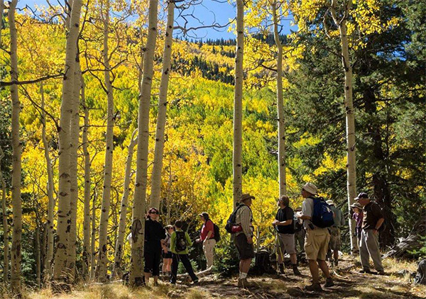
 Trailblazers pass muster at Lockett Meadow. |
||||
|
 The trail is this-a-way. [photo by Quy] We got a little scare with a notice about mid-week that the National Forest Service was going to limit vehicles going into Lockett Meadow on the first two weekends of October to limit the crowds. Then on Friday, the weather suddenly changed which brought cooler temperatures but lots of wind in northern Arizona. Three cars drove up from Phoenix with 10 hikers and six hikers met them at the McDonalds on US 89. We got into four vehicles and headed north on US 89. We turned onto Shultz Pass Road about 9 AM and quickly came to the place that the Forest Service was stopping the entering cars. We were numbers 6-9 in line. We got out and starting making alternative plans for a hike, when we noticed they were waving us in. There were a few cars coming out, so apparently they were creating one-way platoons so cars would not meet each other on the very narrow road that leads to Lockett Meadow. We got right in only to find that the parking area was mostly full. After some searching, all four vehicles found places to park. The Forest Service personnel in the parking area were most helpful. |
 Peak fall foliage. |
 Aspen leaves turn golden in the fall. |
 The trail goes through the forest. [photo by Quy] |
 Aspens reach for the sky. [photo by Quy] |
|
This hike is described in Hiking Northern Arizona by Bruce Grubbs, 2001. We met at the Inner Basin Trailhead which is well signed, and took our traditional group picture. The Inner Basin trail is much different than this hiker remembered from several years ago and different than described in the hiking book named above. The Forest Service has constructed a new trail that is much more sustainable and more beautiful than the old trail that went straight up to the watershed cabins. The new trail starts out passing through an area where the tall aspens were dead, perhaps from a fire, but a lot of young aspens covered the ground and had nice fall color. We trekked up the trail about 3/4 of the way to the watershed cabins when we arrived at a beautiful view area with lots of yellow aspens and gold colored mountains in the background. With lots of picture taking going on, and a break for snacks, we stayed there for perhaps 15 minutes and then continued up the trail. This new trail intersects the waterline trail downhill from the watershed cabins, so we turned right and proceeded to the cabins where there is untreated piped spring water flowing. |
 Trailblazers re-convene to enjoy the view. [photo by Quy] |
 The higher elevations are topped with evergreens. |
 A tiny horned toad joins us. The last part of the trail was badly eroded and made the hike even more challenging. Based on my GPS, we had gone past the mileage in the hiking book so we found a nice place to sit and have lunch. George and Kaitlyn went on up the eroded trail another quarter of a mile, saw a pipe sticking out the ground and decided that must be the spring. Some of the group had stopped earlier when the trail became very eroded. |
 We’re nearing the Flagstaff Spring. [photo by Quy] |
|
After a nice break, we headed back down the trail, turned right at the first opportunity and headed for the Inner Basin. We came to a well graded trail (road) to our left and this leader thought that it is where we should go. We did, and in a few hundred yards came to a City of Flagstaff pump station and a dead end. So we turned around and headed back up to the trail (which also is a well-graded maintenance road) and turned left to continue to the Inner Basin. There we got great views of a meadow surrounded by mountain peaks. We could see Doyle, Fremont, Agassiz, and Humphrey peaks. On the trek up to Flagstaff Spring we saw very few other hikers. One of our hikers remarked “I wonder where all the people are from all those cars parked down there.” Well, we found them in the Inner Basin. Not really crowded, but a notable change from the other area. |
 The going is easier on the down grade. |
 Don’t know if anyone’s there. |
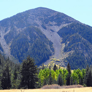 Fremont Peak |
 Doyle Peak |
 Waterline Trail. [photo by Quy] |
 The trail is covered with fallen leaves. |
 Sunset Crater |
 Doney Park |
|
We hiked down the Inner Basin trail to the watershed cabins, turned right onto the waterline trail and headed downhill through some gorgeous Aspen groves in full fall color and lots of golden leaves on the trail blown down by the wind on the previous day. We continued down this trail, which is also a maintenance road and is smooth and constant grade, for about 1.5 miles to where there is a gate and the road turns sharply to the right and the trail continues straight ahead. This trail is also a graded road and we came across some hunters with rifles proudly strapped to their backs and their vehicles parked a little downhill from the gate. We also encountered one ATV. From this part of the trek, we had great views of Sunset Crater and Doney Park, an unincorporated area east of US 89 and other hills and peaks. |
 Autumn color extends to the higher elevations. |
 We’re on the home stretch now. |
|
We have a clear view over the countryside. [photo by Dave M.] |
 Somebody put up these buildings in the Inner Basin. [photo by Dave M.] |
|
The trail continues downhill all the way to Lockett Meadow. The lower part has lots more trees than the upper part of this leg of the hike and it offers some nice fall foliage views. |
 Reach for the sky! [photo by Dave M.] |
 Autumn leaves light up the San Francisco Mountains. [photo by Quy] |
|
All in all, the hike was between 8 and 9 miles in length with an elevation gain of 1500 feet from 8750' at Lockett Meadow to 10350' where we turned around in the vicinity of Flagstaff Spring. It clearly is a B hike and except for the eroded trail near Flagstaff Spring, the trails are all even graded and provide for easy hiking. The altitude, elevation change, and length provide enough challenge, but with the beautiful fall color, it was all well worth it. About half the group departed for home and the other half gathered at Northern Pine Restaurant and Lounge for drinks and eats. |
 Top of Page
Arizona Trailblazers Hiking Club, Phoenix, Arizona
Comments? Send them to the AZHC .
updated August 18, 2020