Outdoor Links
Hike Arizona
Trip Planning Guide
Trip Report Index
Calendar of Events
Library
|
McFadden Horse Mountain Trail Sierra Ancha May 9, 2015 by Andy Zaharchuk |
|
 Andy, Doug, Tamar, Dave, Robert, Monika, Ron, Sana, Amanda, Linda, Michael, Bill, Jim [photo by Bill] |
|
The weather forecasts during the 48 hour period leading up to this hike indicated a lot of instability in the Sierra Ancha. Predictions included the potential for thunderstorms, snow, winds, and below freezing morning temperatures. The predicted high for the day of the hike was 48 degrees with winds. Because of this I considered canceling the hike, but because so many of us were interested in doing this trek, I decided to take a chance and go ahead with it. The following participated: Doug E., Mike H., Monika H, Dave M., Jim B., Sana H., Tamar G., Bill Z., Robert P., Linda S., Amanda E., Ron SW., and myself, Andy Z. Our group of thirteen hikers met as planned close to U.S. route 60, milepost marker 201, in the Basha’s parking lot, near the Jack in the Box in Gold Canyon. We signed up, headed out, and after 45 minutes of driving we made a brief pit stop along the way in Claypool at the Safeway. From there we proceeded North out of Miami and out on to the road to Young, which is AZ route 288. We soon reached the trailhead near milepost 288, where Doug was waiting for us, as he indicated he would be. |
 O.K., Bill, which way is it? [photo by Monika] |
|
We got our gear together, did brief intros, and started the very steep climb up the old forest road. Soon thereafter we reached the trail sign post and headed up the trail. After a couple of hours we reached the top flat area of the mountain, and from there followed the well-made cairns east, then south, and then north. The weather was cool and comfortable – considerably more favorable for us than NOAA had predicted. |
 The mountain is this ’a way. [photo by Bill] |
 Sawyers have cleared some of logs from the trail. [photo by Bill] |
 Bill feels right at home here. [photo by Bill] |
 Linda and Jim find a picnic spot. [photo by Bill] |
 Don’t move or I’ll click. [photo by Monika] |
|
As we approached our destination we noticed that the trail was much better marked than it had been when the club had done this same hike a couple of years before. Clearly, some good Samaritans had done work and set up several additional cairns which better defined the last quarter mile or so of the trail. At about noon we reached our destination. The views there were as glorious as ever. We took our time and had lunch and snacks, and took photos. After our break we headed back the way we came. The hike back was considerably easier. |
 Trailblazers top out on Horse Mountain. [photo by Bill] |
 The forest frames Four Peaks in the distance. [photo by Bill] |
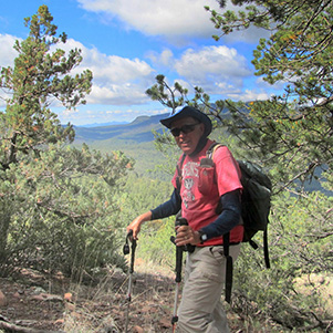
 We’ve climbed a lot to get here. [photo by Bill] |
 Sweeping view from atop the Sierra Ancha. [photo by Monika] |
|
After the hike, most of the group stopped for a meal in downtown Superior at a cafe called Porters, where we had burgers and fries. I wish to thank all participants for the good comradeship, and I thank Monika Hahues and Bill Zimmerman for taking the fine photos of our adventure, and Bill for helping lead the way. |

|
|
||||||||||||||||||||||||||||||||||||||||||||||||
 Top of Page
Arizona Trailblazers Hiking Club, Phoenix, Arizona
Comments? Send them to the AZHC .
updated November 10, 2018