Outdoor Links
Hike Arizona
Trip Planning Guide
Trip Report Index
Calendar of Events
Library
|
Prospector’s View Day Hike Superstition Mountains December 9, 2006 by Ted Tenny |
|
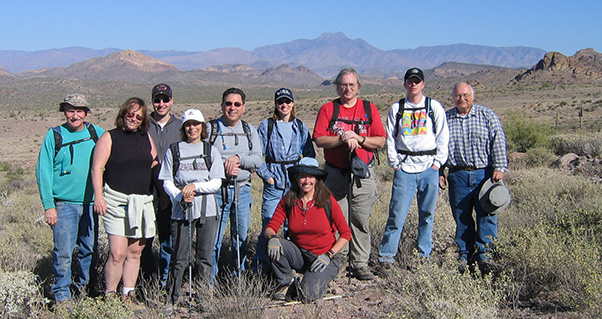 Trailblazers have a sunny view of the Four Peaks on our way down. |
|
Ten hearty hikers set out from Jacob’s Crosscut Trailhead on a breezy cool morning. |
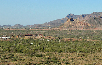 I can see Goldfield Ghost Town. But where’s that bulldog? |
We walk south on the Crosscut Trail through a Saguaro - Palo Verde forest in the shadow of the Superstitions. Our trail crosses several valleys and offers fine views of the Massacre Grounds to the south and Goldfield Mountains to the north. Ted points out a boulder on the south end of Blue Ridge that’s known as Bulldog Peak. |
|
“I’ve looked at it from every side but have yet to see the bulldog,” he observes. |
|
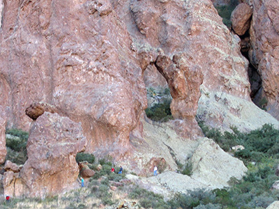 The Capstone Arch is bigger and farther away than it looks. 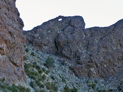 The snake’s eye overlooks our descent. Here we turn left and go east, up to the towering cliffs of the Superstition Mountains. Linda assures us that it’s possible to climb to the top from this side, but only those who can fit through a tunnel on the way up. The Prospector’s View Trail tops out just before it ends at the Treasure Trail. “Hey, there’s an arch!” It sure looks that way, on the base of the cliffs above us. Six hikers decide to climb up and get a closer view. The Capstone Arch is a steep climb over gravel and rocks. The top of the arch would be open except for a boulder that perfectly fits. Nearby is a boulder wedged precariously in a crack, and there may be a smaller arch. After starting down Ted looks over to the west and spots the snake’s eye, a little arch on the top of rock fin. There’s no climbing up to it, and you can’t see it at all from the trail. |
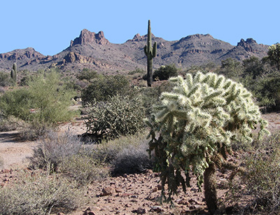 Saguaro and jumping cholla cheer us on the way. After a group picture we turn right at a sign and follow a different trail back toward Crosscut. This trail is actually a road, clearly marked on the topographic map but abandoned a long time ago. By now the bursage and brittlebush have given way to cactus and palo verde. We’re back on the Crosscut Trail. Another road, easily recognizable but missing from the topographic map, heads back toward the mountains. “There’s nothing at the other end, but it’s a good way to walk down.” Our cars are waiting at the trailhead. |
 Top of Page
Arizona Trailblazers Hiking Club, Phoenix, Arizona
Comments? Send them to the AZHC .
updated January 25, 2018