Outdoor Links
Hike Arizona
Trip Planning Guide
Trip Report Index
Calendar of Events
Library
|
Groom Creek Trail Day Hike Prescott October 13, 2007 by Beth Baumert |
|
 Karen, Eileen, Beth, Aaron, Jenni, Doug, Ted |
|
On a beautiful fall morning, with temperatures in the 60s at the trailhead, seven Trailblazers hikers dodged horse trailers and horses to start off on the Groom Creek Trail. |
 A brisk morning greets us on Spruce Mountain. |
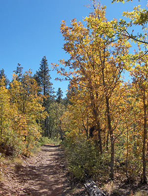
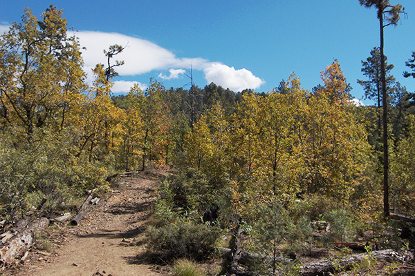
The hikers were warned of the four confusing places encountered when hiking in a clockwise direction around the loop, and we set off eagerly. What can I say about my favorite trail that has not already been stated? The weather was perfect. The fern-like but stiff plants with the pungent smell were flaming hues of orange and crimson. (Eileen suggested that they might be wild dill.) The yellow leaves of the Gambels Oak trees shone against the green of the pine trees. It was warm in the sun, but there was a crisp breeze blowing from the north. |
|
There was silence except for the sound of the wind high in the trees, and some occasional bird songs. It was heavenly. I paused occasionally to take in the breathtaking views of the surrounding mountains and valleys. We met at the picnic tables at the top for lunch, lively conversation, and sharing of some good snacks. There we had our group picture taken and afterward proceeded to the fire tower for more lovely views of the Prescott Valley and several of the prominent mountains near Flagstaff (although the San Francisco Peaks were obscured by clouds). Most of the group visited the ranger up in the tower. |
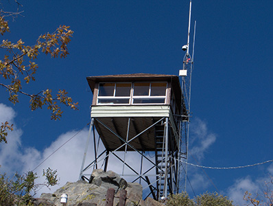 Whew! We made it all the way up to the lookout tower.  There’s a grand overview from the top, but no ladybugs this time. |
 Hmmm. This looks like the right trail, wouldn’t you say? |
The group proceeded merrily downhill together after lunch. Some equestrians told us that they had spotted deer in the woods, but we never saw them. There were a lot of fallen trees and piles of logs, so a lot of work had been done to clear them out. These were no doubt the result of drought and pine bark beetle damage. We passed blue spruce trees covered with moss. It was clear which side faced north. |
|
We reached one particularly large tree trunk blocking the trail. We negotiated our way around it by various methods, then went to the left. We found an area in which to take a break, and then we took off again downhill. Not long afterward, we saw a huge cabin with an ugly green roof right next to the trail. Who put that there? Who allowed it to be so close to the trail? What happened to our wilderness? |
 Autumnal glory! But I don’t remember seeing a lake. |

That lovely lake at the end was Hassayampa Lake, on Walker Road.

Oh, I hope this road takes us back to the trailhead.
Which way do we go now? The trail wasn’t marked. Some of the hikers asked a man on an ATV which way to go to get back to the main road. We followed a smaller road through a neighborhood and came upon a beautiful lake that we never knew of before. Ted later identified it as Hassayampa Lake. It was lovely and was surrounded by maple trees with fiery yellow, orange, and red leaves. The group was very good-natured about the mishap. We found the main road, where some kindhearted passersby gave Ted a ride to the trailhead (which was about 4 miles down the road). He then drove Eileen’s van back to pick up the rest of us, who were walking down the road. We figured out later that we missed one of the confusing turns at the large, fallen log. A good dinner in downtown Prescott made it all right again. Pictures and map courtesy of Ted Tenny. |
|
Supplemental Report by Ted Tenny |
|
Thanks to Beth Baumert for leading such an enjoyable and adventurous hike! According to my GPS we walked 7.48 miles with +1627'-1283' elevation change before getting back to the Senator Highway. The lovely lake at the end was Hassayampa Lake, on Walker Road. I found the location of our wrong turn, by superimposing today’s GPS map over our map from the Groom Creek hike a year ago, October 7, 2006. The coordinates are 34°26.630' N, 112°25.100' W [NAD27]. At that time we had walked 5.25 miles. Beth was right: it’s the place where a fallen tree obscured the trail junction. The Forest Service needs to clear it up. |
 We start climbing right away. |
 The fires of autumn. |
 What a great day for hiking! |
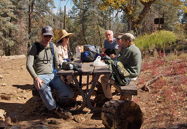 Trailblazers enjoy a fine picnic lunch. |
 The lookout tower on Spruce Ridge. |
 Are you sure this is on the up and up? |
 Merrily, merrily, down the trail we go. |
 Lots of fallen branches. |
 Autumn color at its best. |
 Top of Page
Arizona Trailblazers Hiking Club, Phoenix, Arizona
Comments? Send them to the AZHC .
updated April 26, 2020