
Outdoor Links
Hike Arizona
Trip Planning Guide
Trip Report Index
Calendar of Events
Library
Phoenix South Mountain Park
February 3, 2007
by David Bickford
|
|
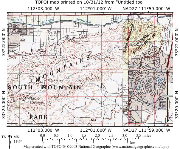
After a cold and rainy week, the first weekend of February offered the best of Phoenix winter weather. On a sunny Saturday morning, four participants met at the 46th St. Trailhead, just off Baseline Road in Phoenix. The 46th St. Trailhead offers access to the same trails as the better-known Pima Canyon Trailhead but with less congestion and a clearer meeting point for participants. After waiting a few minutes for any other participants who might not have RSVP’d, the group set out at 8:45 AM. The group proceeded west from the trailhead along the Javelina Canyon Trail. The Javelina Canyon Trail runs roughly parallel to Baseline Road but gradually ascends and turns away from the city and into the heart of South Mountain Park. Early during this initial segment, one participant in the hike found the route too strenuous and turned back to the trailhead. The hike leader maintained cell phone communication with the participant until the group was assured that she had returned safely to her car at the trailhead. After approximately 1.5 miles, the group continued farther west along the Mormon Loop Trail. The Mormon Loop Trail ascended more dramatically, putting the group atop a ridge with an impressive view of the Phoenix skyline. After approximately a mile on the Mormon Loop Trail, the group turned onto the southbound Mormon trail and followed it approximately one quarter mile to the National Trail. The National Trail is the main east-west trail in the park and runs 15 miles from beginning to end. The group proceeded west on the National Trail for approximately half a mile and then turned off the trail to visit Fat Man’s Pass and Hidden Valley. Fat Man’s Pass is one of several interesting rock formations in the region of South Mountain Park known as Hidden Valley. After a short break at Fat Man’s Pass, the participants proceeded east through Hidden Valley and rejoined the National Trail after approximately half a mile. Using the National Trail as an eastbound route, the group began its return route, taking the National Trail approximately one mile and then turning northeast onto the Beverly Canyon Trail. After another mile on the rocky Beverly Canyon Trail, the group returned to the 46th Trailhead. Total hiking time was approximately 3 hours. Elevation gained (and then lost on the return) was approximately 1000', mostly at a gradual pace. The hike leader’s camera was out of commission, resulting in no photos for this report. |
 Top of Page
Arizona Trailblazers Hiking Club, Phoenix, Arizona
Comments? Send them to the AZHC .
updated October 24, 2017