Outdoor Links
Hike Arizona
Trip Planning Guide
Trip Report Index
Calendar of Events
Library
|
Reavis Trail Canyon Day Hike Superior January 6, 2007 by Ted Tenny |
|
 We follow in the footsteps of Elisha Reavis. |
|
Fifteen breezy Trailblazers set out from Happy Camp Trailhead to seek their fortunes on the Arizona Trail. |
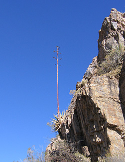 A century plant stands sentinel on the trail. Before long the road branches off to the right and a large cairn marks the place where our trail leaves the streambed. Soon we are high above the stream, looking down on the rugged and intricate rock formations where Reavis Trail Canyon flows into Whitford Canyon. The trail dips back down to the streambed, then crosses the stream many times as we climb relentlessly up to the higher reaches of the canyon. Montana Mountain looms ahead. The canyon walls gradually become lower and closer together. Finally the trail crosses the streambed for the last time as we emerge onto a slope covered with scrub vegetation. Several hikers ask our leader “When are we going to stop for lunch?” |
|
The we round a bend and arrive at one of the loveliest picnic spots in the Superstition Wilderness. The rocks provide tables and benches right beside the trail. Several hikers go off exploring the area and taking pictures as we all enjoy our picnic lunch. “Walk at your own pace on the way down,” Ted advises, “But stay on the trail. I’m going to sweep.” Hikers begin starting down, two or three at a time. By this time the day has warmed up somewhat, and we have the wind at our back. Sights that we didn’t even notice on our way up are brightly illuminated by the midday sun. Just after returning to the canyon we find a cute little waterfall, slowed to a trickle by the dry weather. Over the eons, floods have eroded the rocks into fantastic shapes. |
 The rocks provide a lovely picnic area. 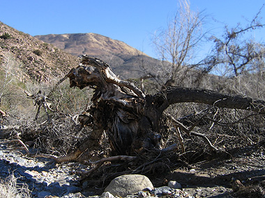 The Reavis Canyon Troll says, “Pay me toll.” |
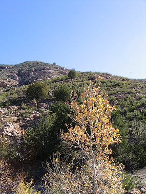 Cottonwood trees catch the golden winter sun. |
Even though it’s January, many of the trees and shrubs still have their bright autumn colors. Soon we are high above the creek, heading in the direction of Peachville Mountain. At this point the last hikers receive a radio transmission from first ones to start down. “We’ve made it back to the cars.” They graciously agree to wait for the pokey hikers who are taking pictures as they enjoy their leisurely stroll down the trail. After following the creek upstream we decide to stay on the trail and the road on our way down. It takes to an old corral with stone walls and the remains of a corrugated steel building. The trail then re-joins Forest Road 650. The road and the creek seem to be playing hopscotch in the last mile. We pass a ranch, then cross the streambed for the last time. |
 Who said this was the OK Corral? |
|
Everyone is in high spirits as we re-convene at the trailhead. ’Til we meet again. |
|
This hike is described in Footloose from Phoenix, by Ted Tenny, pages 205-211. |
 Top of Page
Comments? Send them to the AZHC .
updated October 2, 2018