Outdoor Links
Hike Arizona
Trip Planning Guide
Trip Report Index
Calendar of Events
Library
Sedona
October 1, 2005
by Chuck Parsons
|
On a beautiful and sunny October morning in Red Rock Country, Arizona, nine Arizona Trailblazers gather in front of the Loy Canyon Trailhead sign for a group photo opportunity. |
||||||
 Arizona Trailblazers are ready to hit the trail running. |
||||||
|
||||||
|
We are about to embark on a brand new hike for the Arizona Trailblazers Hiking Club, as we set out to explore one of the Sedona area’s more remote and less traveled trails, located at the far west end of the Secret Mountain Wilderness Area. |
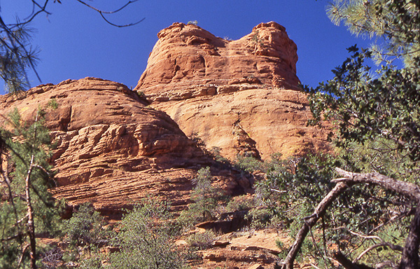
 Picturesque red rock buttes on the Hancock Ranch. |
|
The first half mile of the Loy Canyon Trail skirts along the eastern boundary of the vast Hancock Ranch, marked by a long barbed wire fence. We spot this long-abandoned ranch building near a small grove of trees nestled against the base of a red rock butte about midway along the fence line. Appropriately enough for a trail running parallel to a ranch, Loy Canyon Trail was originally built as a cattle trail in the late 1890s to run cattle to the top of the Mogollon Rim during the hot summer months. This trail is one of the very few that manages to forge a passageway to the top of the rim, rising sharply for a thousand feet above the surrounding land as a seemingly impenetrable rocky fortress. Once we leave the ranch and all remaining signs of civilization behind us, we soon start following a dry creek bed northward along the floor of Loy Canyon, criss-crossing the creek bed from time to time through an open pinyon-juniper forest. The canyon begins to narrow down and close in on us after a couple of miles of hiking, and we begin to gain elevation as the trail steepens and swings to the northeast. |
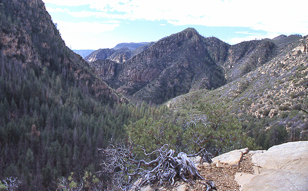 Looking down into Loy Canyon. |
|
In another mile or so the trail leaves the canyon floor behind and begins to switchback in earnest up the north side of Loy Canyon, as our lungs and leg muscles start to get a major workout. We will climb a total of 1,700 feet before leveling out at the top of the trail. This vantage point gives us a great view of the canyon, with the Mogollon Rim rising sharply in the far background. Having already put about half the elevation gain behind us at this point, we stop for a brief rest break and enjoy the views, as well as the cooling breezes sweeping up from the canyon below us. In the following picture Mike and Zeke, along with Janet, Peggy, and Brian take a breather on a large tilted slab of sandstone, before pushing onward and ever upward. |
 Mike, Zeke, Janet, Peggy, and Brian enjoy the scenery. |
|
With most of the trail and climbing now behind us, we pause for another rest break in the shady glen of a mixed grove of pine, oak, and juniper trees nestled at the foot of this spectacular butte thrusting high into a sparkling blue Arizona sky. Some elect to turn back at this point, while the rest of us push onward toward our final goal, which is the saddle between Secret Mountain and the Mogollon Rim, in addition to being the junction where the Loy Canyon Trail meets the Secret Mountain Trail coming up from the east. Sitting at an elevation of 6,400 feet, the saddle provides the hiker with the third option of pushing to the north and gaining another 1,000+ feet of elevation, before topping out on the Mogollon Rim. |
 The signature red rocks of Loy Canyon. |
|
This marathon hike we will save for another time, as well as a loop hike combining the Loy Canyon Trail with the Secret Mountain Trail. For now, we enjoy the views, take a few pictures, and head back down the same trail to our waiting vehicles. |
 Top of Page
Arizona Trailblazers Hiking Club, Phoenix, Arizona
Comments? Send them to the AZHC .
updated October 14, 2019