Outdoor Links
Hike Arizona
Trip Planning Guide
Trip Report Index
Calendar of Events
Library
|
Wilson Mountain Barrelhouse Sedona April 16, 2005 by Ted Tenny |
|
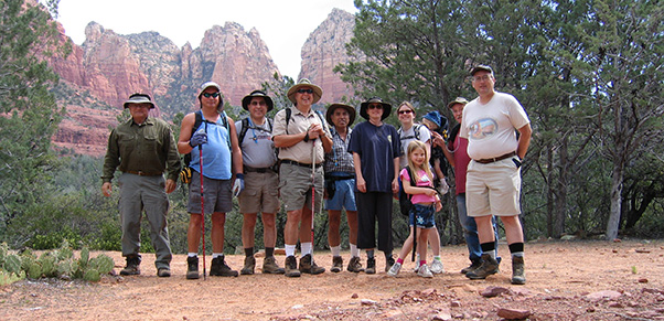 Ted, Brian, Barry, Joe, Rudy, Michelle, Terri, Zoe, Damian, Doug, Michael |
|
Pleasant weather and two enthusiastic young hikers livened our trip to Sedona’s red rock country. Zoe Beauer, age 7, made it to Angel Falls and back with her mother Terri Beauer and grandfather Doug East. Damian Beauer, age 1 1/2, was carried by his mother most of the way. Michelle East, Joe Michalides, Brian Cross, Rudy Arredondo, Michael Humphrey, Barry Altschuler, and hike leader Ted Tenny rounded out the troop. |
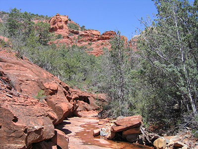 Wilson Mountain can be seen through a clearing. Recent rains left some water in the canyon. The fin, elevation 5667', makes an excellent landmark for finding your way to the Barrelhouse. You see the fin from the south side at the beginning of the hike, then after turning north you see it edge on. “Don’t leave the Brins Mesa Trail until you see the fin from the back side,” Ted advised the hikers. We left the Brins Mesa Trail, on the right, just before it started up the staircase toward Brins Mesa. An unmarked trail took us northeast and then east into Mormon Canyon. The trail goes through a wooded area, mostly manzanita, crossing several gullies before it drops steeply into the canyon. Ted set up a cairn of red, white, and blue rocks to make sure we could find our way out. Water was flowing freely in the canyon. We rock-hopped a quarter mile upstream, to a place where a tributary with a smooth slickrock bottom flows in from the right. There is a red rock pinnacle straight ahead. This is the only place where you can see the Barrelhouse from the canyon. Look above you to the right, which is the west side of Wilson Mountain. |
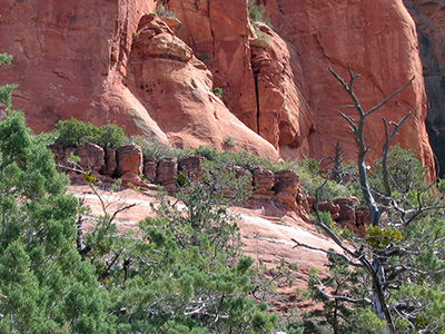 Wilson Mountain Barrelhouse. 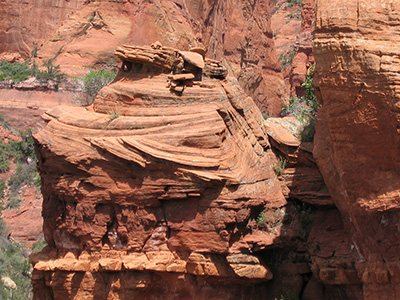 Lookout cupola on Wilson Mountain. Rudy made it up to the barrels. The rest of us enjoyed the view from the ledge. There are fantastic rock formations in all directions, and a sweeping view of Brins Mesa and beyond. Zoe, Damian, and Terri were waiting for us down in the canyon. We stopped there for lunch before hiking upstream to Angel Falls. After seeing all the water in the canyon, it was kind of surprising to find Angel Falls dry. The falls are actually in a tributary of Mormon Canyon. Desert varnish marks the places where water pours off the side of Wilson Mountain and down into the spectacular rock formations. |
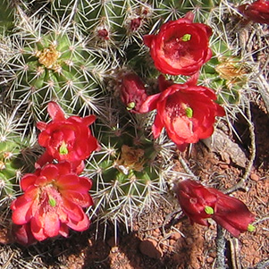 Claret-cup hedgehog cactus. |
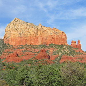 Steamboat Rock. |
|
Our return trip was slow but very scenic. It turns out that you can see the barrels from one place on the Brins Mesa Trail, but you have to know just where to look. Near the barrels are several other formations of stacked rocks, each of them on a slickrock ledge. There are many possibilities for exploratory hikes in this area! |
 Top of Page
Arizona Trailblazers Hiking Club, Phoenix, Arizona
Comments? Send them to the AZHC .
updated September 23, 2018