Outdoor Links
Hike Arizona
Trip Planning Guide
Trip Report Index
Calendar of Events
Library
|
Beverly Canyon to Hidden Valley South Mountain Park January 14, 2017 by Dave French |
|
|
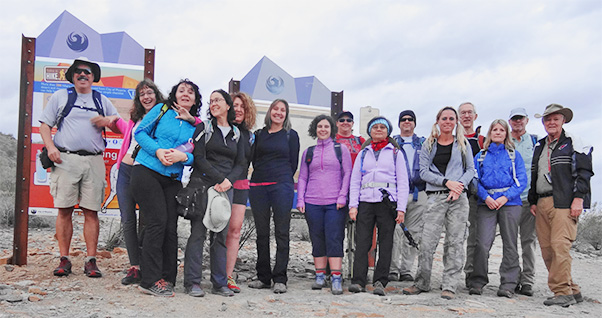
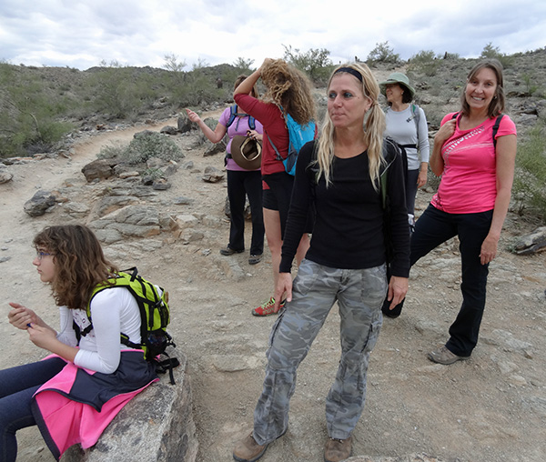
| Group L to R: Dave M., Emma, Biljana, Dee, Kari, Vicki, Pamela, Michelle, Mimi, Mark, Debbie, Tom, Dorinda, Ralph and Dave F. Not pictured is Janet. |
|
This hike is perhaps the longest route to the famous Hidden Valley in South Mountain Park. We started at the Beverly Canyon trailhead on south 46th Street and hiked a figure 8 using the Javalina Canyon, Mormon Loop, Mormon, National, Hidden Valley, National, Ridgeline, and Beverly Canyon trails. It was 7.9 miles long with a low to high elevation change of 900 feet. With the ups and downs, I estimate the net change to be about 1200 feet. Fifteen hikers showed up before 8 AM on a cloudy, cool Saturday morning. I got two calls from hikers who relied on cell phone directions and ended up in the wrong places. One of those hikers made it to the correct trailhead and caught up with the group and the end of the Javalina Trail. The 15 hikers gathered for a group photo and quick introductions and began the hike at 8:15. The weather forecast had a 30% chance of rain that morning and increasing chances later in the day. Accordingly, I encouraged the group to “Let’s git her done.” And we did. |
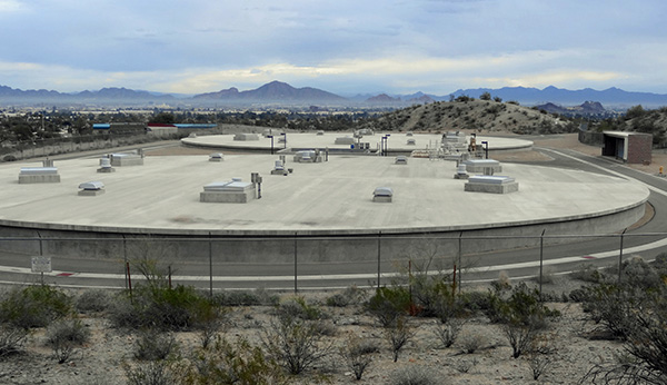 The water tanks are covered to control evaporation. |
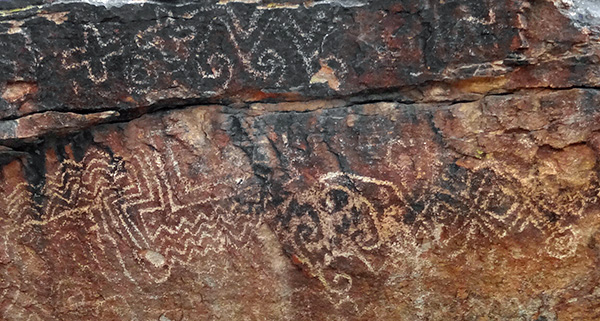 An ancient artist left his mark. |
 Hmmm, this looks like the right trail. |
 Hikers trudge onward and upward. [photo by Tom] |
 Here the trail has a downhill stretch. |
|
The Javalina trail has a fairly gentle climb, passing by some large, mostly underground tanks that I assume to be city water supply tanks. We continued to climb until we reached the junction with the Ridgeline Trail. We did not take that trail yet, and continued west down to the petroglyph site and then up the Mormon Loop trail to meet the Mormon trail that comes up from the 24th Street trailhead. We turned left here for 0.12 miles to the National Trail, where we turned right and hiked a little over a half mile to the entrance to Hidden Valley. The high elevation of 2100 feet occurred just before we dropped down to Hidden Valley. |
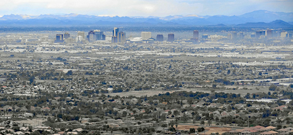 Phoenix, from the top. |
 The view from here gives us pause ... |
 Come on, you’ve got to be kidding. [photo by Ralph] |
 Easy for Emma. [photo by Ralph] |
 Not so easy for Dave. [photo by Tom] |
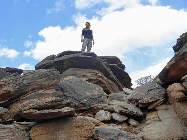 Debbie, queen of the mountain. |
 Let’s stop here for snacks. |
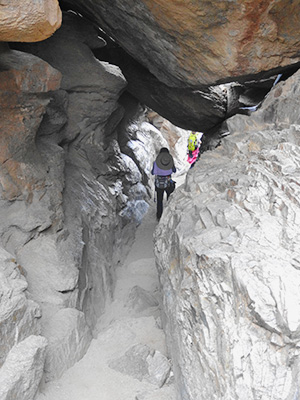
 The first tunnel. [photo by Tom] |
|
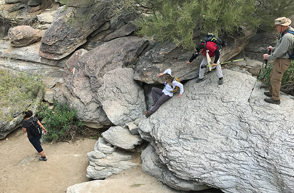
Only 3 of the 16 hikers had ever been to Hidden Valley, so it was quite a treat for the newbies to encounter Fat Man’s Pass. Some squeezed through easily (this hiker barely makes it but always has) and some bypassed it. We stopped for snacks on the other side. Little Emma was so fascinated with the pass she went through at least 7 times. Others that had bypassed finally gave it a try and made it through. |
 Scoot carefully, and you’ll get down. [photo by Ralph] |
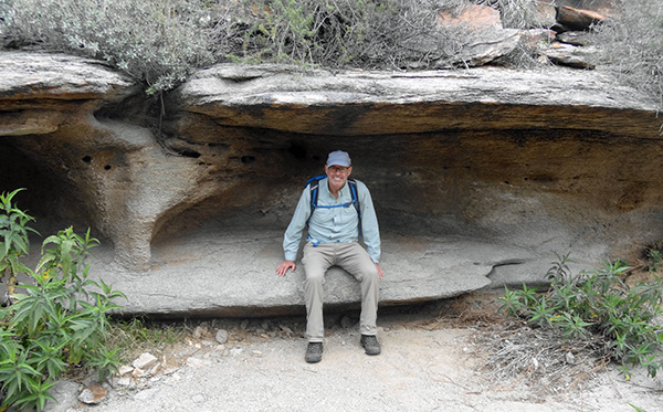 Ralph finds a comfortable bench. |
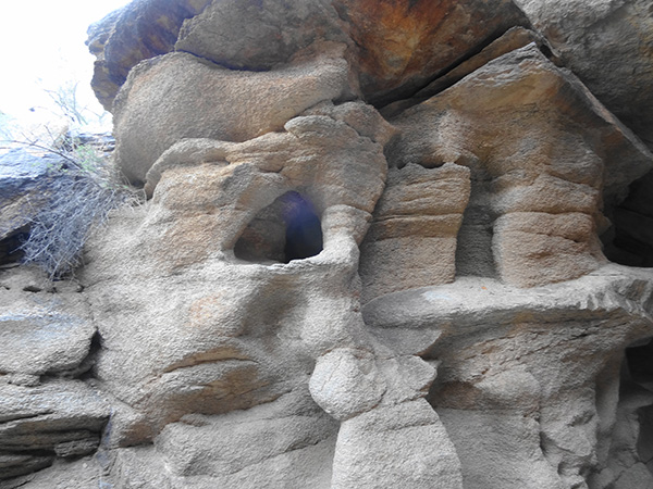 Do elves live here? |
|
After the snacks we continued eastward through the Valley, enjoying the views of the rock formations, peep holes and windows. We passed through the first short “tunnel” continued on to the butt scoot, “the bench” and the natural tunnel. We regathered at the junction with the National Trail and continued eastward and eventually down to the junction with the Pima Wash Trail. I suggested that any hikers that did not want to climb up to the Ridgeline Trail could take a right on the Pima Wash Trail to the Beverly Canyon Trail and return to the trailhead without another major climb. Five hikers decided on that route and the rest of us turned left and started the climb to the Ridgeline. We got great views of Phoenix and Camelback Mountain to the north, Tempe more or less straight ahead and the “Ahwatukee” area to the southeast. We made it back to the trailhead with a total lapse time of 4 hours, 15 minutes. We encountered just a few light sprinkles and occasional sun breaking through the clouds, which provided an interesting play of light spots for our views. |
 The natural tunnel. |
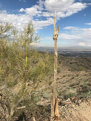 Saguaro turned into a zombie. [photo by Ralph] |
 South Mountain is the largest park in the city of Phoenix. |
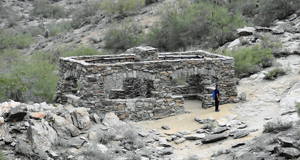 I don’t think anybody’s home. |
 Aunt Chilada’s. [photo by Tom] |
|
Afterwards, some of the hikers ventured to Aunt Chilada’s on Baseline Road near I-10. |
 Top of Page
Comments? Send them to the AZHC .
updated January 15, 2017