Outdoor Links
Hike Arizona
Trip Planning Guide
Trip Report Index
Calendar of Events
Library
|
Corral Loop Day Hike McDowell Sonoran Preserve December 19, 2020 by Chuck Parsons |
|
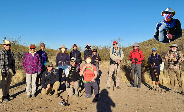 Trailblazers ready to hike. [photo by Lin] |
||||||||
|
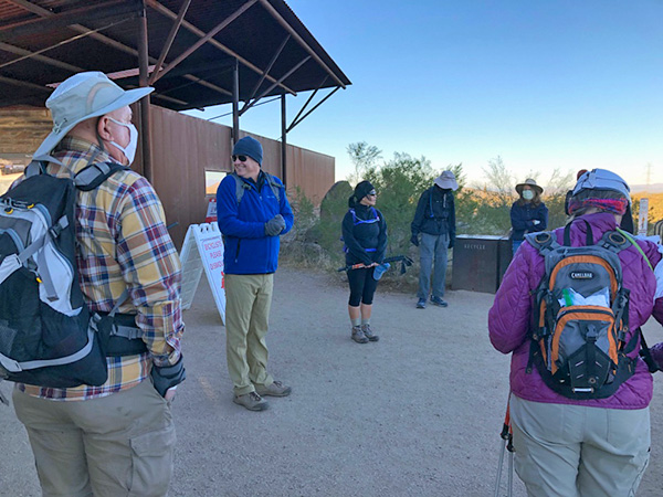 Trailblazers start gathering at the trailhead. [photo by Carol] |
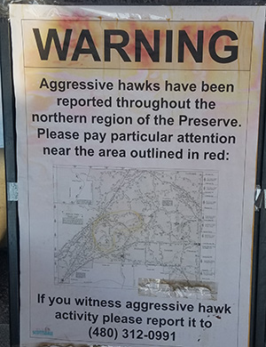 Aggressive hawks now? Good Grief! [Billie] |
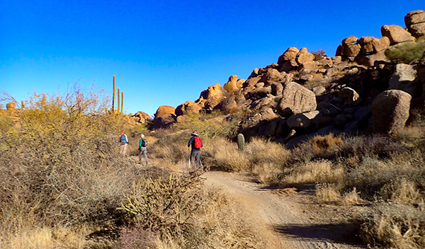
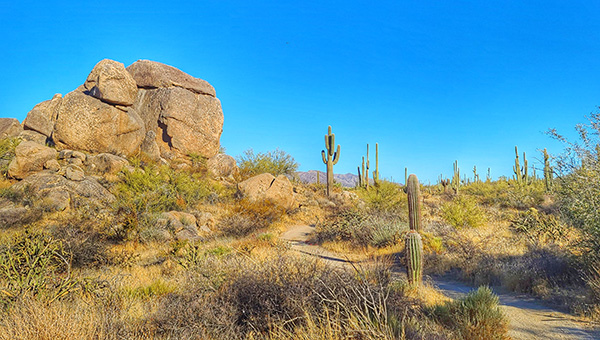
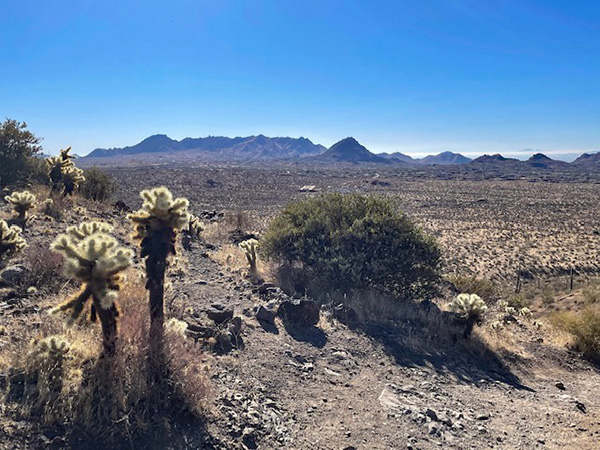
It’s 8:20 on a gorgeous and sunny Saturday morning in the McDowell Sonoran Preserve, Northern Region, as 16 Arizona Trailblazers strike out from the Brown’s Ranch Trailhead. The air temperature is a chilly 42 degrees, but we’ll warm up fast once we get moving in full sun. We start hiking north on Brown’s Ranch Road, more of a smooth, wide-track gravel trail these days, and will continue for 1.5 miles to the junction with the Corral Loop Trail. Brown’s Ranch Road is relatively flat, with almost negligible elevation changes along the way, as it takes us through scenic and pristine Sonoran Desert terrain. About halfway through, the road gently bends in an arc to the northwest before connecting to the Corral Trail at CL1 on the map. |
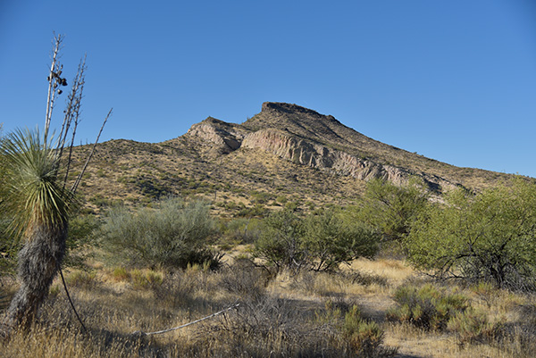 Brown’s Mountain. [photo by Chuck] |
|
As we continue making our way north on Brown’s Ranch Road, we enjoy good views of Cone Mountain, Brown’s Mountain, Cholla Mountain, and Granite Mountain, before we finally reach the junction with the Corral Loop Trail at CL1. We make a right turn here, and after less than 50 yards, depart from the trail to search for remains of the old Brown’s Ranch. And it doesn’t take long for us to start finding rusted and crumbling remnants of the old ranch, including badly weathered and leaning wooden fence posts, tangles of rusted barbed wire—some still clinging to the posts and others coiled up in piles—disintegrating concrete feed troughs, crumbling concrete foundations, rusted metal posts, and a very large water tank or boiler shot full of bullet holes. |
 Neil and Billie hiking down Brown’s Ranch Road. [photo by John] |
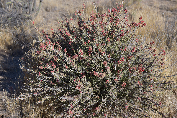 Pencil Cholla, aka Christmas Cactus. [photo by Chuck] |
 This giant saguaro has certainly seen better days. [photo by Lin] |
 While this one seems to have lost its head. [photo by Lin] |
|
This is all that remains of the once bustling Brown’s Ranch, one of Arizona’s largest family run ranching operations. Almost every named trail, trailhead, mountain peak, and countless other landmarks throughout Arizona have some sort of a history behind their name. And there’s an interesting and storied history behind Brown’s Ranch. |
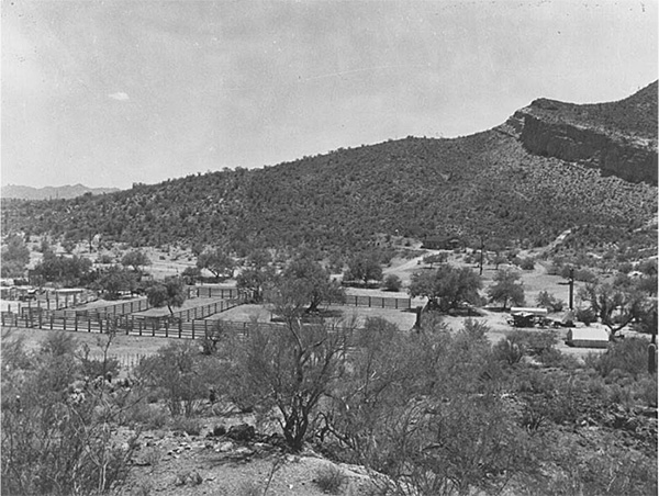 Historic picture of Brown’s Ranch. |
|
It all began with one E.O. Brown, an established businessman who migrated to Arizona from Wisconsin in 1901, buying up tracts of land that would continue to eventually grow and expand over two generations of the Brown family, into a mammoth cattle ranching empire that would later become the DC Ranch, sprawling across 44,000 acres of rugged desert terrain on the western slopes of the McDowell Mountains. The Lower Ranch ran from present-day Shea Blvd. north to Pinnacle Peak Road, while the Upper Ranch stretched for almost six miles north of Pinnacle Peak Road to what is today Carefree Highway. The western boundary of the DC Ranch was present-day Scottsdale Road, while the eastern boundary was the summit of the McDowell Mountains. Today’s Brown’s Ranch Trailhead is part of the old Upper Ranch. After E.O.’s death in 1937, his eldest son E.E. “Brownie” took over ranching operations and continued to purchase additional tracts of land in the following years. But cattle ranching throughout this area gradually begin tapering off during the 1950s and 1960s, as the economy boomed and hundreds of thousands of people begin to pour into Arizona. Threatened with ever-increasing urban sprawl and development (sound familiar today?), an environmentally critical voter-approved initiative in the year 2000 authorized the City of Scottsdale to buy much of the old DC Ranch’s Upper Ranch land and add it to the McDowell Sonoran Preserve. But the preserve actually got its initial start in 1994 with just five square miles of desert. |
 Crumbling building foundation. [photo by Chuck] |
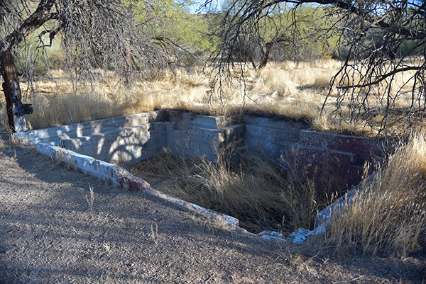
 Large water tank or boiler. [photo by Chuck] |
 Carl peers into one end of the tank. [photo by Lin] |
 Neil looks into one end of the tank. [photo by Lin] |
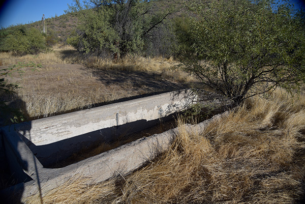 Crumbling feed trough. [photo by Chuck] |
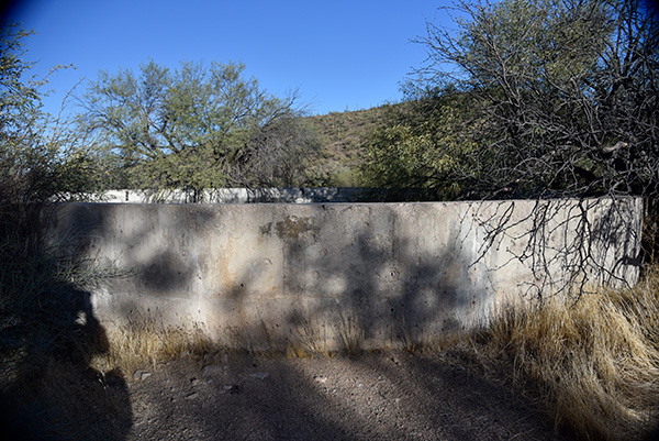 Huge concrete water tank. [photo by Chuck] |
|
This year marks the 26th anniversary of the McDowell Sonoran Preserve. This preserve, along with the Phoenix Sonoran Preserve, the Phoenix Mountains Preserve, and a sprawling network of 12 Maricopa County Regional Parks, Preserves, and Conservation Areas, stretching from the White Tanks to the McDowell Mountains, provides protection and preservation for nearly a hundred thousand acres of pristine and unspoiled Sonoran Desert that would otherwise be consumed by development, for this and hopefully many future generations to come. Today the McDowell Sonoran Preserve is the nation’s largest urban land preserve, encompassing a total of 57 square miles, or 36,500 acres, that borders the Tonto National Forest. Founded in 1991, the McDowell Sonoran Conservancy is tasked with protecting and preserving this vast preserve through a combination of environmental education, training hundreds of volunteers, or Stewards, to work in and help protect and preserve the land, and becoming a key part of a growing movement to change the laws that facilitate the conservation of Arizona’s State Trust Lands. Preserving and protecting critical and vulnerable lands has never been an easy task. Instead, it’s a never-ending struggle involving the hard work, commitment, and dedication of thousands of people in the epic battle of conservation vs. development. |
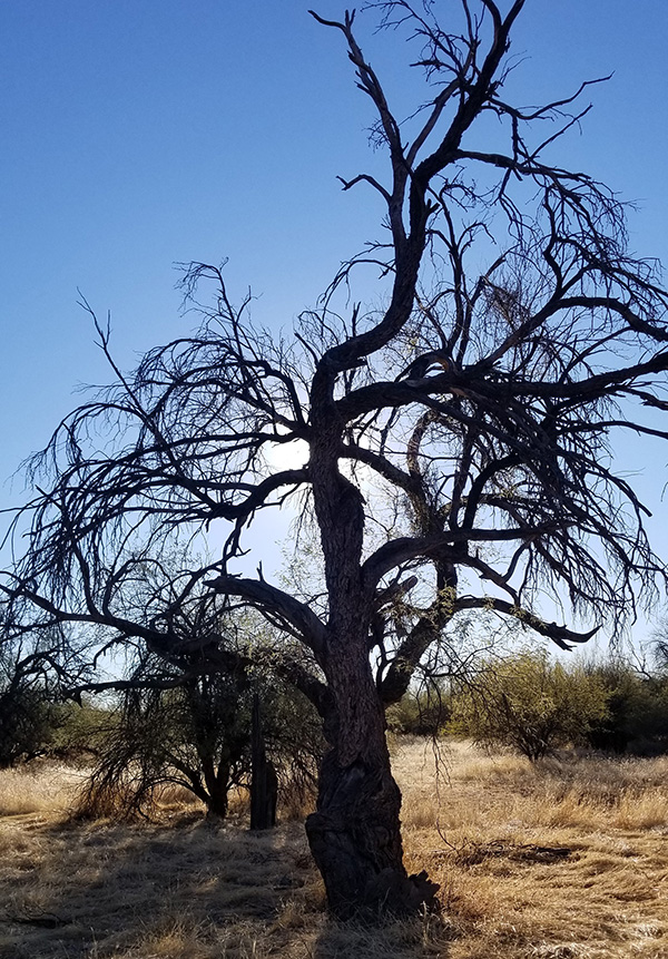 This long dead, but still standing, ironwood tree stands guard over the ranch ruins. [photo by Billie] |
|
After exploring what remains of Brown’s Ranch and briefly discussing the history and vast size of the ranch, we link back up with the Corral Loop Trail and start hiking east and looking for the next junction at CL2. |
 Trailblazers make their way up the Dry Gulch Trail to Cathedral Rock. [photo by Lin] |
 Closing in on Cathedral Rock on the Cholla Mountain Trail. [photo by John] |
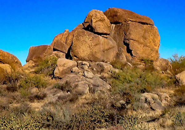
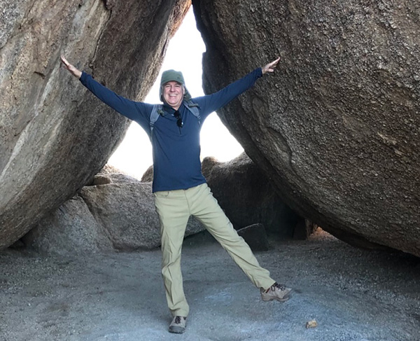
 House-sized boulders along the trail. [photo by Lin] |
 Close-up view. [photo by John] |
 Trailblazers gather near Cathedral Rock. [photo by Lin] |
|
At the junction we make a right turn onto Dry Gulch Trail, follow that for 0.3 miles, and then make a left turn onto Cholla Mtn. Loop Trail for 0.2 miles to reach Cathedral Rock. This will be a short one-mile round trip to the rock and back. After finally reaching Cathedral Rock, we all take a long break and hang out for a while for numerous photo ops, before reversing course and backtracking to the Corral Loop Trail. |
 Taking a break next to Cathedral Rock. [photo by John] |
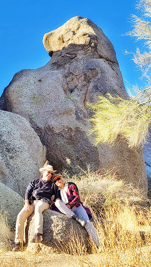 Neil and Billie get cozy and comfy. [photo by Lin] |
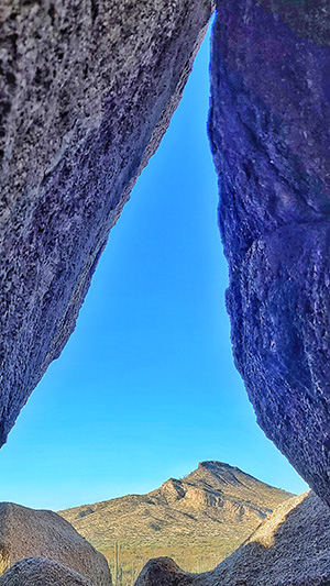 A cleft in the rock, with Brown’s Mountain in the background. [photo by Lin] |
 Randall is holding it all together. [photo by Carol] |
|
On the hike back to the Corral Loop, my mind starts drifting and I can’t help but think about Brown’s Ranch again and wonder what daily life must have been like for the men struggling to manage and raise hundreds or possibly thousands of head of cattle in such a tough and hostile environment during the long and blistering summer months. Wouldn’t it be interesting if we could go back in time and place ourselves in such an environment, if only for a short period? I’ve often wished I could go back 100 years or more in time, again for just a short period, to see what life was like in different parts of Arizona before the state, especially the Phoenix and Tucson metro areas, became so crowded. Long before any dams were built on the Colorado River or the Salt and Verde Rivers. When the Salt River flowed freely year around, south of Phoenix and emptied into the Gila River, the Gila River emptied into the mighty Colorado River, and the Colorado flowed all the way south into the Sea of Cortez in Mexico, as it had been doing for millions of years before man appeared on the scene to “harness and tame” the great river. With multiple dams now choking off its normal flow and the seven Lower Basin states sucking billions of gallons from the river to satisfy their annual allotments, what’s left of the Colorado slowly dies in the burning desert sands and no longer reaches the sea at all. Roughly halfway through the Corral Loop Trail, we start to encounter more and more mountain bikers. Then several more bikers warn us they are the lead group in a large group of 50 or more bikers. Fifty plus bikers! Are you kidding me? What is this, National Mountain Biking Day? |
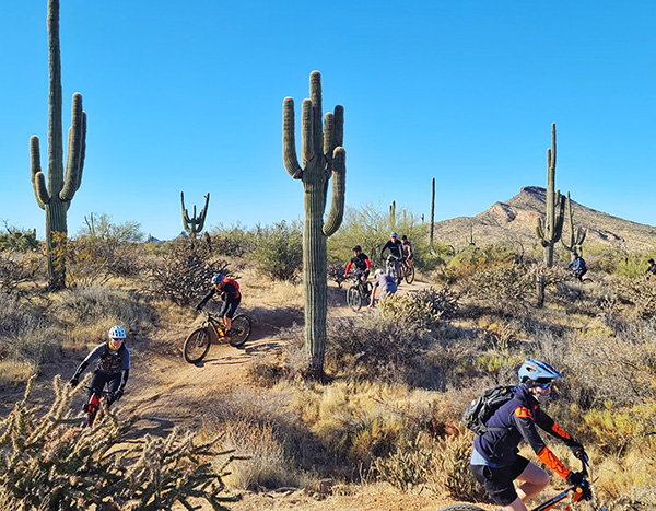 Mountain bikers race down the Corral Loop Trail. [photo by Lin] |
|
Billie had mentioned earlier this was a popular mountain biking trail, but we had no idea it was this popular. So we all step off the trail to let them pass, and pass, and pass, and then pass some more. And just when we think they’ve all finally passed us and it’s safe to get back out on the trail again, here comes the trailing group of about ten more bikers. Apparently this is the most popular trail in the McDowell Sonoran Preserve for mountain bikers. But certainly not so much for hikers, since we don’t see a single other hiker on the full 2.5-mile length of the Corral Loop Trail today. We finally complete the Corral Loop at UR8 on the map and take a short rest break, while discussing options. Most of the group favors continuing on Brown’s Ranch Road back to the trailhead and calling it a day. But Tamar, Lynnette, Kelley, and Cindy decide to take the Upper Ranch Trail and Brown’s Mountain Trail and go for the summit of Brown’s Mountain. |
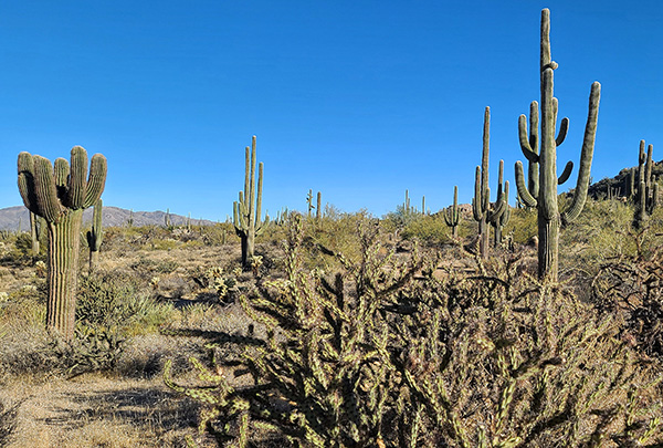 A sea of giant saguaros and staghorn chollas. [photo by Lin] |
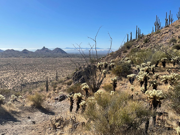 Looking across the desert from the base of Brown’s Mountain. [photo by Tamar] |
 Second view from the base of Brown’s Mountain. [photo by Tamar] |
 Last view of Brown’s Mountain from the trail. [photo by John] |
 Carl and Lin strike a pose as they head back down Brown’s Ranch Road. [photo by John] |
 A study in saguaro symmetry. [photo by Chuck] |
 A study in form, shape, and patterns. [photo by Chuck] |
|
This was part of the original hike description, so I’m a little surprised that so many on this hike decide to pass on it. But it does involve a 500-foot climb up Brown’s Mountain, and by now most of us are tiring out. So Tamar, one or our more experienced hike leaders, takes the lead and the Fabulous Four quickly disappear up the trail. Following is Tamar’s supplemental report. Meanwhile, the rest of us return to Brown’s Ranch Trailhead by 11:20. The temperature is still a cool and refreshing 58 degrees. Yet another perfect day for hiking the always interesting and scenic Sonoran Desert. |
|
Supplemental Report by Tamar Gottfried |
|
Four of us decided we were up for more elevation change and did the hike as posted. A slog up the hill leads to beautiful vistas and elevated heart rate, as well as a nice overview of where we had been previously on the hike. We jogged down the mountain, reaching the trailhead before noon. FootnoteAs requested by me, Tamar phones me as soon as her group reaches the trailhead, so I know they’ve all made it back safely. |
 Top of Page
Arizona Trailblazers Hiking Club, Phoenix, Arizona
Comments? Send them to the AZHC .
updated December 25, 2020