Outdoor Links
Hike Arizona
Trip Planning Guide
Trip Report Index
Calendar of Events
Library
|
Peavine Trail Day Hike Prescott April 17, 2021 by Li Li |
|
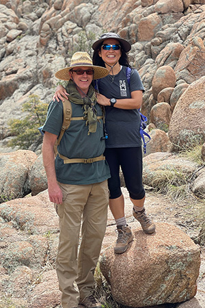
 Trailblazers by Watson Lake. [photo by Li] |
||||
|
|
After two consecutive hot and long hikes, I was looking for a cool-weather hike for a change. I was doing some research and found the Peavine Trail, which was featured on TripAdvisor as an excellent hike in Prescott. I searched further and decided this would be an interesting hike for the Trailblazers, since it contains a rich history of the Prescott area and features lakes as well as granite dells, which would make it a beautiful hike. Fifteen enthusiastic trailblazers gathered at Peavine Trailhead for an early start. The weather was perfect for a hike at Prescott, with the highest temperatures being in the 60s and the lowest in the 40s. After a quick introduction, we started the hike from the dilapidated industrial area, which was a disappointing beginning for the supposedly beautiful historic hike. After about a half-mile walking on the wide road, we saw a large open area with Watson Lake in view. |
 Watson Lake. [photo by Li] |
 The wide trail, which was converted from the railroad track. [photo by Li] |
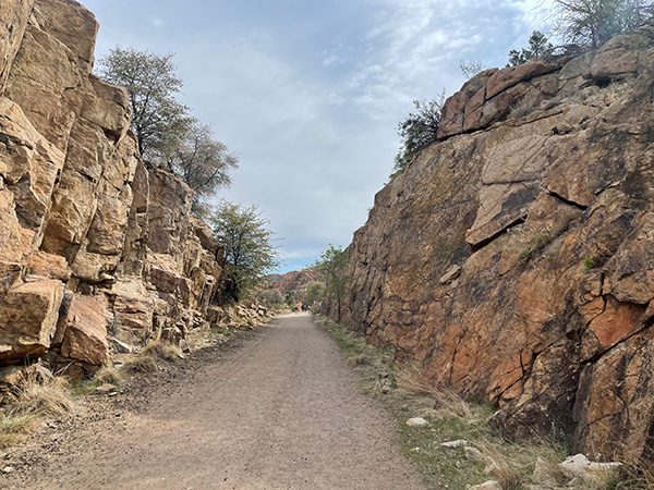
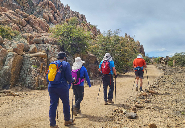
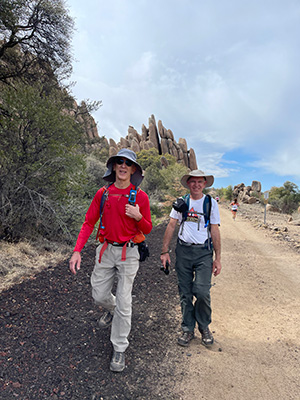 Kevin and Tom on Peavine trail with a marathoner in back. [photo by Li] Peavine Trail is different from other typical trails, as it is a wide dirt road because it was converted from an old railroad track. It was built in 1887, as a part of the Santa Fe Railroad that connected Phoenix to Prescott. Businessmen, ranchers, and miners believed that the railroad would lead the Prescott area to a boom, so Prescott and the Arizona Central company finished construction in 1887. It paralleled today’s Watson Lake and then followed highway 89 into the Prescott area. The ambitious entrepreneur Frank Murphy organized the Prescott and Eastern Railway Company to build the railroad in 1890, which connected Bradshaw to the town of Mayer to transport ore, livestock, passengers, machinery, and manufactured goods. This caused the Prescott area to boom. The trains also transported passengers from Ash Fork to Crown King. In 1895 it was connected to Phoenix through Skull Valley, Wickenburg and Congress. The passengers’ depot was called points of rocks or Entro and was described in detail in John Sayer’s book. Santa Fe Railroad was discontinued in 1984 due to transportation becoming dominated by automobiles. The railroad tracks were removed to form the present-day Peavine Trail. Standing on the old railroad bed, we could still see the famous winding and serpentine path of the route. |
 Tom found beautiful Cactus! [photo by Li] |
 Tom enjoys the beautiful view of Waston Lake. [photo by Li] |
 Kevin, Michelle and Mark enjoy the good weather hike. [photo by Li] |
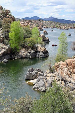 Kayaking is fun at Waston Lake. [photo by Kevin] Walking on the Peavine Trail is like walking into the past. One can imagine the town’s railroad stations, resorts on the lake, ballrooms, restaurants, and stores populating the area during its boom. According to Prescott history, Thomas Wing built the first homestead in the Granite Dells in 1886, and it became the entertainment center of Prescott. The second owner, Edwin Payne’s son, developed a recreational area including swimming, boating, baseball, and picnics places. Later they added swimming pools, rental cabins, a dance hall, and a lake, making it the most popular place in the summer. After World War II, the railroad and resort declined and later permanently closed. |
 Granite Creek Dam. [photo by Kevin] |
 Tom at the Granite Dells. [photo by Li] |
 Li at the Granite Dells. [photo by Tom] |
 A quiet cove. [photo by Li] |
 Trailblazers on the rocks. [photo by Li] |
 Trailblazers on the rocks. [photo by Li] |
 Michael [photo by Li] |
 Heather [photo by Li] |
 Tom and Cindy [photo by Li] |
 Kevin [photo by Li] |
|
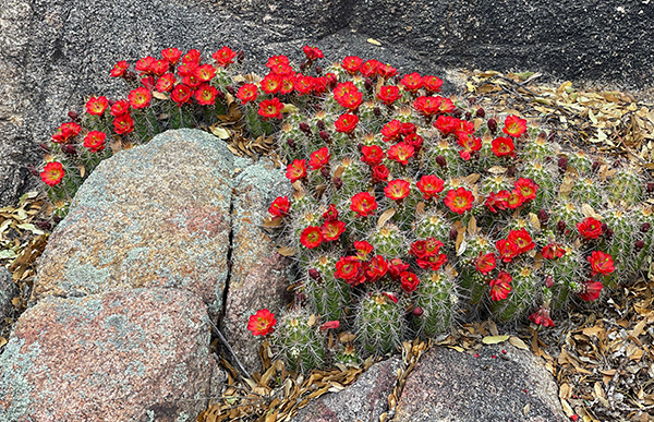
As we continued walking along this trail, we could see the leftover concrete foundation of the Depot railroad station on the left side of the trail before we reached Iron King Trailhead. A quarter-mile past of this area, the landscape started to change. The mountains were left behind and a new housing development area came into view. There was a group of marathoners running for a 90-kilometer race, so we had to share the wide trail with the runners, which made the wide trail seem narrower and more crowded. We stopped at the 5.6 miles mark, right before highway 89, since the weather became warmer and the landscape had changed drastically. So we decided to turn around. Peavine Trail is connected to many beautiful side trails near Watson Lake. On the way back, nine of us decided to do side trail exploration. Our extra effort proved worthwhile. We climbed up and down granite cells, hopped over many large boulders, and saw beautiful red blooming cacti. Water reflections decorated the creek area along the mountains, making a spectacular view. As we hiked on a hill we heard the loud sounds of a waterfall. |
 Natalie and Laura on a granite mountain. [photo by Lin] |
 Mark and Michelle in the lead. [photo by Lin] |
 Lin’s awesome group: Natalie, Laura, Lin. [photo by Tom] |
 Beautiful Lin with beautiful cactus. [photo by Kevin] |
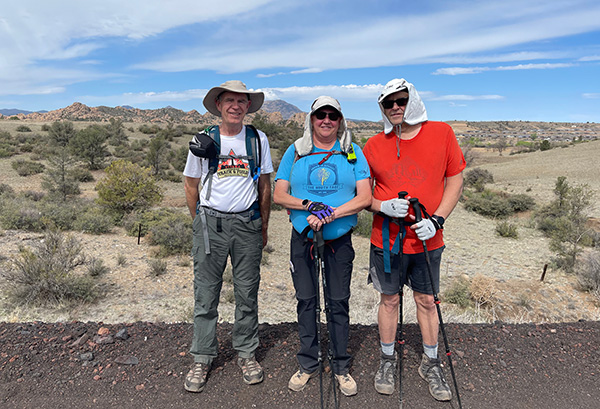
 Li found the railroad station. [photo by Kevin] As we returned to the main trail, the weather was getting warmer and the hikers were getting tired. For some of them, this was their first long hike, so we decided to stop exploring further and returned to the Peavine Trail to finish the hike. We all made it to the trailhead safely and finished at roughly the same time. We did 12.8 miles in 5.5 hours. Some members who did the shorter hike went home earlier. Everyone had a good time. Tom and I were talking about doing more exploring next year since there are lots of mountains and trails in this area that we have yet to see. Just like the Yavapai magazine in 1915 described, the Watson lake recreational area is beautiful and incomparably idyllic! → More pictures, by Li.→ More pictures, by Lin. → More pictures, by Kevin. |
 Top of Page
Arizona Trailblazers Hiking Club, Phoenix, Arizona
Comments? Send them to the AZHC .
updated April 26, 2021