Outdoor Links
Hike Arizona
Trip Planning Guide
Trip Report Index
Calendar of Events
Library
Superstition Mountains
February 13, 2022
by Bruce Wilczynski
 Trailblazers at Peralta Trailhead. [photo by Lin] |
| Chris, Bruce, David, Robert, Kevin, Li, Tom, Debbie, Lin, Micheal, Spencer |
| Not shown in the picture is Grace. |
|
On a beautiful day at the Peralta Trailhead 12 hikers started the hike about 8:20 AM. After a short ⅓ mile or so up the Peralta Trail we cut left to begin the 800 ft. plus bush whacking ascent to get to the top of the Dacite cliffs. A few places on the way up were challenging, but once on top, everyone enjoyed the unique views of the area South. We could see the Peralta Road, Goldmine parking area, Carney parking, the Don’s Amphitheater below us, and a great distance. |
 Hikers gather at Peralta Trailhead. [photo by Tom] |
 It gets rough on the way up. [photo by Kevin] |
 We’ve come this far. [photo by Li] |
 We’re gettin’ high (topographically). [photo by Kevin] |
 Geronimo Cave and Peralta Canyon. [photo by Tom] |
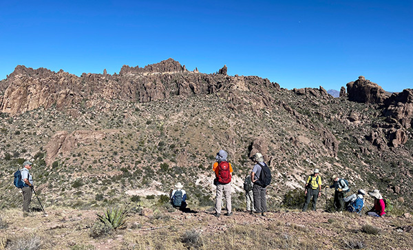
 Hikers above Peralta Trailhead. |
 Tom and Li shoot Chris. (photographically). [photo by Kevin] |
 Peralta Road and Lost Goldmine Trailhead. [photo by Kevin] |
|
After a couple viewpoints we began bushwhacking towards the Robber’s Roost area. There were three decent hills and rocks to climb up and over. Along the way we passed by a man-made water collection pit and had more great views. Before we descended to Robber’s Roost some hikers had to go surfing on a ‘wave rock’. We had lunch and picture taking in Robber’s Roost. Next began the trek over to Fremont saddle. From there we headed to the lone pine, but before getting there we took a turn to descend into the Upper Barks Canyon. |
 Trailside flowers grace our passage. [photo by Kevin] |

|
 South Peak of the Superstition Mountains. [photo by Li] |
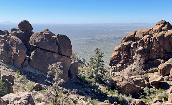 What a view! [photo by Li] |
 Debbie flies off a balanced rock. [photo by Kevin] |
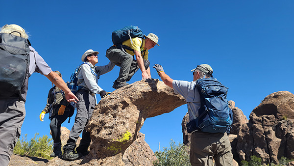 Easy does it. [photo by Lin] |
 Robber’s Roost. [photo by Lin] |
 Trailblazers head toward Weaver’s Needle. [photo by Kevin] |
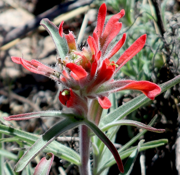 Indian Paintbrush. [photo by Kevin] |
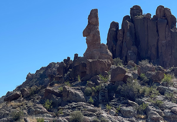 Old Grumpy is watching. [photo by Li] |
|
Although there are rock cairns along the trail it was easy to get slightly off trail. Eventually we intersected the Bluff Springs Trail, which divides Upper and Lower Barks. After a short break at the intersection, I decided to cut the hike short and forego the Lower Barks Canyon due to the time (2 PM). Many wanted to take Bluff Springs back at that time anyway, to be able to get home for the Super Bowl. I apologize to those few that wanted to continue down Lower barks. We all took the Bluff Springs Trail back to the Peralta Trailhead finishing at 3 PM. We did gather around and shared some refreshments in the parking area before heading home. |
 Moving right along. [photo by Kevin] |
 Picketpost Mountain in the distance. [photo by Kevin] |
 Tom and Li have a magnificent view. [photo by Lin] |
|
The final stats were 7.34 miles and 2,499 ft. of elevation gain. There was so much to see and enjoy that a lot of excellent pictures were taken, and too many to insert into this report. I am including links from some hikers that capture the hike scenes quite well. → More pictures, by Kevin.→ More pictures, by Li. → More pictures, by Tom. → More pictures, by Lin. Thank you to all that hiked and were patient with me. |
 Top of Page
Arizona Trailblazers Hiking Club, Phoenix, Arizona
Comments? Send them to the AZHC .
updated February 21, 2022