Outdoor Links
Hike Arizona
Trip Planning Guide
Trip Report Index
Calendar of Events
Library
|
Seven Springs Cottonwood Tonto National Forest November 5, 2022 by Vicky Johnson |
|
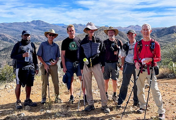
 Trailblazers at Cave Creek Trailhead. [photo by Vicky] |
Thirteen hikers showed up on a crisp Saturday morning at the trailhead of the Cave Creek Trail #4 in the Seven Springs Recreational Area, and began a trek across a stream filled with yellowing sycamore, cottonwood, willow, and ash trees, displaying beautiful fall colors.
 Remains of a ranch. [photo by Li] |
From the Cave Creek Trail at an elevation of about 3,045 feet, the group intersected Cottonwood Trail #247, that continued a steep climb up at old road to the intersection of Cottonwood Trail #246, where the group turned right.
 Trailblazers start to cross Cave Creek. [photo by Li] |
 Amid autumn glory. [photo by Li] |
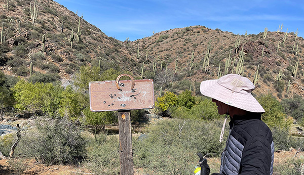
 Trails are well-signed around here. [photo by Li] |
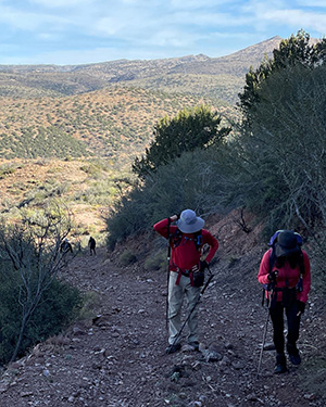
 Trailblazers going downhill. [photo by Kevin] |
 A gate is encountered. [photo by Kevin] |
This unused road of moderate difficulty ran 7.5 miles along an old cowboy trail, where the group passed several springs including Quien Sabe and Skunk Tank, that also offered spectacular views of Skunk Ridge and Skull Mesa.
 Trailblazers on an unused road. [photo by Li] |
 In the high country. [photo by Li] |
 Strangely, the rocks are green. [photo by Li] |
 Hikers going downhill. [photo by Li] |
 Hikers going downhill. [photo by Li] |
The last two miles of the trail were once part of an old mining road, where sections of a road could be seen heading up to an abandoned mine. At the high point of the trail at 4,163 feet the group intersected the Cave Creek Trail #4 on our downward climb and stopped for lunch by the creek.
 New River Mesa from the slopes of Quien Sabe. [photo by Li] |
 A rusty sign doesn’t faze Ken. [photo by Li] |
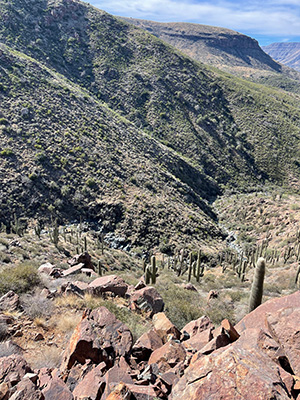
On the Skunk Tank section of Trail #4 the hikers passed two crested saguaros, and lots of cottonwood mesquite juniper and palo verde trees, in addition to chollas, barrel cactus that were plumb from recent rains. In addition, beautiful pools of water with emerald, green hues could be seen covering rocks at their bottoms.
 Crested Saguaro. [photo by Kevin] |
 Trails are well-signed around here. [photo by Kevin] |
 Tom and Li have a big climb. [photo by Kevin] |
 Prickly Pear offers intricate details. [photo by Li] |
 Cave Creek is a babbling brook. [photo by Li] |
 Watch your step, Tom! [photo by Li] |
 Some of the boulders are green. [photo by Li] |
|
Prickly Pear offers intricate details. [photo by Li] |
Cave Creek is a babbling brook. [photo by Li] |
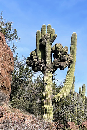 Crested saguaro. [photo by Li] |
 Tom admires the crested saguaro. [photo by Li] |
The group headed back to the trailhead, where they were greeted by a chubby orange tabby cat hiking by its owner on a leash, his companion a brown Pomeranian, and a small Scottish Terrier.
Dinner was held afterwards in Cave Creek at the Mexican restaurant El Canto Two.
Total Distance Hiked: 10.44 miles
Minimum Elevation: 3,045'
Maximum Elevation: 4,163'
Total Ascent: 1,985'
Average Moving Speed 2.5 miles per hour
Car Pooling Distance from the meeting site to Trailhead: 12.2 miles
Car Poolers: Terry Lynch, Bruce Alter
→ More pictures, by Vicky. The first seven are mine and the rest are Kevin Edwards Photos
→ More pictures, by Li.
 Top of Page
Arizona Trailblazers Hiking Club, Phoenix, Arizona
Comments? Send them to the AZHC .
updated November 10, 2022