Outdoor Links
Hike Arizona
Trip Planning Guide
Trip Report Index
Calendar of Events
Library
|
Lower White Canyon Hike Superstitions February 17, 2024 by Robert Plowman |
|
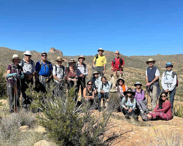 Trailblazers are ready to brave White Canyon. |
| Deirdre, Bruce, Felix, Gerry, Peggy, Richard, Cindy, Robert, Kevin, Yanis, Tom, Lin, Li, Anna, Greg, Edith, Lisa. |
Our hike started with a four mile drive down Battle Axe Road, the last two miles of which were in a sandy wash. Two of our vehicles were 4x4 HC, the other two were all wheel drive SUVs. The road in this showed signs of considerable erosion in the four weeks since we pre-drove it. Despite the new gullies, all four vehicles made it without problem.
 Start of the hike. [photo by Li] |
We parked at the first stock fence, just north of the hot spring on the old AZ trail, which is now fenced off with a big no trespassing sign. Beyond here, the road deteriorated, passable (slowly) by HC only. We hiked west a half-mile on this road, then turned north into White Canyon. When I last hiked this route ten years ago, there was no trail, and we hiked through the drive stream bed. This time the stream was running with a significant flow. Fortunately, there is now a trail paralleling the stream. The trail is easy to find, up until we reached several boulder tangles, which we slowly made our way through. GPS track: https://www.gaiagps.com/public/qt3rky9bP38zPusAf5VY4HQx
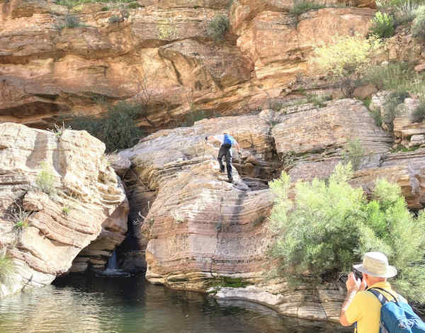 Jerry, Kevin above the pool. [photo by Cindy] |
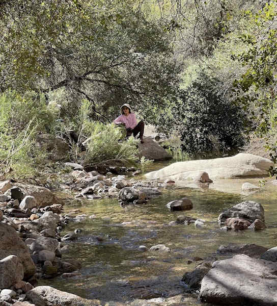 Lin by the stream. [photo by Li] |
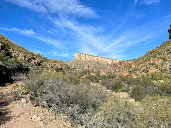
After about two miles in the canyon, we ascended to a high bluff looking out over the canyon. In the past we have seen bighorn sheep around here, but not this time.
 Kevin, Felix, Cindy, Richard, climbing out of the canyon. [photo by Li] |
 Overlook, Li and Tom. [photo by Lin] |
|
Looking south down White Canyon, Tom in foreground. [photo by Li] |
After eating lunch at this scenic overview, we proceeded east over a series of ridges, four or five. This section was slow, hot, and entirely off-trail. A bit of excitement was added by the discovery of a large and irritable diamond back, the first we had seen this year.
 Diamondback. [photo by Lin] |
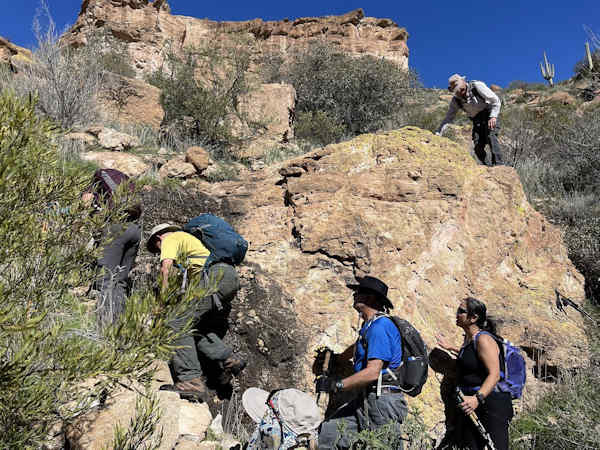
After descending the final ridge on an old road, we entered the last canyon. This canyon has no name on the map I was using, but it could be considered the northernmost end of Walnut Canyon. This canyon was dry and easy hiking until we found a twenty-foot cliff. We were able to bypass this on the left-hand side.
 Bypassing the final cliff: Bruce, Jerry, Peggy, Robert, Richard, and more. [photo by Kevin] |
Bypassing the final cliff: Bruce, Jerry, Peggy, Robert, Richard, and more. Photo by Kevin We intersected the road a few hundred yards further down from the cliff, and reached our cars a few minutes later. Overall, the canyons were prettier than I remembered.
 Top of Page
Arizona Trailblazers Hiking Club, Phoenix, Arizona updated March 16, 2024
Comments? Send them to the AZHC .