Outdoor Links
Hike Arizona
Trip Planning Guide
Trip Report Index
Calendar of Events
Library
|
Three Sisters Summit Hike Superstitions March 2, 2024 by Li Li |
|
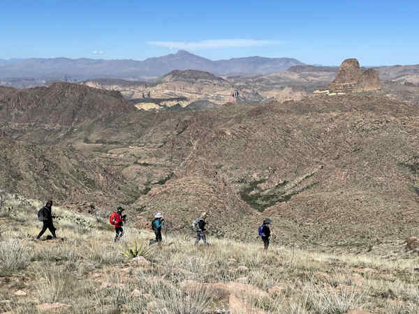
 Trailblazers At the first peak. [photo by Michael] |
| Ilangovan, Cindy, Lisa, Carolyn, Kevin, Li, Kevin, Edith. |
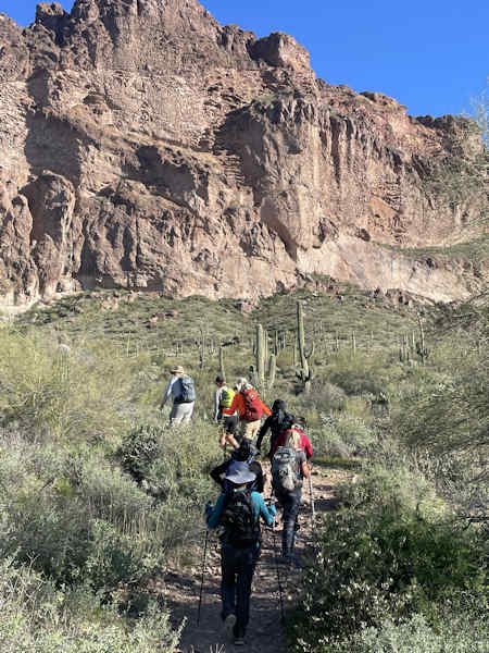
I’ve always wanted to repeat the Three Sisters' Peak hike in the Superstitions, ever since the last time I was there in 2023. Memories of the stunning views from the top of the mountain have stuck with me, calling me back to the mountain. This was a tough hike even with the most experienced hikers since It was the first part of Ridgeline Trail, a notoriously hard trek. I was happy that I had 9 hikers to share the experience with since my limit was 10 for the hike.
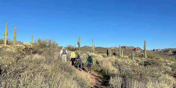
 We are heading to Carney Spring trail. [photo by Kevin] |
 Time for a snack. [photo by Li] |
 Short rest break. [photo by Kevin] |
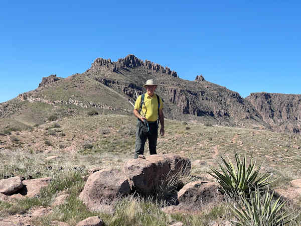
It was a beautiful sunny day on Saturday March second, temperatures were as good as we could ask for this hard hike although I wished it could be cooler since climbing up the Carney Springs Trail proved to work up a sweat. One hiker returned after a 1.5 mile ascent due to health concerns. On the way back he was surprised with an unusual encounter, a Gila monster. After saying goodbye, the eight of us continued going up fast on our way to the Ridgeline Trail. I was happy that I had so many elite hikers with us since everyone was so fast but waiting patiently for those of us who were slightly behind. We had our first group photo on the first peak, taking out time to enjoy the spectacular views of the Superstition Mountains.
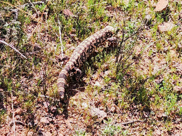 There are monsters in the Superstitions, Gila. [photo by Tom] |
 Up on the Ridgeline. [photo by Li] |
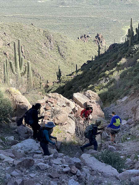
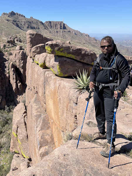 Watch that next step. [photo by Li] |
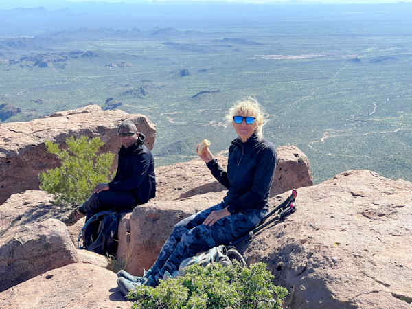
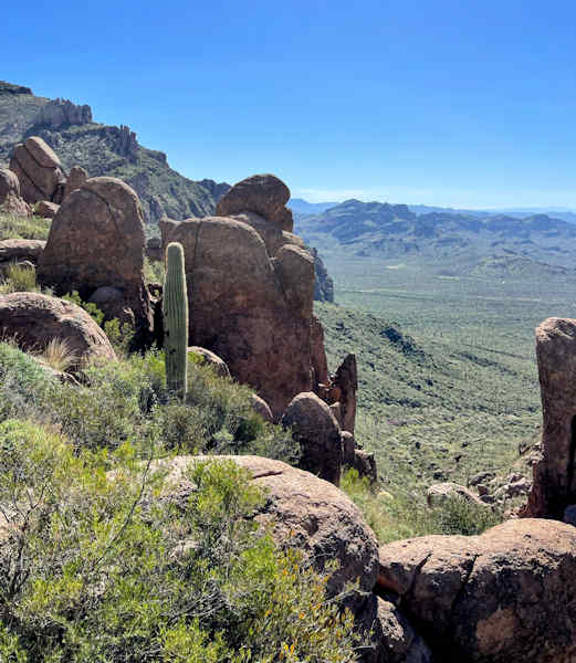
The second peak was easier than the first so none of us had problems getting there. After everyone got to the peak, a few faster hikers continued hiking toward the north on the Ridgeline trail while three of us waited a little longer for the last hiker recovered before continuing on the flatter part of the Ridgeline trail. There were many side trails which made finding the right trail trickier. One hiker even got lost for a short period of time but he soon found the way. It was a big scare but we were so glad and relieved to see him on the trail again after some anxious searching. It really proved that the radios are must have equipment on any hike and we were happy that we were well prepared for this situation. One hiker decided to wait at a trail junction for the group decent, instead of hiking to the summit, while the rest of us continued our journey to the peak. We could see Superstition Peak (5057) clearly on our right and Weaver's Needle behind us when we got to the junction that separates the Ridgeline Trail and Three Sisters Trail. After, we turned left going uphill until we reached a large open field that provided a stunning view of Three Sisters’s summit. Although it was a sunny day, on the peak it was quite windy and chilly besides for a few sunny spots which provided some much needed warmth. There, we snapped many photos and took a well deserved lunch break before making our way down from the ridge.
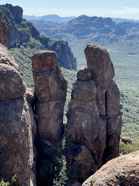 The massive hoodoo. [photo by Kevin] |
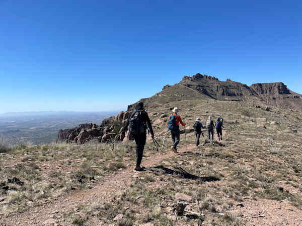 Onward to Three Sisters. [photo by Kevin] |
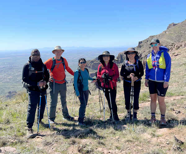 Trailblazers on Three Sisters. [photo by Lisa] |
We started our decent at the social trail junction where a ravine was close by. It took a few minutes to find the faint outline of the social trail that we could follow. It took us through large boulders and large piles of rocks. Everyone walked carefully to make sure nobody was at risk of getting injured. It went much smoother than I expected considering we had a much larger group compared to the last time I was here. Eight of us stayed together the whole time to make sure no one left behind. Due to the steep descent, bushwhacking down the rocky ravine was not an easy task so we took breaks to ensure that everyone was in good shape before descending further into the canyon. When Michael pointed out a large boulder next to the Wave Cave Trail, we were happy that our trail finding task had finally come to an end. Michael and Cindy decided to descend from Wave Cave Trail back to the East Goldmine Trail to finish the hike, while the rest of us decided to go up a quarter mile to the cave. Six of us continued ascending on the last part of the rocky, slippery Wave Cave Trail which was tough since by now we had hiked more than 7 miles with more than 2000 feet of elevation gain. Nevertheless, we reached the cave very fast and took another group picture, satisfied that we finished hiking two iconic spots in the Superstition Mountains.
 On the way down. [photo by Kevin] |
 On the edge, do not go down this way. [photo by Li] |
 Scrambling in the Ravine. [photo by Kevin] |
 Exiting the Ravine. [photo by Kevin] |
We met Michael at the end of the Goldmine trail and Cindy at the parking lot so no one had to wait long. I was so glad that I had such a wonderful and experienced group of hikers who made my job as leader much easier by offering their helping hands and working together as a team to finish this tough hike. What an elite group of people! Cheers to our Trailblazers as we had another marvelous day in the mountains!
 We are at Wave cave. [photo by Li] |
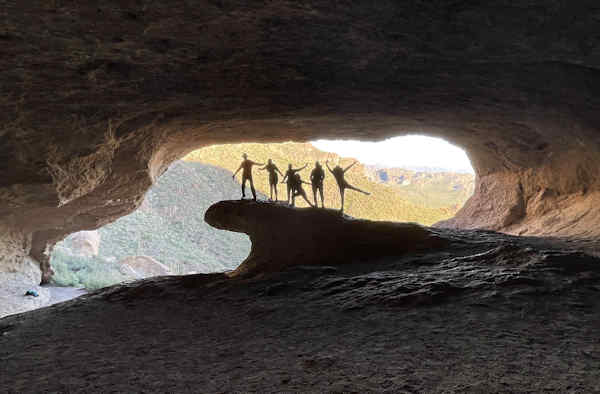 The Wave cave is fairly deep. [photo by Li] |
 Almost back to the cars. [photo by Li] |
 Rattle snakes are out. [photo by Kevin] |
 Top of Page
Arizona Trailblazers Hiking Club, Phoenix, Arizona updated March 26, 2024
Comments? Send them to the AZHC .