Outdoor Links
Hike Arizona
Trip Planning Guide
Trip Report Index
Calendar of Events
Library
|
Log Corral Loop Day Hike Mazatzal Mountains February 9, 2013 by Bill Zimmermann |
|
 Quy, Eileen, George, and Bill stand before a snowed saguaro. |
|
Quy, Eileen, and Bill met George at the Bush-SR87 interchange at 8:15. We drove to the MP212 trailhead where we were treated with hail as we unpacked from the cars. |
 Hail, Hail! [photo by Quy] |
 Sycamore Creek flows wet, and cold. |
|
|
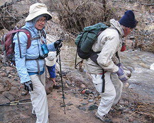
| What we need is some more stepping stones. [photos by Quy] | |
|
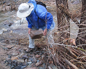
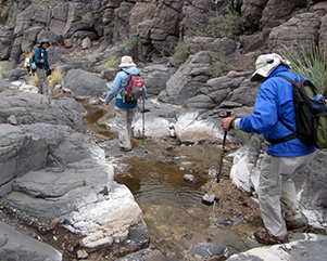
First agenda was to cross Sycamore creek. Considerable time was spent looking for a good spot for rock-hopping. The creek was moving at good speed and not all the rocks had dry spots above the water. The process had to be repeated two more times. On one occasion George and Bill tried their hand at building a rock path. We sidestepped a small flowing stream on FR 3456 from “01” to “Cactus”. It’s maybe called a forest road but this section seemed insurmountable to any full-size jeep. The stream stopped and the sandy wash became smoother and wider and as we left “Cactus”. Snow adorned the north slopes of Granite Mountain. The sun peeked through small holes in the darkened clouds, as it would briefly light up a section of the hillside. |
 Granite Mountain is cloud-topped and dusted with snow. [photo by Quy] |
 Prickly pear foreshadows the cloud-topped Mazatzals. [photo by Quy] |
 Weaver’s Needle is but a distant silhouette on the horizon. |
 Saguaros shiver under the winter clouds. |
|
At “TX” we left the road. Bill had noticed this as a possible route starting point on a previous hike. It was narrow and had deep ruts on the steeper section. The GPS was indicating time to leave the dirt bike trail and head for “B11”. We ignored the GPS and continued on the trail. |
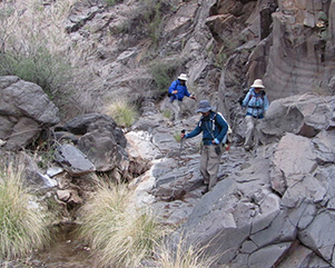
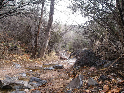 Log Corral Canyon. [photo by Quy] As we entered the wash we found it open with some dry waterfalls. After “B8” it became choked with willows and catclaw. Quy lead the way and was able to duck under some thick spots that Bill had to crawl through. At “B7” it opened up as we headed toward a decision point at “B6”. Up to Maverick Spring? Over Indian Springs Ridge? Down Brush Canyon? We headed part way up the ridge were we stopped for lunch at a rock pile with a mini-arch. |
 Frosted hedgehog cactus doesn’t seem to mind. |
 Big enough for an arch? George measures. |
 Indian Spring Peak. |
 Saguaros on the march, before a patch of blue. |
|
We lost all sun as we headed down Brush Canyon. The wash narrowed after “B3”. Black rocks and running water greeted our feet and a spitting rain greeted our uppers. Soon we were back on FR 3456 then on to more creek crossings. |
|
|
| Brush Canyon is our natural route down. | |
 Here’s some real bushwhacking! [photo by Eileen] |
 An artist finds this day beautiful. [photo by Quy] |
|
To our surprise we passed an artist trying to capture the beauty of the cloud-covered Pine Mountain. Back at the cars we hoped for hot soup but settled for a COLD beer before we were on our way. |
 Top of Page
Arizona Trailblazers Hiking Club, Phoenix, Arizona
Comments? Send them to the AZHC .
updated November 14, 2016